HISTORIC FERN CREEK FARM
Sold!

Historic Fern Creek Farm offers 115 +/- at-peace acres located in the heart of the Hatfield and McCoy Trail System in Mercer County, West Virginia.
| Price: | |
|---|---|
| $159,500 | |
| ID: | 976 |
| Acres: | 115 +/- |
| Address: | |
Agent Contact:
Richard Grist, 304-645-7674

MAPS & DOCUMENTS-CLICK LINKS TO VIEW
Historic Fern Creek Farm Google Earth map (Foxfire)
Historic Fern Creek Farm topographic map (Foxfire)
Historic Fern Creek Farm location map 2 (Foxfire)
Historic Fern Creek Farm general location map 2 (Foxfire)
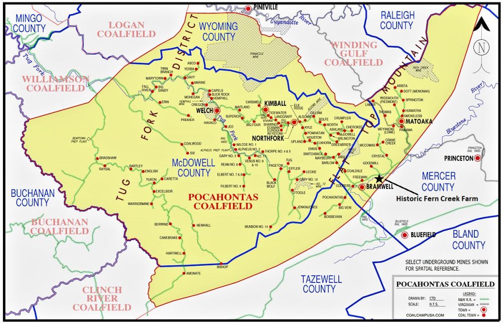
Historic Fern Creek Farm Pocahontas Coalfield map
Historic Fern Creek Farm state map (Foxfire)
OVERVIEW
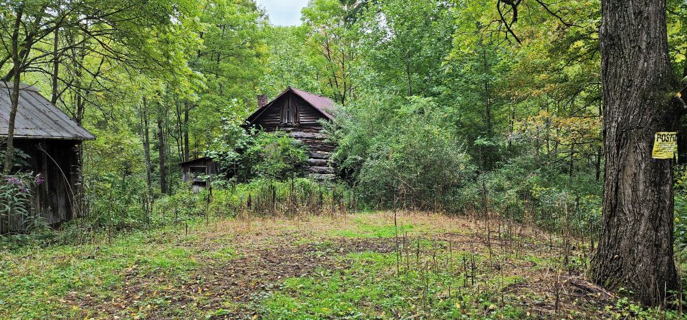
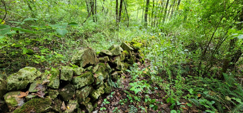
The Historic Fernwood Creek Farm offers 115 at-peace acres+/- and includes a late 1800’s hand hewn log cabin, mountain spring, hand-stacked rock walls and an incredible old growth forest. More than 100 year’s old, the historic farmstead represents an opportunity to reignite the self-sustaining family ownership legacy for a new generation.
HFCF has not been developed and possesses significant recreational, natural, aesthetic, watershed, wildlife, forest, open space, and plant habitat features.
HIGHLIGHTS
Historic Fern Creek Farm offers 115 +/- at-peace acres located in the heart of the Hatfield and McCoy Trail System in Mercer County, West Virginia. The property’s rich soil, abundant water, 4 season climate, diverse biotic habitat and interesting topography provide all the necessary elements for a successful, self-sustaining, permaculture system.
- 115 acres +/- multi-use timber investment, recreational and biologically diverse property
- Incredible old growth timber ready for immediate harvest to offset purchase and holding costs
- Late 1800’s hand hewn log cabin, smoke house, stacked rock walls, and outhouse
- Excellent access on year-round state-maintained roads
- Forest trails for ATV riding, hiking, camping, and nature viewing
- Electric line is on the property
- Dark skies with little or no light pollution for star gazing and planet observation
- Large size lends itself to create a wonderful country retreat – very private but not remote
- The mature forest is comprised of Red Oak, White Oak, Sugar Maple, Red Maple, Cherry Hickory, Hemlock and Tulip Poplar
- Perfect for all water sport activities supported by the region’s lakes and rivers
- City amenities are available in nearby Princeton, Bluefield, and Beckley
- Hospital and medical facilities nearby in Princeton & Bluefield
- Amazing resident wildlife population rich in diversity and ever changing
- One hour to the 70,000-acre New River Gorge National Park
- A half hour drive to Winterplace Ski Resort
- Fur bearing – deer, black bear, squirrel, rabbit, bobcat, raccoon, fox, chipmunk, opossum
- Area winged wildlife includes Neotropical songbirds, turkey, grouse, eagles, herons, hawks, owls, ravens, king fishers, ravens, crows, and hummingbirds
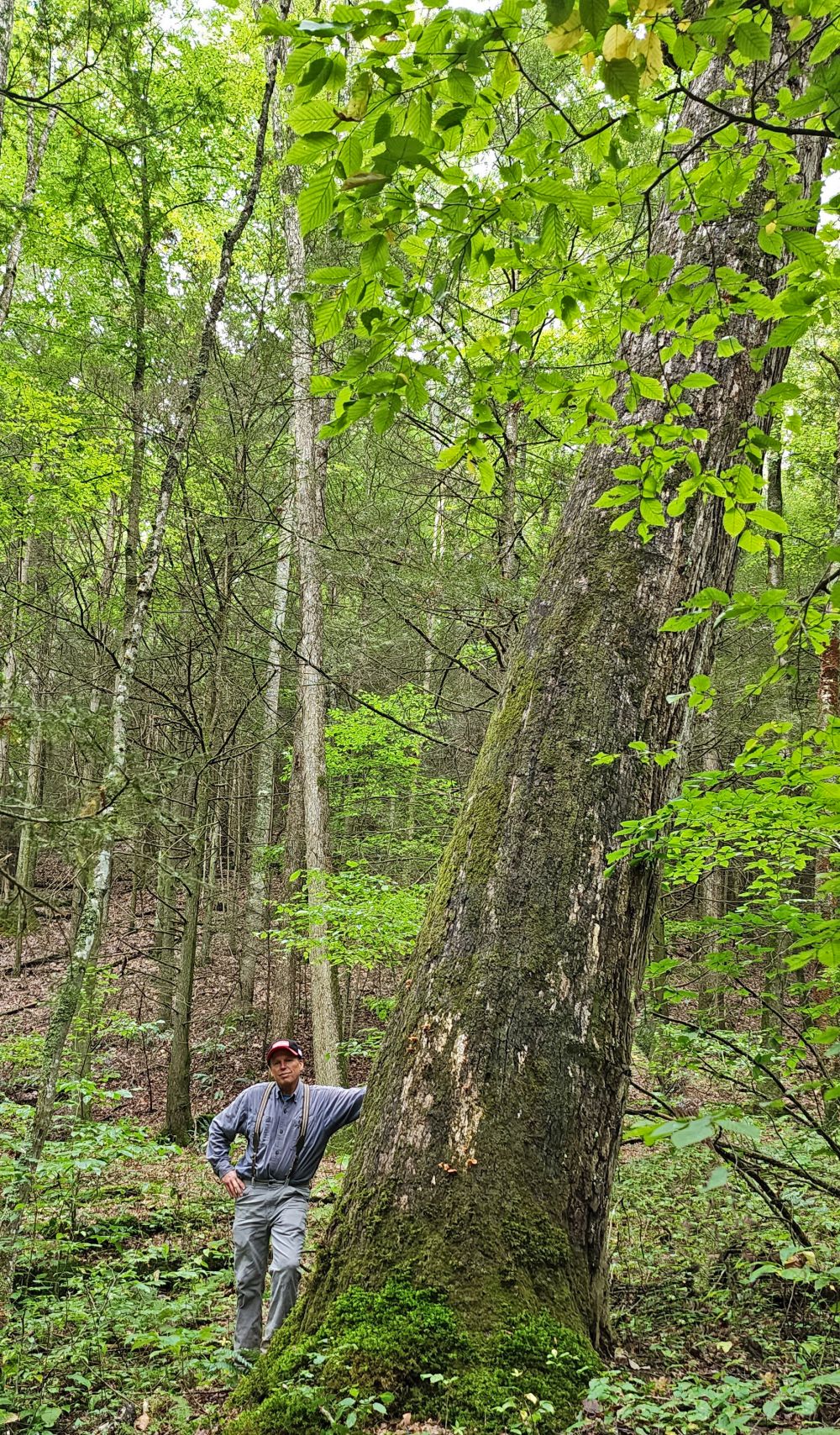
- Dynamic forest with some old growth trees estimated to be 150-200 years old
- Extraordinary rock outcrops, huge moss & lichen covered boulders perfect for rock climbing, bouldering and exploring
- Forest soaks up tons of Carbon Dioxide and produces tons of life-giving oxygen
- A rewarding off-grid permaculture lifestyle can be easily developed
- Cell phone coverage is good on the ridges, sketchy in the deeper hollows.
- Surrounded by mountain farms and forested tracts in a quiet rural neighborhood
- Low taxes, low population density
- All carbon credits, water, timber, subsurface and mineral rights in title will convey
- No current gas or oil leases
- Conveys by Special Warranty Deed
- USPS, FedX, UPS delivery
- Near Pinnacle Rock State Park, Jimmy Lewis Lake, Bluestone River
- Spectacular long-range views approaching 30 miles
- Operable ground supporting farming, forestry, recreation and future cabin sites
- Elevations range from 2390’ to 2644’
- Perfect area for watersports, nature viewing, fishing, hiking, horseback riding
- 90 Minutes to jet airports – Roanoke, Charleston, Lewisburg
- Proximity to I-77, US 460, and I-81
- 90 minutes to Blacksburg, VA and Virginia Tech
LOCATION
 Google Coordinates: 37.327092°(N), -81.279243°(W)
Address: Razorback Road or Shrader Hollow Road, Montcalm, WV 24737. A 911 address is not assigned to a property without active residential structures.
Elevation Range: 2390 ft. to 2644 ft. +/-
DIRECTIONS
Driving Destination Google Coordinates to near property boundary on Razorback Road: 37.333549, -81.276139. Contact the Foxfire Office about visiting the interior of the property.
From the Coal Heritage Road US 52 intersection with Old Route 20 at the CVS Pharmacy in Bluewell. Travel US 52 North for 1.4 miles and the property will be on the right. The entrance to the property is to the left of the building. (The property line lays to the left and runs behind the building. The building is not on the property for sale)
From Coal Heritage Road US 52 intersection with WV Route 20 at the CVS Pharmacy in Bluewell. Travel 3.3 miles+/- on US 52 North (approximately 10 minutes). Take the Rt. 120 exit off Coal Heritage Road US 52 at the end of the exit ramp, turn left onto Simmons Avenue Rt. 15 away from Bramwell; passing under the Coal Heritage Road, travel Simmons Avenue later becoming Simmons River Road for 2 miles; turn right onto Shrader Hollow Road Rt. 15/8; travel 3/10 mile to the end of the road and the property begins at the locked farm gate with several posted signs on it.
From Coal Heritage Road US 52 intersection with WV Route 20 at the CVS Pharmacy in Bluewell. Travel US 52 North for 1000’ and turn right on Lorton Lick Road. Travel 3 miles and turn left on to Simmons Creek Road. Travel past the Montcalm Post Office and High School 2.9 miles and take a left onto Shrader Hollow Road (CR 15/8) and travel 3/10 mile to the end of the road and the property begins at the locked farm gate with several posted signs on it.
- 10 minutes to Bluewell, Bramwell, Montcalm
- 15 minutes to Mercer County Airport
- 20 minutes to Princeton, Bluefield, I-77, US 460
- 1 hour 15 minutes to Blacksburg, VA and Virginia Tech
DEED and TAX INFORMATION
Deed Information: DB 1116 Pg. 475
Mercer County, West Virginia
Acreage: 115.2 total acres +/-
Real Estate Tax ID/Acreage/Taxes:
Mercer County (28), West Virginia
Rock District (11)
Tax Map 55 Parcels 38, 82, and 83; Class 3
2022 Total Real Estate Taxes: $538.28
MINERAL RESOURCES
West Virginia is one of the states in the US that has two ownership titles, those being SURFACE RIGHTS and MINERAL RIGHTS. A title search for mineral rights ownership has not been conducted. All rights the owner has will convey with the property.
BOUNDARIES AND SURVEY
The property is comprised of 3 adjoining tracts of land. Each tract has a metes and bounds description in the owner’s deed. A portion of the southern western property boundary runs with a State road right-of-way and with the center of a farm road. Portions of the eastern boundary run with various types of roads. The property is being sold by the boundary and not by the acre.
UTILITIES
Water: Spring water from the established onsite Spring or a well could be drilled
Sewer: a private septic system would have to be installed
Electricity: onsite
Telephone: nearby
Internet: available through nearby phone lines or from satellite providers
Cellphone Coverage: Excellent to good with 5G
ACCESS/FRONTAGE
Portions of the property boundary run with State road right-of-ways (US Route 52, Shrader Hollow Road (15/8) and Razorback Ridge Road (CR 15/9), the center of an unnamed farm road, and other sections of unimproved dirt roads.
ZONING
The county is subject to some zoning and subdivision regulations. All prospective buyers should consult the County Commission and also the Health Department for details regarding zoning, building codes and installation of septic systems.
PROPERTY TYPE/USE SUMMARY
The southern and central areas of the property formerly contained large fields of approximately 50 acres associated with the life of the homestead, with the remaining property being forestland. The farm fields were abandoned sometime in the 1950’s and have returned to a valued forest of tulip poplar, red maple, hemlock and white pine. The remaining 60 acres has not been timbered since the early 1900’s.
(This summary is an estimation of current property use as determined from aerial photography. It is made subject to the estimation of property boundaries and any errors in the interpretation of land use type from the aerial photography utilized.)
HISTORIC LOG CABIN AND OUTBUILDINGS
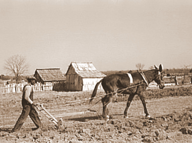
 The Historic Fern Creek Farm has a long and rich agricultural history, beginning many decades before electricity, telephone, tractors and motor powered farming equipment were readily available. Piles of field stone testify to the back-breaking work early settlers endured to clear the forest and establish a successful and self-sustaining life for themselves and their descendants.
The property features a hand hewn log cabin dating back to the late 1800’s. The hand hewn logs were created using special hand axes made specially for squaring up the logs into consistent sized timbers. There is also an outbuilding that doubled as a smoke house above and root cellar below. The roof rafters are made with “bark off” long poles (small trees) along with heavy circle sawn rough cut lumber. The shiplap siding on the upstairs of the cabin is more than likely made of tulip poplar. The roofing of the structures is heavy tin which has developed a wonderful dark red patina after more than a century of service.
Hand carved cut stone blocks can be found in the foundations of the cabin and smoke house. The siding and flooring of the cabin addition, smoke house and outhouse is made of heavy circle sawn rough-cut wide plank oak, poplar and hemlock.
The topographic map of the property conspicuously shows a “Spring” located at the old homestead site. Generally, a topographer would not show a spring site unless it was of considerable importance. An old metal water pipe has been located running from the area of the spring towards the log cabin.
FOREST/TIMBER RESOURCES
 The Farm’s timber resource, about 115 acres, is composed of some very large, high quality Appalachian hardwoods, hemlock and white pine. Much of this timber will contain veneer logs for export. This well managed timber resource can provide a great deal of flexibility to the next ownership in terms of potential harvest revenue and can be managed to provide cash flow opportunities to offset holding cost and long-term asset appreciation.
The forest is predominantly composed of secondary successional mixed mesophytic forests on moderate to steep Western Allegheny Plateau slopes. Two intermittent blueline streams combine providing a flow of ¾ mile through the property and drain directly into the Bluestone River ½ mile to the north. The creeks have associated riparian areas that are of great importance to the integrity of the ecosystem. Isolated forest wetlands that are located among a large terrestrial ecosystem provide a key role in amphibian productivity and maintaining community dynamics by coupling aquatic habitats with those adjacent terrestrial habitats via transfer of biomass and energy
Species composition:
The forest’s predominately well-drained upland terrain has led to a resource dominated by hardwood species. Overall, the species composition is highly desirable and favors Appalachian hardwood types, consisting primarily of:
- Black Cherry
- Sugar Maple
- Poplar/Cucumber/Basswood
- Red Oak Group
- White Oak/Chestnut Oak
- Soft Maple
- Hickory
- Hemlock/White Pine
- Black walnut
- As well as a host of other species (birch, beech, sassafras, wahoo, buckeye, sourwood)
Forest-wide, most stands are fully stocked, providing the next ownership with a great deal of flexibility in shaping their own silvicultural legacy. Stem quality forest-wide can be considered excellent with the forest containing an abundant current and future veneer source.
The timber component has been well managed over the years and generally consists of 40-150-year-old stems ranging in size of 10”-50” dbh. Portions of this stand have been thinned over the last several decades as prudent forest management called for. Many sections of this stand are ready for a selective thinning which will generate considerable income.
Diameters are well represented across the commercial spectrum with a notable mature size class, as well as abundant pole size timber and growing stock.
Several “Heritage Trees” are scattered throughout the forest and field edges. These ancient trees, some 200-300 years old, have withstood the test of time, weathering ice, wind, lightning strikes and fire.
The forest is healthy and presently there are no signs of pest infestations of Gypsy Moth. The Emerald Ash Borer and Hemlock Wooly adelgid are present and it is anticipated that the mature Ash tree component will be devastated by the borer over the next decade. There have been no forest fires in the recent memory.
The forest floor is home to several types of mushrooms, medicinal plants, wild ginseng, ferns and cool green mosses. One could spend a lifetime getting to know this inviting environ.
FOREST FARMING
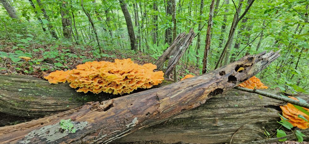 The most common crops are medicinal herbs and mushrooms. Other crops that can be produced include shade-loving native ornamentals, moss, fruit, nuts, other food crops, and decorative materials for crafts. These crops are often referred to as special forest products.
Here are some specific examples of crops:
- Medicinal herbs: Ginseng, goldenseal, black cohosh, bloodroot, passionflower, and mayapple
- Mushrooms: Shiitake and oyster mushrooms
- Native ornamentals: Rhododendrons and dogwood
- Moss: Log or sheet moss
- Fruit: Pawpaws, currants, elderberries, and lowbush blueberries
- Nuts: Black walnuts, hazelnuts, hickory nuts, and beechnuts
- Other food crops: Ramps (wild leeks), maple syrup, and honey
- Plants used for decorative purposes, dyes, and crafts: Galax, princess pine, white oak, pussy willow branches in the spring, holly, bittersweet, and bloodroot and ground pine (Lycopodium)
WATER RESOURCES
The topographic map of the property conspicuously shows a “Spring” located at the old homestead site. Generally, a topographer would not show a spring site unless it was of considerable importance. An old metal water pipe has been located running from the area of the spring towards the log cabin.
Fern Creek runs through the central area of the property for about ½ mile. It begins and travels as an intermittent dashed blueline stream in the southern portion of the property for about ¼ mile. As it approaches the historic homestead (log cabin) location, it grows into a solid blueline stream traveling for another ¼ mile before it exits the property and later empties into the Bluestone River ½ mile downstream. Another un-named intermittent dashed blueline stream travels near the northeastern boundary of the property for about 3/10 mile before it exits the property and also later empties into the Bluestone River. The streams should have some regular water flow, especially during a rain event or periods of snow melt. The life and activities of old homesteads relied heavily on such streams being nearby.
RECREATION AT THE OLD FERN CREEK FARM
The property offers many recreational opportunities. Numerous soft recreational activities are anchored by the proximity to the Bluestone River.
Nature viewing is first in line of recreational activities. Attentive wildlife management has been geared not to just game animals. Equal consideration has been extended to increasing the numbers and diversity of species including neo-tropical songbirds, butterflies, turtles, frogs, rabbits, chipmunks, dragonflies, owls, hawks.
Stargazing-Planet Observation
Complete or very near darkness can be still be found on areas of the property, thereby affording the opportunity to view the night sky in all its brilliant wonder.
Water-sports enthusiasts will find the nearby Bluestone River ideal for swimming, canoeing, fishing, kayaking, tubing, snorkeling, paddle boarding and windsurfing.
Shooting-sports devotees find all the land and privacy needed to enjoy:
- Paintball-Airsoft-Laser tag-Archery tag
- Shotgun sport shooting including Skeet, Trap, Double Trap and Sporting Clays
- Rifle & Handgun shooting: bullseye, silhouette, western, bench rest, long-range, fast draw
- Archery and Crossbow competition shooting
- Plain ole’ plinking: Grandpa’s old 22 single shot rifle and a few tin cans make a fun day
All Terrain Motorsports
The property has several forest trails that are perfect for experiencing the property from an ATV or UTV. These exciting machines handle the wide variety of the forest’s terrain.
Dirt bikes can also be a lot of fun and they come in all sizes and horsepower to fit anyone who enjoys being on two wheels.
Mountain Biking, Horseback Riding and Hiking
The property’s excellent network of trails may be used for conventional and mountain biking, hiking or horseback riding.
Hunting would be a first-class experience. White tail deer, black bear, red/gray fox, bobcat, wild turkey, grouse, squirrel, raccoon, and rabbit make up the resident wildlife population. It is hard to find a property that has a better mix of wildlife.
HATFIELD-MCCOY TRAIL SYSTEM
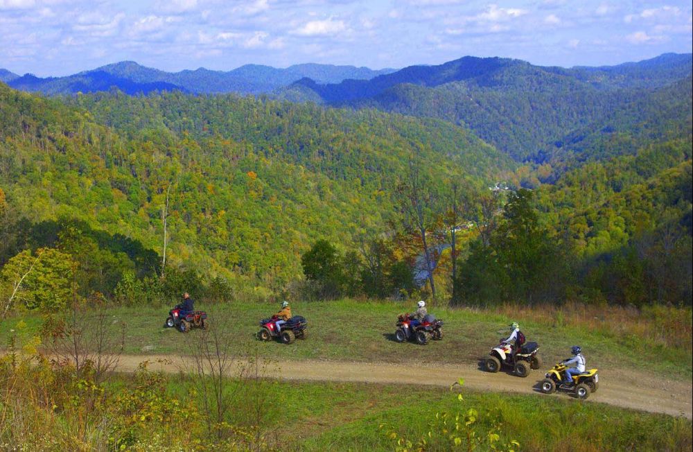 HFCF is just 5 minutes ATV ride to the Pocahontas Trail Head. This trail is most noted for being one of the largest continuous areas of the HMT network of trail systems and connectors. Pocahontas Trail System links up to three other Hatfield- McCoy Trail Systems—Indian Ridge, Pinnacle Creek and Warrior— making for the most continuous miles of trails east of the Mississippi. The trailhead is located in Coaldale, just outside of the town of Bramwell, historically known for its numerous millionaire homes from the early 20th century. This trail system has direct access to gas, food and lodging.
It is legal (and encouraged) to operate ATV’s on the county roads in this area to reach the numerous designated trail heads. The HMTS is made up of over 600+ miles of trails and located in the rich mountains of southern West Virginia. The 600+ mile HMTS is second only to the 2000-mile-long Paiute ATV Trail in Central Utah.
As one of the largest off-highway vehicle trail systems in the world, HMTS is open 365 days a year and offers something for every skill level. The trail system caters to ATV, UATV, and motorbikes (dirt bikes). However, hikers, mountain bikers, and horse riders can also use the trails. The trail system is a multi-county project, including West Virginia counties Logan, Kanawha, Wyoming, McDowell, Mercer, Wayne, Lincoln, Mingo, and Boone.
The name of the trail system is derived from the names of two families, the Hatfields and McCoys, who famously feuded near the West Virginia and Kentucky border after the Civil War.
Law enforcement officers patrol the trail to assure compliance with safety regulations. Motorized users of the trail system must wear a DOT-approved helmet and are prohibited from “doubling” (having a passenger), unless their vehicle is designed for two people. These rules, and a host of others, have allowed the trail system to enjoy a quality safety record, despite an increase in ATV-related injuries around the country.
CARBON SEQUESTRATION
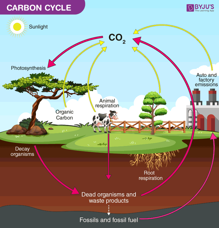 The 115+/- acres of forest is a tremendous producer of Oxygen and sequester of Carbon Dioxide. Carbon Sequestration is the act of processing carbon dioxide through sinks and stores and releasing them into the atmosphere as oxygen. With 115 acres, the vigorously growing forest is sequestering thousands of tons of Carbon Dioxide each year and producing tons and tons of life giving Oxygen.
This natural process allows the owner (and family/friends) the opportunity to potentially enjoy a carbon neutral footprint.
Note: The burning of one (1) ton of coal results in release of 2.57 tons of the carbon dioxide (CO2) into the environment. Carbon dioxide is the primary greenhouse gas emitted through human activities.
The leasing of “Carbon Credits” to environmental mitigation companies is a rapidly emerging financial opportunity for the property owner to receive income without placing any burden to the land. The leases can be for as little as one year.
The owner will convey all rights, benefits, privileges and credits related to carbon sequestration in the above ground and below ground biomass, and the soil.
SELF SUSTAINING LIFE OFF THE GRID
 Just as 150 years ago, when the first mountaineers settled the area, the property can be self-sustaining in times of necessity – even without electricity.
- Fresh water for drinking and cooking can come from the established mountain spring or a drilled water well (hand drawing water from the well using a cylinder well bucket).
- The creeks and forest can provide fresh food (deer, squirrel, rabbit, and turkey).
- The former agricultural land could be cleared again and provide vegetable gardens, berry patches, fruit orchards, and row crops of corn, oats and barley.
- Bee hives can provide honey and beeswax for candles and pollenate the fruit trees.
- The forest can provide firewood for heating and cooking, lumber for building, maple syrup and pounds of nuts (walnuts, beechnuts and hickory nuts).
- The vineyard could be created to provide jellies, jams, juices and wines.
- Livestock can be raised including dairy cows, chickens, geese, turkey, rabbits, goats, sheep, pigs and cattle. Milk, cheese, eggs, meat, wool, leather, fur, feather pillows and down comforters can all be produced.
WHAT IS A PERMACULTURE DESIGN?
 The three core tenets of permaculture are:
- Care for the earth: Provision for all life systems to continue and multiply. This is the first principle, because without a healthy earth, humans cannot flourish.
- Care for the people: Provision for people to access those resources necessary for their existence
- Setting limits to population and consumption: By governing our own needs, we can set resources aside to further the above principles. This includes returning waste back into the system to recycle into usefulness. The third ethic is sometimes referred to as Fair Share, which reflects that each of us should take no more than what we need before we reinvest the surplus.
Permaculture design emphasizes patterns of landscape, function, and species assemblies. It determines where these elements should be placed so they can provide maximum benefit to the local environment. Permaculture maximizes useful connections between components and synergy of the final design. The focus of permaculture, therefore, is not on each separate element, but rather on the relationships created among elements by the way they are placed to
gether; the whole becomes greater than the sum of its parts. Permaculture design therefore seeks to minimize waste, human labor, and energy input by building systems, and maximizes benefits between design elements to achieve a high level of synergy. Permaculture designs evolve over time by taking into account these relationships and elements and can evolve into extremely complex systems that produce a high density of food and materials with minimal input.
The design principles, which are the conceptual foundation of permaculture, were derived from the science of systems ecology and study of pre-industrial examples of sustainable land use. Permaculture draws from several disciplines including organic farming, agroforestry, integrated farming, sustainable development, and applied ecology. Permaculture has been applied most commonly to the design of housing and landscaping, integrating techniques such as agroforestry, natural building, and rainwater harvesting within the context of permaculture design principles and theory.
PAST AGRICULTURAL USE
The property contains approximately 50 acres of long-ago abandoned farm fields that were once the anchor and heartbeat of the self-sustaining lifestyle of the original homestead. Past farming history included cattle and sheep grazing, production of hay, oats, barley and corn. The soils and elevation are well suited for establishing a vineyard or fruit orchard.
WILDLIFE
 Years of progressive wildlife management practices have created the ideal wildlife reserve. Management goals promote overall wildlife health, developed wildlife viewing areas, increased carrying capacity, and improved species diversity.
An abundance of water is a major contributor to the local ecosystem richness and diversity for both plants and animals. The nearby Bluestone River, creeks, and ephemeral streams support the surrounding aquatic plant life and create a water supported community with a wide variety of wildlife. Some of the margins of the creek are fringed by lowlands, and these lowlands support the aquatic food web, provide shelter for wildlife, and stabilize the shore of the streams. The plant life associated with the wetland includes rushes, sedges, cattails, duckweed and algae.
There are many animals, including raccoons, opossums, wood ducks, mallards, minnows, native fish, turtles, salamanders, newts, crayfish, muskrat, bull frogs, eagles, hawks and redwing blackbirds associated with the creeks’ riparian area and the nearby Bluestone.
There is the insect and microscopic world including butterflies, dragonflies, pond skaters, water beetles, damselflies, tadpoles and various insect larve.
The property has a mixture of mature hardwood species, white pine, and hemlock. The diverse tree species, coupled with the abundant water supply from the nearby river and creeks, creates the perfect wildlife habitat. The miles of “edge effect” created between area farm fields, powerline, creeks, hollows, ridges, and rock outcrops benefit all the resident wildlife. Bald eagles, white tail deer, black bear, wild turkey, squirrel, rabbit, bobcat, raccoon, fox and many species of songbirds, owls and raptors make up the resident wildlife population.
The hardwood forest provides the essential nutrient source and produces tons of hard mast including acorns, hickory nuts, beech nuts and black walnuts. Soft mast includes stag horn sumac, black cherry, tulip poplar seeds, maple seeds, autumn olive berries and blackberries.
RIPARIAN ZONES
 In earlier times, before the environmental and societal values of riparian zones (RZ’s) were discovered, the RZ was commonly called a “swamp”. These enchanting areas are biologically rich and wildlife diverse, being akin to the world’s largest swamps found in the Florida Everglades and the Amazon River Basin. The mighty RZ works to provide “ecosystem services”—non-monetary benefits like clean water, clean air, carbon sequestration, and recreation for everyone.
These areas are the best of both worlds. Here you can watch for deer, squirrels, raccoon, and turkey while exploring for butterflies, turtles, frogs, crawdads, songbirds, salamanders, newts, and a host of other aquatic invertebrates, migratory birds, reptiles, and amphibians.
The RZ’s are a very productive part of the environment; more productive of vegetation, in fact, than some agricultural soils. This vegetation serves important purposes. It shelters and feeds many wildlife species that cannot survive elsewhere. Almost 35 percent of all rare and endangered species depend, in some way, on RZ’s. More common riparian zone species provide enjoyment to many by serving educational, research and recreational needs. Waterfowl and many furbearers such as beaver, mink and muskrat provide both consumptive and no consumptive recreation and are dependent on the zones. Many fringe RZ’s provide the food that young fish need to survive. By slowing the flow of water, RZ’s help keep banks from eroding and they trap and settle suspended silt before it smothers fish eggs and covers the insects and other animals that fish eat.
Riparian zones add visual diversity and offer an opportunity to see many different plant and wildlife species seen nowhere else on the property.
SURROUNDING AREA
HFCF is located in the rugged mountainous region of southwestern West Virginia, an area perhaps best known as a destination for outdoor recreation and off-road vehicle tourism. Thousands of tourists visit the region to explore the rugged landscape using all-terrain vehicles (ATVs), utility-terrain vehicles (UTVs), and other motorized off-road vehicles. The network of trails and backroads that lead through the region is complimented by designated and maintained off-road trails managed by the state-operated Hatfield-McCoy Trails.
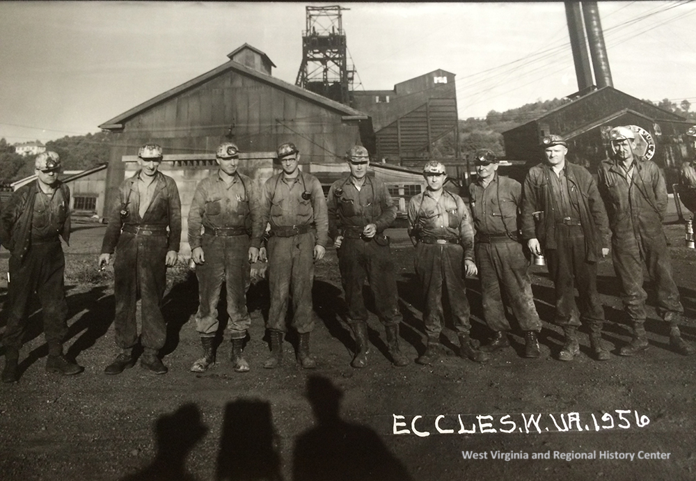
The region was formerly among the most productive coal-mining regions in the world. Many tourists are drawn to the ghost towns and abandoned industrial sites that may still be found within its forested mountains. Hundreds of thousands of miners and their families lived in the surrounding mountains through the early 1900s, though by the 1950s, employment began to dwindle. The richest seams had been mined out, and mechanization replaced many traditional mining jobs. For instance, the population of adjoining McDowell County had dropped from nearly 100,000 people in 1950 to little more than 10,000 today.
Though the decline in mining presented enormous difficulties, the decrease in population and industrialism allowed the environment to renew. Forests teeming with wildlife now cover vast expanses of mountain terrain, and some streams in the region are nearly primeval in their character. Residents cite the rural landscape and its welcoming communities as a principal reason for their residency.
REGIONAL ATTRACTIONS
Tourism is now a chief economic force in the region, especially where off-road vehicle recreation is concerned. Primary travel draws are hiking, biking, hunting, fishing, camping, and kayaking. Though the coal industry employs many mine workers and the timber industry employs many laborers, the travel industry continues to employ and supplement an increasing number of county residents. Many residents have opened restaurants and lodging facilities, including cabins and vacation rentals, to host visitors exploring the off-road adventure trail network.
Hatfield-McCoy Trails
One of the southern state’s largest networks of off-road motor vehicle trails, the Pocahontas Trail system approaches within a mile and a half of the property. Part of the Hatfield-McCoy Trails, the Pocahontas Trail explores more than 400 miles of some of the most rugged mountain country in the Mountain State. The nearest trailhead is located 2 miles from the property. In 2021, more than 94,000 riding permits were sold for the trails, of which more than 78,000 were out-of-state permits.
Twin Falls Resort State Park
One of the state’s flagship resort parks, Twin Falls hosts an average of more than 300,000 guests annually. Most are attracted by the park’s vast woodlands, though it also includes an 18-hole golf course and a lodge with 47 guest rooms, an indoor pool, and a restaurant with scenic views. Fourteen cabins and 50 campsites are also available to overnight guests. More than 25 miles of hiking trails wander the park, visiting natural landmarks that include the two waterfalls for which the park is named. It also includes a restored pioneer cabin.
National Coal Heritage Trail
Traveling more than 180 miles through southern West Virginia, the National Coal Heritage Trail visits some of the most important historic landmarks in the region, including the Itmann Store and Office. The region was America’s most productive energy-producing region through the early 1900s, providing the carbon-rich fuel that helped transform the U.S. into a world power capable of defending itself through two world wars. The National Coal Heritage Authority administrates the route.
Winterplace Ski Resort
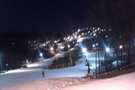 A drive of approximately 30 minutes from the property, Winterplace attracts thousands of skiers annually, notably from the southeast. The resort boasts 90 acres of skiable area and 28 trails, a terrain park, nine lifts, and a 16-lane snow-tubing park. The average annual snowfall at the resort is 100 inches. Protected by the mountains, the valleys around Bramwell remain more moderate. January temperatures average a high of 45 degrees and a low of 25.
New River Gorge National Park and Preserve
The nation’s newest national park, the New River Gorge National Park and Preserve, attracts more than 2.6 million visitors annually to the region. The park’s best-known attraction, the New River Gorge Bridge, is a drive of approximately an hour and 15 minutes from Itmann. Hiking, biking, angling, hunting, kayaking, and camping are popular throughout the park, though it may best be known as a destination for rock climbing and whitewater rafting.
The Summit Bechtel Family National Scout Reserve
An hour’s drive from the property, the 14,000-acre Summit Bechtel Reserve is an outdoor-recreation park that also hosts the Boy Scout Jamboree and is one of five high-adventure bases for the scouts. The 24th World Scout Jamboree welcomed more than 45,000 visitors in 2019. The 17th Interamerican Scout Jamboree is planned for 2023. The reserve is the home of the Paul R. Christen National High Adventure Base, the James C. Justice National Scout Camp, and the John D. Tickle National Training and Leadership Center.
Camp Creek State Park
Camp Creek State Park and Forest is known for beautiful waterfalls and great camping. With nearly 6,000 acres of lush forest, 35 miles of trails and seven miles of seasonally stocked trout streams, there is something for every hiker, biker, horseback rider and angler to explore and enjoy. The pristine area was officially named a state park in 1987 after 550 acres were marked off from the Camp Creek State Forest. Located off I-77 in Mercer County, the park is great for family trips and stop-overs during a scenic drive through southern West Virginia.
Pinnacle Rock State Park
A tower of sandstone long known as Pinnacle Rock provides a classroom for history, geology, and topography at Pinnacle Rock State Park in the valley of the Bluestone River. The geologic force that uplifted the rock have also created the dramatic panoramas that unfold as hikers ascend to an overlook at the summit. The pinnacle had been a popular local picnic area through the early 1900s and was purchased by the state in 1938 and developed as a roadside park along the newly completed highway US-52. In the late 1960s, the park was expanded to include 15-acre Jimmy Lewis Lake. Hiking, biking, fishing, and boating are the principal recreation venues accommodated at the park.
Pinnacle Rock State Park is located near Bramwell, WV, northwest of Bluefield, WV, in Mercer County, on the verge of the Bluestone Region and the southwestern reach of the Hatfield & McCoy Region in southern West Virginia.
Bramwell
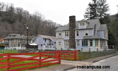 Definitely not a coal camp, Bramwell is an independent town in western Mercer County that was also home to more than a dozen millionaire coal barons in the early 20th Century. It seems that these coal operators knew just what they were doing when they decided to build their homes in Bramwell – not only is it on a nice, flat spot along the Bluestone River, it’s also just beyond the edge of the coal, thus sparing these coal millionaires the experience of living next to their dusty and noisy coal mines. However, the coal trains coming from Pocahontas and Boissevain did rumble through the town constantly.
SOUTHERN WEST VIRGINIAN COAL FIELDS
With infusion of money from the Philadelphia area, the Norfolk &Western Railroad was completed through southern West Virginia to Pocahontas, Virginia by 1892. It quickly became the leading hauler of Pocahontas coal. The Pocahontas Coalfield boasted the thickest bituminous coal seam in the world—as high as 14 feet in some places. In addition, Pocahontas coal burned cleaner than other bituminous coals, or, as an inspired marketing executive dubbed it, “smokeless coal.” Overnight, the Pocahontas Coalfield—located primarily in McDowell and Mercer counties—became the most valuable coal-producing region in the world.
By 1892, the N&W had been extended to the Ohio River at Kenova, sparking the rapid growth of towns along the way, including Welch and Williamson. Bluefield’s population grew from 600 to 11,188 people in just 20 years. One small Mercer County town became a banking center for leading coal operators; Bramwell became known as the “home of millionaires.”
KING COAL
 For many years, southern West Virginia produced more bituminous coal than any other region in the country. The coal boom began simply, as operators opened small mines with little money. The coming of the railroads changed everything, as hundreds of independent operations sprung up in Fayette and Raleigh counties in the 1870s. Within months of the C&O’s arrival in 1873, Joseph Beury opened the first large-scale mine in southern West Virginia at Quinnimont in Fayette County; after the N&W’s completion, Beury also became a pioneer in the Flat Top-Pocahontas Coalfield. By the end of the 1870s, the New River Coalfield produced more than 365,000 tons of coal annually.
Investors in the N&W realized the C&O’s error in not acquiring valuable coal lands near its tracks. The N&W purchased vast acreage in the smokeless coalfields of Mercer and McDowell counties. In 1885, the railroad’s executives formed the Flat-Top Coal Land Association Company (later reorganized as the Pocahontas Land Corporation), which leased tracts to coal operators. This system of owning the rails, the mines and the land gave the Pennsylvania-based N&W (and, later, other railroads) vast power. Due to the economic dominance of the railroads, in 1895, the West Virginia Legislature prohibited rail companies from engaging in the coal industry. In response, the railroads simply sold the property to separate land companies, which frequently had the same stockholders as the railroads.
Railroads were the catalysts for the burgeoning coal industry. Before the railroads arrived, however, investors had anticipated the growth. Hundreds of coal companies were formed in the years after West Virginia became a state. Many of the investors were from out of state, creating a situation where non-West Virginians controlled the bulk of the state’s economy.
COAL PRODUCTION
 The numbers tell the tale. In 1867, West Virginia produced 490,000 tons of coal; 20 years later, that number had grown to 4.9 million tons. By 1917, the state was producing nearly 90 million tons annually. Meanwhile the number of miners in the state increased from 3,701 to nearly 90,000 between 1880 and 1917.
By the early 1900s, coal was essential to virtually every aspect of life in the United States. Bituminous coal heated homes, powered railroad engines and fueled Navy battleships. For many years, southern West Virginia produced more bituminous coal than any other region in the country.
Perhaps no other industry depended on West Virginia coal more than the Northeast steel factories. Steel production required a clean-burning coal byproduct known as coke. In the early 1900s, approximately 10 to 15 percent of all West Virginia bituminous coal was loaded into hot-burning beehive-shaped ovens and distilled into coke. About one-half of this coke production occurred in McDowell County.
The U.S. Steel Corporation realized it could boost profits by owning its own coal and coke operations. U.S. Steel formed a subsidiary, U.S. Coal & Coke, which purchased land and built a fully integrated mining operation in McDowell County. The crown jewel of U.S. Steel’s coal empire was the town of Gary.
U.S. Steel was just one example of the monopolies that began controlling the coal industry in the early 1900s. Even as the industry expanded, the number of companies decreased. Large corporations bought out many small mines and forced others out of business.
Several companies dominated vast sections of the southern coalfields: Samuel Dixon’s New River Company controlled more than 70,000 acres in Fayette and Raleigh counties; U.S. Coal & Coke eventually possessed more than 300,000 acres in the Flat Top-Pocahontas field; and Justus Collins’s Winding Gulf Collieries owned much of the region served by the Virginian Railway.
FLAT TOP POCAHONTAS COAL FIELDS
 The earliest people in the New River area were the generations of the American Indians; believed to be the Shawnee, Cherokee, and Delaware tribes. In the 1750s and early 1800s, settlers made their way into the area. In the middle 1800s, the Chesapeake & Ohio Railroad made its way into the New River Gorge, making a major travel corridor along the river.
The Flat Top-Pocahontas Coalfield contained some of the best coal in the world. A high BTU (~15,000) low volatile met coal is what this region is known for. This was the No. 1 coal producing field in the state after the decline of the New River Coalfield. Now this coal field is in decline.
The Flat Top-Pocahontas Coalfield consists of the coal mining region of eastern Mercer County, McDowell County upstream of Iaeger, and Pinnacle Creek and Indian Creek in Wyoming County. It also extends into Tazewell County, Virginia. This coal field was mainly the domain of the Norfolk & Western Railway. The main line of the Virginian passed through the eastern part of the field, also. Norfolk-Southern owns all of it today. They still maintain a large repair shop for their engines in Bluefield. Mining began in the 1880s around Bramwell (and nearby Pocahontas, VA), and really accelerated when the N & W built their “Ohio Division” from Bluefield to Kenova in the 1890s. A large number of European immigrants and African-Americans from the Deep South came to the area to work in the mines. U.S. Steel was a major player in this field until the 1980s, as was Eastern Associated Coal (Eastern Fuel and Gas). The region has seen a steep drop in population. In 1950, McDowell County had a population of about 98,000 people. It now has less than 20,000.
BLUEFIELD RAIL YARD
 The Bluefield Rail Yards stand as a symbol of the importance of the Norfolk and Western Railroad to the coal industry. During the prosperous days of the coal boom, Bluefield emerged as the corporate center of the coalfields. The town played a pivotal role in the opening of the Pocahontas Coalfields and was the home of the headquarters of the Pocahontas Division of the Norfolk and Western Railroad. The rail yards are located adjacent to the Bluefield Downtown Commercial Historic District, which serves as the southern gateway to the Coal Heritage Trail.
The Bluefield Train Yard remains the busiest yard in the (now) Norfolk Southern Railway system. The location of the division’s mechanical shops was determined because of the area’s natural gravity “hump,” creating the highest point on what had previously been the Norfolk & Western mainline. Railroaders used gravity to help collect eastbound coal cars into unit trains. In the early days, coal cars were “draped” over the hump and sent eastward in trains of 100 or more cars.
REGIONAL AREA
The surrounding area offers unlimited soft recreational activities including ATV riding, white water rafting, golfing, fishing, camping, hiking, bird watching and rock climbing. The surrounding Mercer County landscape is part of the southeastern Ridge and Valley Region, a scenic tapestry of elongated Allegheny & Appalachian mountain ranges. Much of Mercer County remains undeveloped and is characterized by its scenic farm valleys, small communities and large expanses of hardwood forest.
The property is supported with the communities of Bluewell, Montcalm, Bramwell and the cities of Princeton and Bluefield. The area is a strong economic generator with a solid workforce employed in county/state government, tourism, hospitality, education, retail, construction, wood products, mining and agriculture. The surrounding area is richly blessed with a wide array of cultural events that keep life interesting and satisfying. Visit http://www.visitmercercounty.com/
Snow skiing at the Winterplace Ski Resort is a ½ hour away. The Amtrak train can be flagged down in Hinton for a ride to Chicago or New York City.
Charleston is West Virginia’s state capitol and is a 90-minute drive. Charleston is West Virginia’s largest city with a population of some 50,000 and a metro area of 225,000. It is the center of government, commerce, culture and industry. There is a commercial airport with daily flights to most major hubs.
Beckley is a 45-minute drive, has a population of 34,000, and is the county seat of Raleigh County. All amenities are available in Beckley. Beckley is located at the intersection of I-77, I-64 and US 19 so easy access to Charlotte, Pittsburgh, Charleston and Cincinnati is just around the corner.
Several area golf courses are available in the area. The New River Gorge recreation area offers white water rafting, rock climbing, ziplining, camping and horseback riding. The nearby and very popular 600+ mile long Hatfield-McCoy ATV trail system makes for a very active recreation area.
State maintained roads provide easy access. Weekly trash pickup, daily newspaper and daily mail delivery is available. UPS and FedEx service this area also.
Situate within an hour’s drive of the confluence of the New River, Bluestone River and Greenbrier River, the 2000 acre Bluestone Lake, at Hinton is truly a gateway to water recreation. The 70,000 acre New River National River Park, Bluestone State Park, Pipestem State Park Resort and 17,000 acre Bluestone Wildlife Management Area are recreational cornerstones in the area. The new 14,000 acre Boy Scout high adventure camp is an hour’s drive.
THE NEW RIVER GORGE NATIONAL PARK and PRESERVE
 The 70,000-acre New River Gorge National Park and Preserve is a unit of the United States National Park Service (NPS) designed to protect and maintain the New River Gorge in southern West Virginia in the Appalachian Mountains. Established in 1978 as a national river, the NPS-protected area stretches for 53 miles from just downstream of Hinton to Hawks Nest State Park near Ansted. The park was officially named America’s 63rd national park, the U.S. government’s highest form of protection, in December of 2020, amid the COVID-19 pandemic as part of a relief bill.
West Virginia is home to parts of the Appalachian National Scenic Trail, a foot path that stretches more than 2,100 miles between Maine and Georgia; the Lewis & Clark National Historic Trail, which cuts through 16 states for 4,900 miles; the Bluestone National Scenic River; and Harpers Ferry National Historic Park. Now, over 70,000 acres of land, bordering 53 miles of the gorge, has earned the government’s protection.
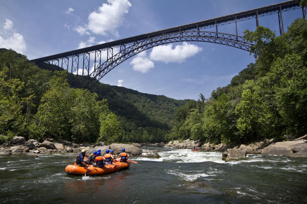
The New River Gorge National Park and Preserve is rich in cultural and natural history and offers an abundance of scenic and recreational opportunities. New River Gorge is home to some of the country’s best whitewater rafting, mainly from the Cunard put-in to the Fayette Station take-out and is also one of the most popular climbing areas on the East Coast.
Home to the New River, which drops 750 feet over 66 miles, with its Class V rapids, has long drawn adventuresome rafters and kayakers to this whitewater area. The New River, which flows northward through low-cut canyons in the Appalachian Mountains, is actually one of the oldest rivers on the planet.
Rock climbing on the canyon walls, mountain biking and hiking on trails that flank the river, and wildlife viewing—bald eagles, osprey, kingfishers, great blue herons, beavers, river otters, wild turkeys, brown bats, snakes, and black bears—are all popular activities within the park.
The New River Gorge Bridge is a work of structural art. Construction of the bridge began in 1974, and was completed in 1977. The Bridge spans 3,030 feet in length and is the third highest bridge in the U.S., at 876 ft. During Bridge Day, an annual one-day festival celebrating the construction of the Bridge, BASE jumpers launch off the 876-foot bridge and parachute down to the New River. New River Gorge is the only national park in the U.S. that permits this extreme activity.
President Jimmy Carter signed legislation establishing New River Gorge National River on November 10, 1978 (Pub.L. 95–625). As stated in the legislation, the park was established as a unit of the national park system “for the purpose of conserving and interpreting outstanding natural, scenic, and historic values and objects in and around the New River Gorge, and preserving as a free-flowing stream an important segment of the New River in West Virginia for the benefit and enjoyment of present and future generations.” The New River Gorge National Park and Preserve Designation Act was incorporated into the Consolidated Appropriations Act, 2021, changing the designation to New River Gorge National Park and Preserve. Less than 10% of the original national river was re-designated as a national park, where hunting is no longer permitted, while the remainder is a national preserve with little change.
PUBLIC SCHOOLS
Mercer County School District
Public Elementary School:
Bluewell Elementary School
Public Middle School:
Bluefield Middle School
Public High School:
Montcalm High School
Higher Education:
Mercer County Technical Education Center, Princeton
Concord University, Athens
DIRECTIONS
From the Coal Heritage Road US 52 intersection with Old Route 20 at the CVS Pharmacy in Bluewell. Travel US 52 North for 1.4 miles and the property will be on the right. The entrance to the property is to the left of the building. (The property line lays to the left and runs behind the building. The building is not on the property for sale)
From Coal Heritage Road US 52 intersection with WV Route 20 at the CVS Pharmacy in Bluewell. Travel 3.3 miles+/- on US 52 North (approximately 10 minutes). Take the Rt. 120 exit off Coal Heritage Road US 52 at the end of the exit ramp, turn left onto Simmons Avenue Rt. 15 away from Bramwell; passing under the Coal Heritage Road, travel Simmons Avenue later becoming Simmons River Road for 2 miles; turn right onto Shrader Hollow Road Rt. 15/8; travel 3/10 mile to the end of the road and the property begins at the locked farm gate with several posted signs on it.
From Coal Heritage Road US 52 intersection with WV Route 20 at the CVS Pharmacy in Bluewell. Travel US 52 North for 1000’ and turn right on Lorton Lick Road. Travel 3 miles and turn left on to Simmons Creek Road. Travel past the Montcalm Post Office and High School 2.9 miles and take a left onto Shrader Hollow Road (CR 15/8) and travel 3/10 mile to the end of the road and the property begins at the locked farm gate with several posted signs on it.
REGIONAL INFORMATION
STATE INFORMATION
- State of West Virginia
- West Virginia Explorer
- West Virginia Government
- West Virginia State Parks
- West Virginia Tourism
- Wonderful West Virginia Magazine
- WV Department of Natural Resources
- Virginia – Commonwealth of Virginia
- Virginia is for Lovers
- Virginia Museum of History & Culture
- Virginia Museum of Natural History
- Virginia National Park Service
- Virginia Recreation
- Virginia State Parks

Contact Foxfire
304.645.7674
Gallery


