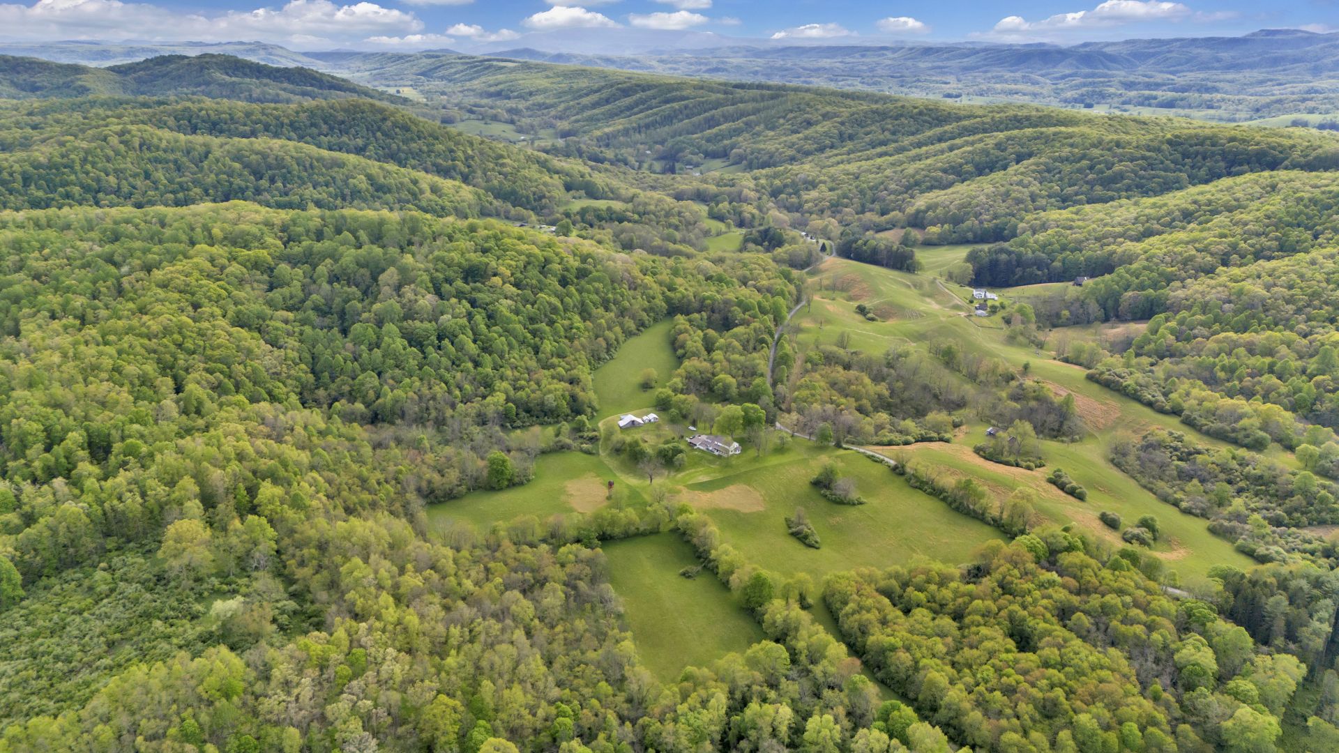
LONG VALLEY COUNTRY ESTATE

| Price: | |
|---|---|
| $1,046,000 | |
| ID: | 1137 |
| Acres: | 95 +/- acres and 3,577 sq. ft. home |
| Address: | 6008 Raders Valley Road, Williamsburg, WV 24991 |
Agent Contact:
Richard Grist, 304-645-7674

HIGHLIGHTS
- Three centuries of ownership
- 95.02 deeded acres with 20 acres of hayfields and 75 acres of mature hardwood woodland
- 3,577 +/- sq. ft. two-story Contemporary style home with 4 bedrooms, 3 bathrooms
- The attached apartment features two bedrooms, bathroom, open kitchen, and storage room
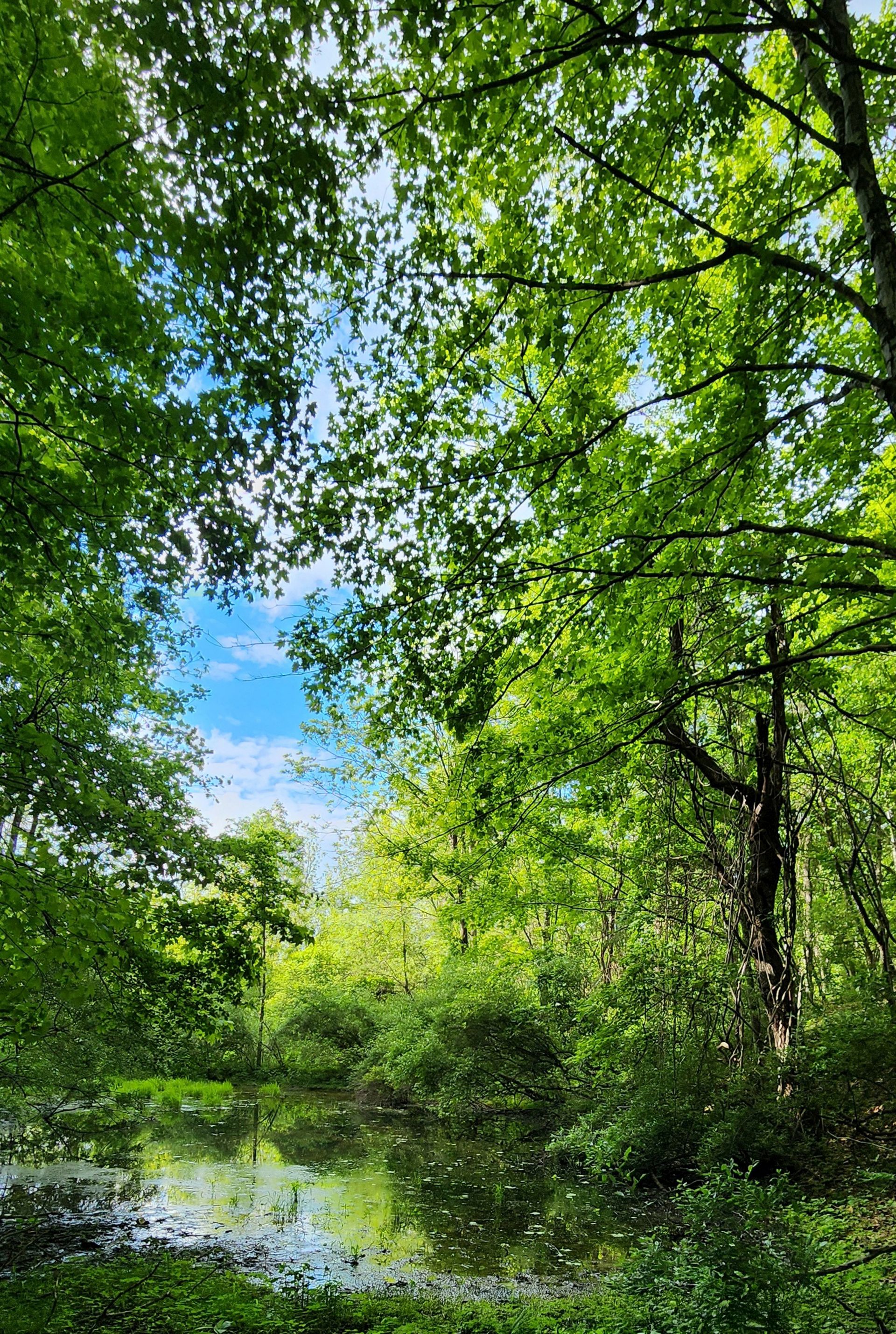
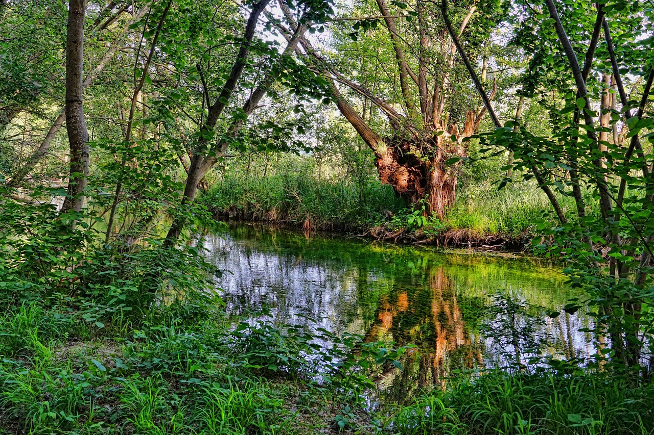
- Culverson Creek, a Blue line stream, runs through the property
- 2 story custom built home with a 2 bedroom apartment above the garage
- Covered front and back porches
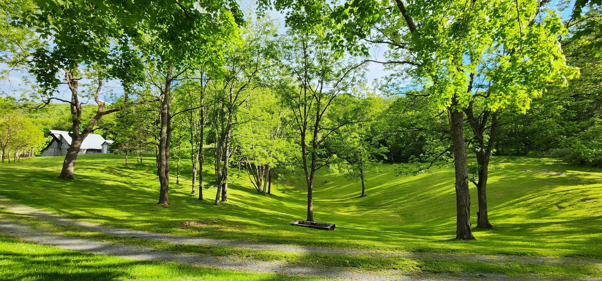
- Stately Maple, Walnut, Hickory and Apple trees throughout the estate grounds
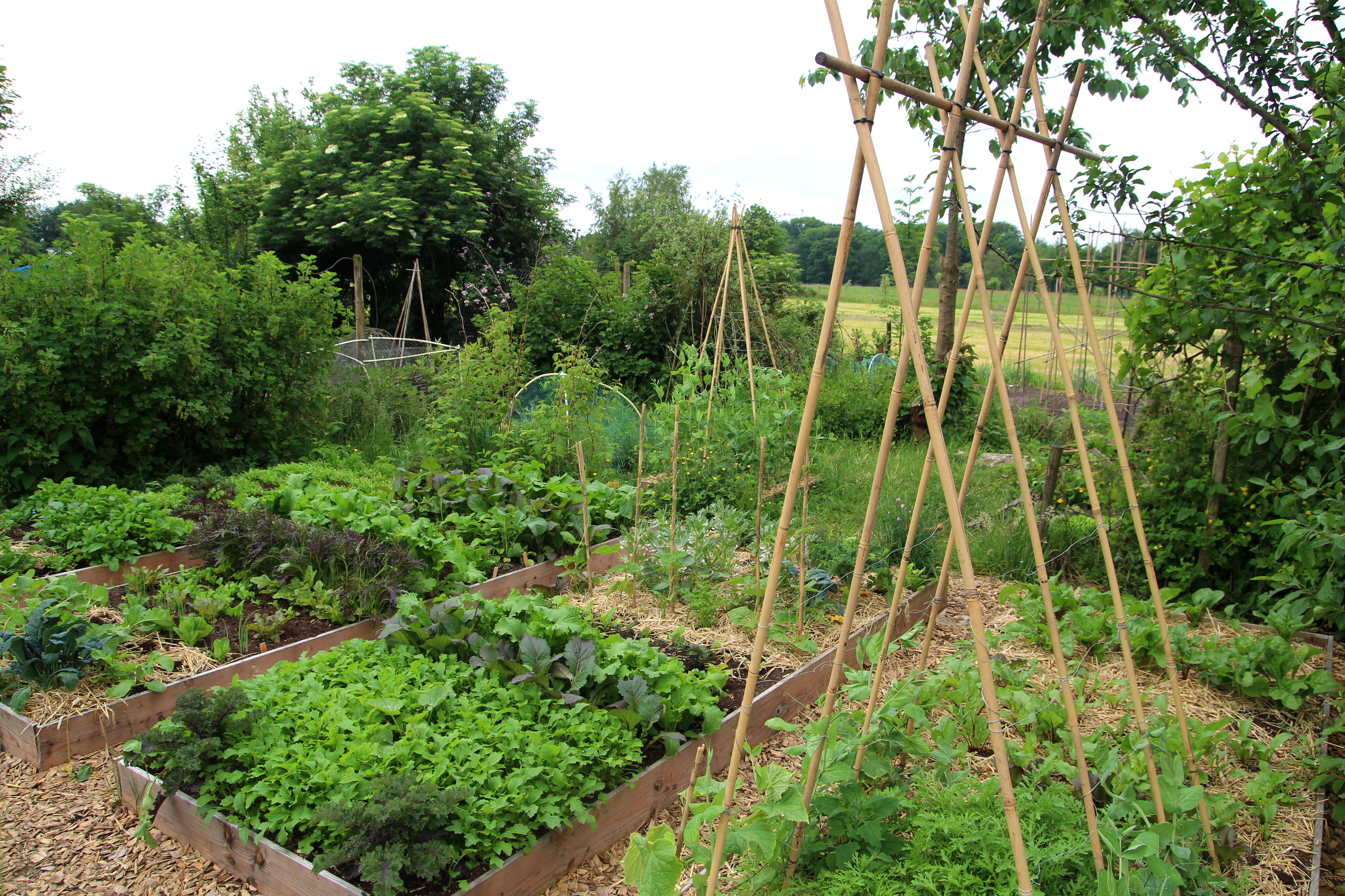
- Orchard and garden area enclosed with a high game fence. The orchard has established Apple, Peach, Cherry fruit trees, Almond trees, a Grapevine and Blackberry bushes
- 50kw whole house generator
- Attached 2 car garage and attached workshop
- Livestock barn and 2 outbuildings
- Greenbrier County is the state’s second largest county- there are more cattle than people
- The farm’s privacy and rural character make it an accessible retreat with broad appeal
- Convenient access to historic Lewisburg and the amenities of the Greenbrier Resort
- Superior access by state maintained paved roads – FedEx, UPS and USPS delivery
- Four season climate
- Mature Appalachian timber-species include oaks, poplar, maple walnut, and hickories
- Fur bearing wildlife – deer, bear, squirrel, rabbit, bobcat, raccoon, fox, opossum
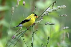
- Winged wildlife – eagles, hawks, owls, ravens, turkeys and Neotropical songbirds
- The trees, fields, and a variety of other plants produce life-giving Oxygen and store Carbon dioxide

- Ideal for recreational activities: shooting sports, ATV & horseback riding, hiking, camping, and nature viewing
- Low taxes, low population density
- Long-range views of mountains and valleys
- Very quiet. Little to no light pollution offers the opportunity for incredible star gazing
- Scenic, cultural, and historic values of the property provide an exceptional quality of life
OVERVIEW
Long Valley Country Estate is distinguished by its unique blend of highly desirable characteristics that are difficult to find together in one property and rarely available for purchase. The modern country style home is surrounded by ninety-five acres blessed with incredibly abundant natural resources, a wealth of water, thriving wildlife, and both mountain and valley habitats. Long Valley features a stunningly diverse and balanced landscape that is wild and scenic, yet accessible and usable. The property offers immediate enjoyment and is ready for a smooth transition to the next legacy of ownership.
Exceptional 95-acre country property with spacious 2-story, 4-bedroom contemporary home with 2-bedroom apartment, attached 3-car garage. Tranquil views, rolling pastures, mixed hardwoods and year-round creek.
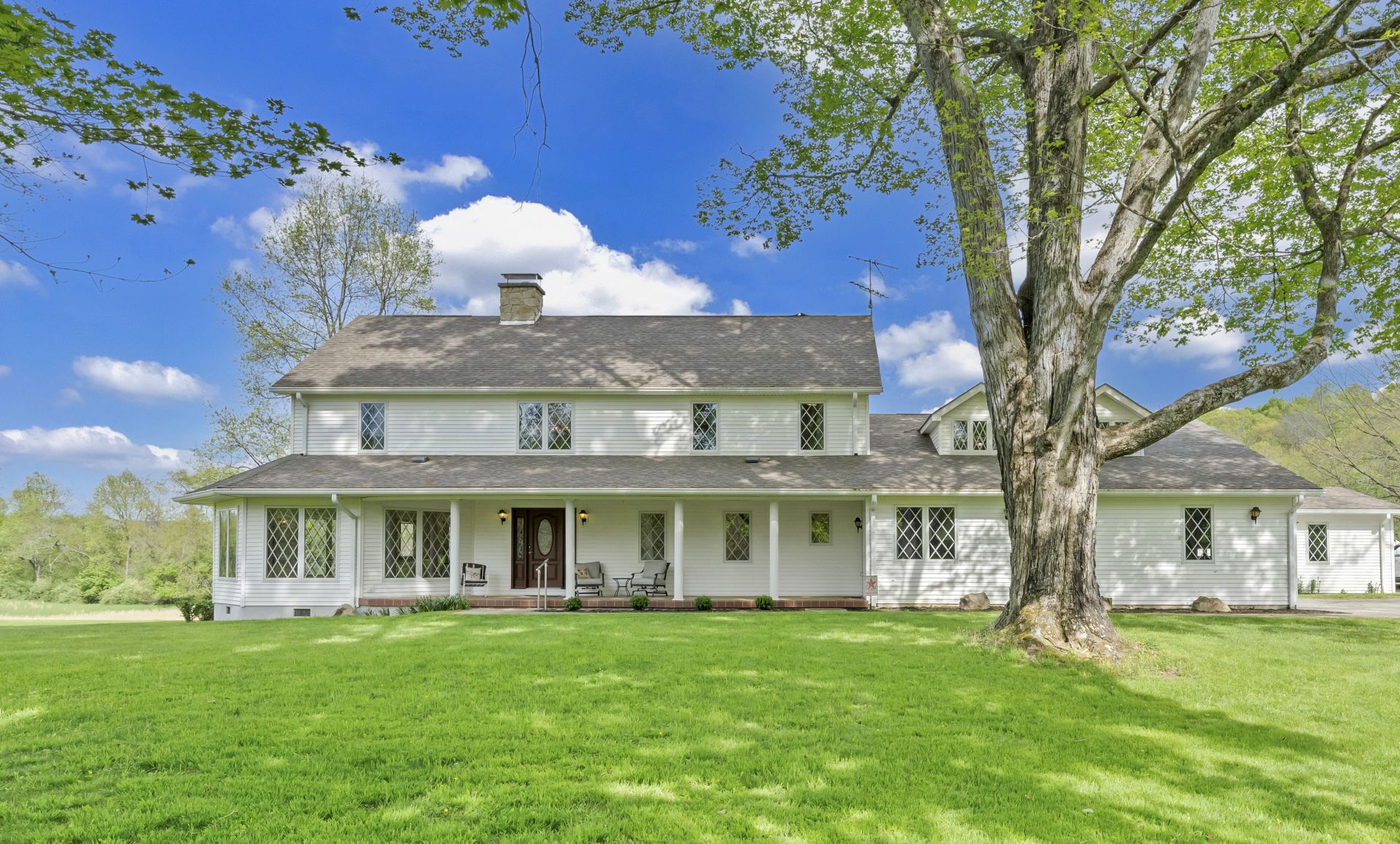
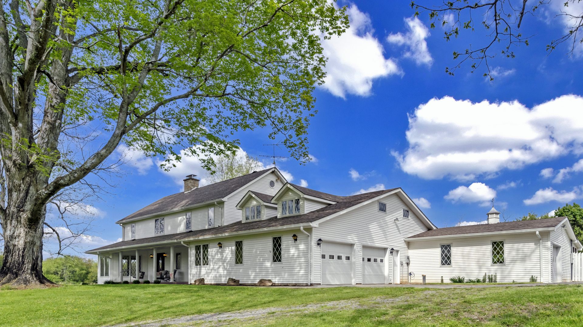
This unique property, once a dairy farm, has been in the same family for more than 3 centuries. The spacious home, built in 1997, incorporates attractive stone, tile and woodwork. Features include beautiful covered front and back porches with tile flooring, a handsome great room with floor-to-ceiling windows and plenty of natural light, a kitchen with a large eat-at island, an office/den, 4 carpeted bedrooms, and an enclosed tiled breezeway leading to two sizeable garages with an upstairs 2-bedroom apartment.
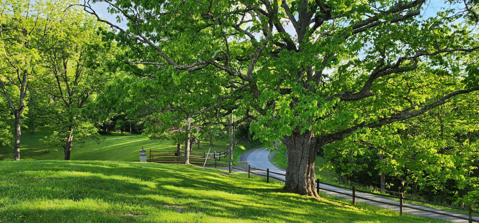
A winding country road leads to the property, fronted by split rail fencing and two stone pillars with lights. Set in a yard with majestic old-growth hardwoods, this picturesque home exudes curb appeal. A sidewalk leads to the columned front porch, with tile flooring, plenty of room for rockers and an impressive view overlooking the yard and quiet country lane.
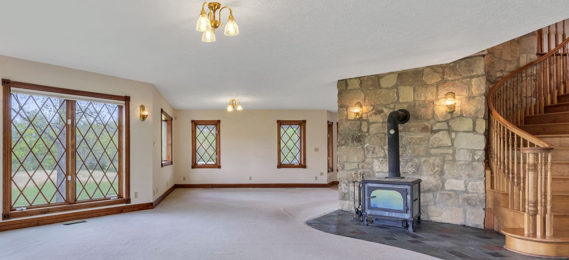
A two-story entry hall with multicolor slate flooring opens to the carpeted great room, which has a large, eye-catching natural stone chimney, a woodstove and five floor-to-ceiling windows. This room flows seamlessly into the carpeted dining area, which has a bay window, and the kitchen, with tile flooring. The spacious kitchen has an island that comfortably seats five and incorporates a Frigidaire electric range. Other appliances include a Whirlpool side-by-side refrigerator-freezer, a Whirlpool dishwasher and a GE microwave. The cabinets are oak and the counters laminate, with a double porcelain sink. The adjacent walk-in pantry has built-in shelving. The kitchen also has a breakfast nook, which along with the island seating and dining area offer plenty of options for casual meals, snacking and more formal occasions.
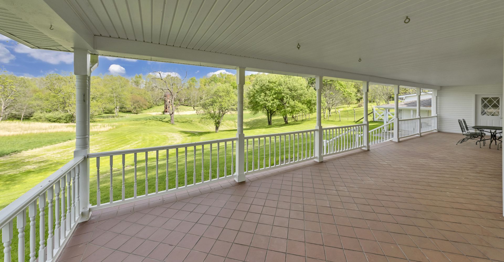
The kitchen opens to one of the home’s most exceptional features, its covered back porch. This large, welcoming space has tile flooring and is roomy enough for outdoor dining and entertaining, and it has even hosted family reunions. The porch offers spectacular panoramic views of the farm and adjacent orchard, with apple, peach and pear trees.
The home’s main level also includes a carpeted den/home office, a laundry room with Roper appliances, shelving and a utility sink, a full bath with a shower-tub and a vanity with solid surface counter, and an enclosed breezeway leading to the garages and the front and back porches. The bath, laundry and breezeway all feature maintenance-free tile flooring. The breezeway includes a gun safe that conveys with the property.
A whole-house vacuum system serves both levels.
The upper-level bedrooms are accessed by a winding oak staircase in the entryway, which wraps artfully around the stone chimney and adds visual appeal to the soaring two-story foyer.
The entire upper level is carpeted, with the exception of the tiled bathrooms. The hallway leads past a natural stone wall, actually the back of the chimney, to the primary bedroom suite, where the same chimney offers the potential for a woodstove in the bedroom, if desired. The primary bedroom includes two small closets with shelving, and a much larger carpeted walk-in closet just inside the bathroom entry. This bath features a shower-tub and an oak vanity with a solid surface countertop with two sinks. Three other bedrooms are just down the hall, and they share a hallway bath with an oval soaking tub and shower, and an oak vanity with a solid surface counter.

The garage apartment is accessed via the breezeway or the upstairs hallway. This private space includes a carpeted living room, a tiled kitchenette with an RCA refrigerator and a GE electric range, a pantry, two carpeted bedrooms and a bath with a shower.
The windows in this well-built home feature attractive latticework, but the lattices are easily removeable. Interestingly, the wood for the baseboards and trim was milled from trees on the farm. All the interior doors are solid wood, with the exception of several that are louvered.
The two attached double garages are noteworthy not only for their generous size and a workshop area with shelving, but also the fact that both are served by a commercial air compressor housed in a separate storage room. One garage includes a half-bath, handy for washing up after farm work or yard chores.
The home is served by a 50kw whole-house emergency generator.
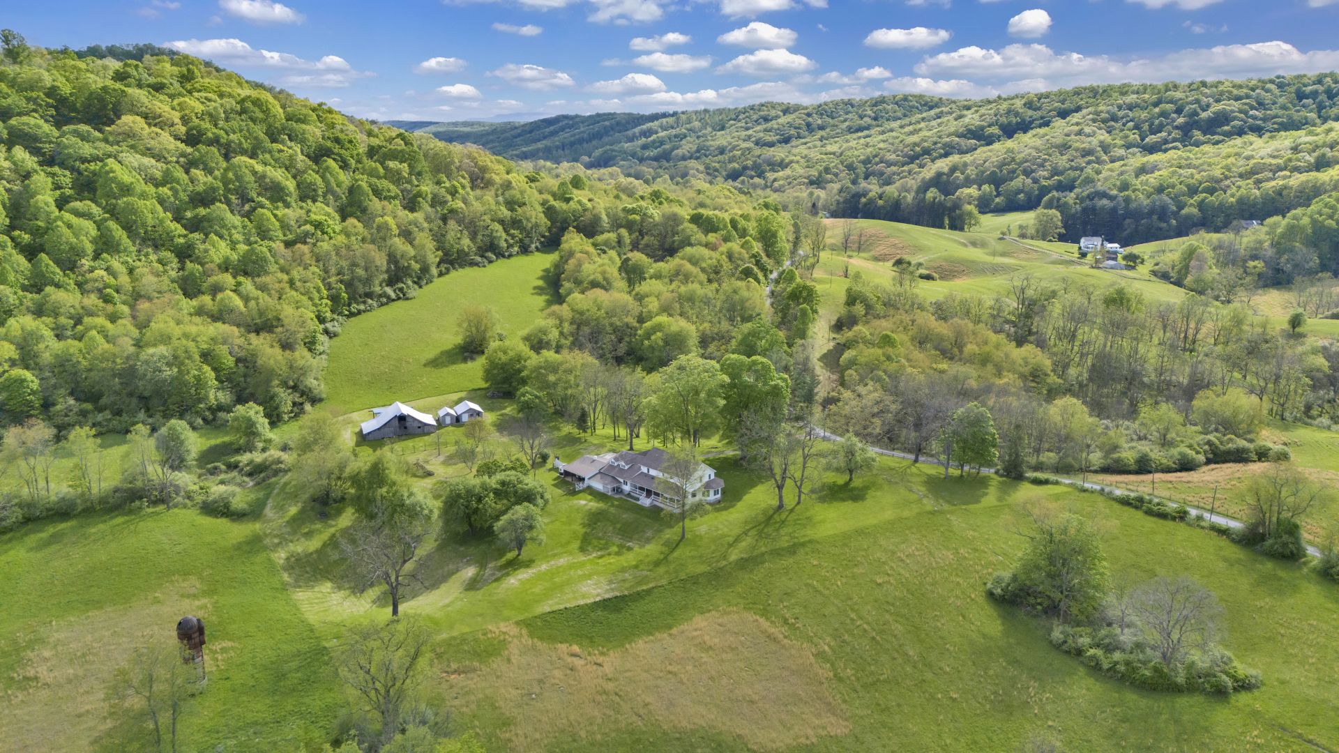
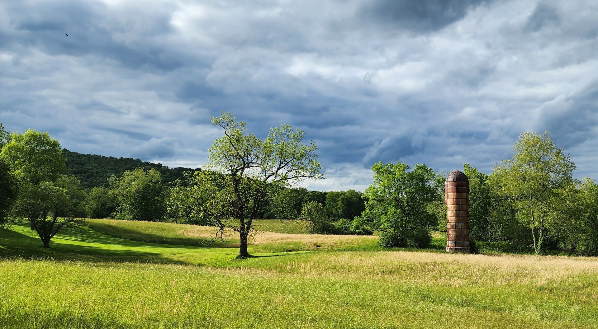
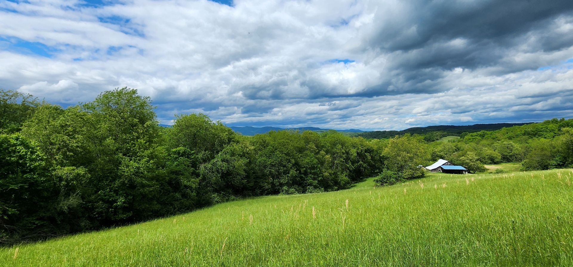
The 95.02-acre property, bordered by both Raders Valley Road and Fort Donnelly Road, is approximately 60% pastureland and 40% woodland with mixed hardwoods. Culvertson Creek runs through the property year-round. The orchard/garden area is fenced. This former dairy hasn’t been a working farm in recent years, but it includes a barn in need of some repair, with stalls and a hayloft, and two cinderblock buildings that once served as the dairy’s milking parlor and milk storage area. These structures offer the potential to return the property to use as a farm, and they are just a short stroll from the house.
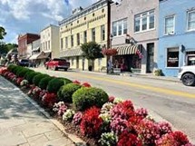
The community of Williamsburg is nearby, and Lewisburg, the seat of Greenbrier County, is 25 minutes away. Often described as an ideal small town, Lewisburg offers fine dining, boutique shops, galleries, a golf course, an 8-screen cinema and a lively arts scene at Carnegie Hall and the Greenbrier Valley Theatre. Annual events include the State Fair of West Virginia in nearby Fairlea, two food-themed street festivals and a literary festival. The town is home to the West Virginia School of Osteopathic Medicine, and a campus of New River Community and Technical College.
The Greenbrier, 10 miles away in White Sulphur Springs, is one of the world’s top luxury resorts. The hotel’s offerings include multiple golf courses, a spa, a tennis complex, a casino, boutique shopping, an artist colony and 10 restaurants. Many of its amenities are open to the public.
The nearby Greenbrier River draws anglers and kayakers, and the 75-mile Greenbrier River Trail is popular with hikers and bicyclists. Snowshoe Ski Resort, a scenic 90-minute drive to the north, is the largest ski complex in the Mid-Atlantic States, and it offers an extensive system of mountain biking trails in the off-season.
This beautiful home is comfortable, picture-perfect and enjoys an idyllic West Virginia country setting.
LOCATION
Google Coordinates: 37.941186°(N), -80.476375°(W)
Address: 6008 Raders Valley Road, Williamsburg, WV 24991
Elevation Range: 2051 ft. to 2526 ft. +/-
Union, WV – 25 minutes
Lewisburg, WV 40 minutes
Charleston, WV – 2 hours (state capitol)
Blacksburg, VA – 1.5 hours
Washington DC – 4 hours
Charlotte, NC 3.5 hours
Atlanta, GA 7 hours
New York City 7.5 hours
Charlottesville, VA – 2.5 hours
Columbus, OH – 5 hours
Lexington, KY – 5 hours
Pittsburgh, PA – 4.5 hours
Raleigh, NC – 5 hours
Roanoke, VA – 2 hours
Richmond, VA – 3.5 hours
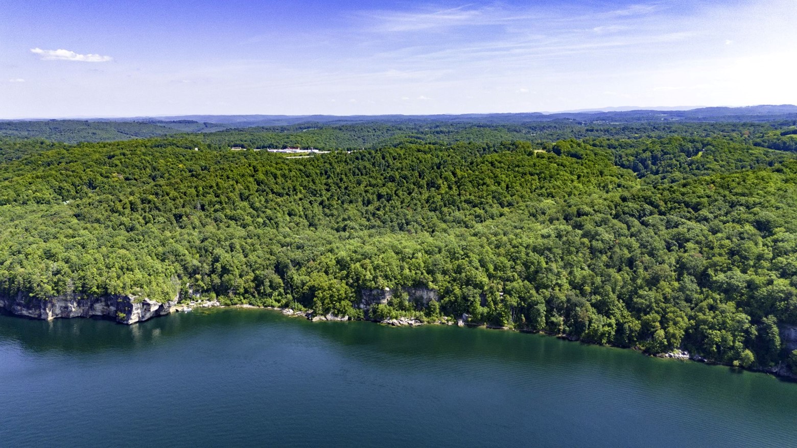
WATER
Culverson Creek, a blueline stream, runs through the northeastern portion of the property for about 290 feet. There should be regular water flow in this stream, especially during rain events and snow melt.
MINERAL RESOURCES
All rights the owner has will convey with the property.
BOUNDARIES AND SURVEY
The property borders extensively on both Raders Valley Road and Fort Donnally Road. Old fences evidence nearly all other lines of the property boundaries. The property was surveyed in 1989 showing 95.02 acres as shown on a survey plat recorded as Hanging File A-30. The property is being sold by the boundary and not by the acre.
UTILITIES
Water: Drilled Well
Sewer: Private
Electricity: On site
Telephone: On site
Internet: Starlink available
Cellphone Coverage: Excellent to spotty
ACCESS/FRONTAGE
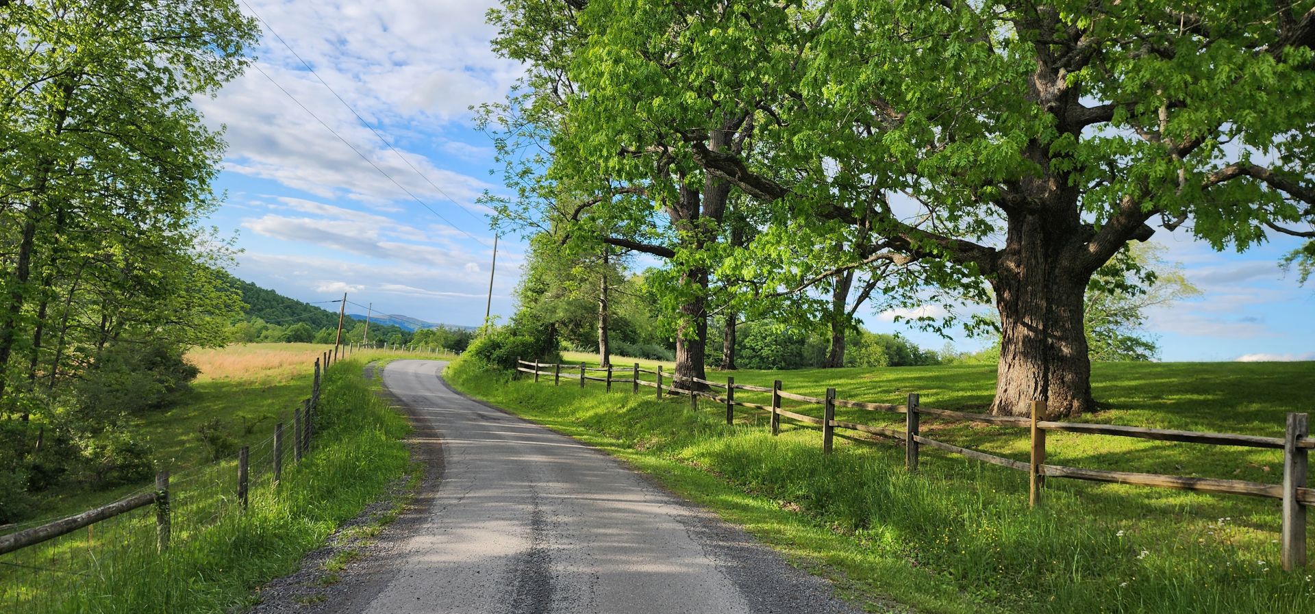
The property has about ½ mile of frontage on Raders Valley Road Rt. 60/28 and about 4/10 mile of frontage on Fort Donnally Road Rt. 17/2. The property driveway connects directly to Raders Valley Road.
ZONING
Greenbrier County is subject to some zoning and subdivision regulations. All prospective buyers should consult the County Commission and also the Health Department for details regarding zoning, building codes and installation of septic systems.
Information can be found at the county website: http://greenbriercounty.net/ordinances.
PROPERTY TYPE/USE SUMMARY
The property has about 5 acres in the home grounds, about 15 acres in fields, and about 70 acres in forestland. There are some small brushy areas associated with field edges.
(This summary is an estimation of current property use as determined from aerial photography. It is subject to the estimation of property boundaries and any errors in the interpretation of land use type from the aerial photography utilized.)
DEED and TAX INFORMATION
Deed Information: DB 262 Pg. 375; 83 Acres
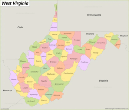
Greenbrier County, West Virginia
Acreage: 95.02 acres +/- by recorded survey plat
Real Estate Tax Info:
Greenbrier County (13), West Virginia
Williamsburg District (18)
Tax Map 53 Parcel 2; Class 2
2024 Real Estate Taxes: $1610.58
SCHOOLS
Greenbrier County School District
Public Elementary School:
Lewisburg Elementary School
Public Middle School:
Eastern Greenbrier Middle School
Public High School:
Greenbrier East High School
Colleges:
New River Community and Technical College (Lewisburg campus)
West Virginia School of Osteopathic Medicine
Private Schools:
Greenbrier Community School (PK-8)
Greenbrier Valley Academy (2-8)
Lewisburg Baptist Academy (PK-12)
Renick Christian School (2-7)
Seneca Trail Christian Academy (PK-12)
DIRECTIONS
From Lewisburg, West Virginia: 13.1 miles +/- (approximately 20 minutes)
From the intersection of US 60 and US 219 in the center of Lewisburg, travel US 60 West for 7.2 miles; turn right onto Raders Valley Road; travel 5.9 miles; the home’
AGRICULTURAL RESOURCES
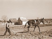
During the period between 1850 and 1920, most of the ninety-acre homestead was cleared with hand tools and animal drawn equipment. Converting timberland into farmland requires a tremendous amount of back-breaking physical labor. The old farmstead is a lasting tribute to the early mountaineers who homesteaded the land.
Presently, the agricultural land contains 20 acres of gently rolling hay fields. The hayfields would also be suitable for row crops like corn, wheat, pumpkins, etc. The rich soil produces a goodly amount of hay each season. Usually, the haying season is from Memorial Day to Labor Day. In late fall the fields are brush hogged.

Past farming history includes raising cattle-sheep, chickens, hogs, growing hay, oats, barley and corn. Onsite is an outstanding two-story barn capped with a vintage standing seam tin roof. A traditional hay mow allowed storage of hay on the upper floor. The barn’s massive internal frame is constructed with circle sawn heavy oak timbers. The barn’s siding is made with circle sawn five quarter oak lumber.
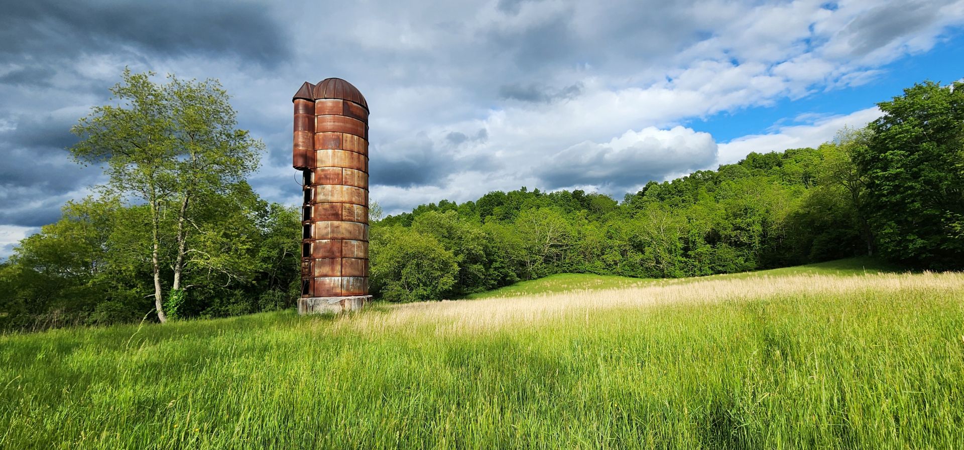
The farmstead included a dairy operation. Two concrete block buildings specific to the dairy operation stand next to the barn. The first was used as the milking parlor and second building was used to keep the milk cold until it could be transported to market.
With the advent of the modern farm tractor in the mid-1940’s, many farm workers were no longer needed and migrated to the large northern cities to work in the factories. This sweeping change resulted in the less productive and steeper areas of the farms were abandoned and were no longer being maintained. These areas eventually became today’s valued forests.
The property has been in continuous agricultural use for some 150 years.
- The property’s rich soil, a blue line and intermittent streams, 4 seasons climate, and varied topography provide the necessary elements for a permaculture lifestyle.
- Fruit and nut trees, plus a small grape arbor, make up the components of the fenced in orchard. Crops of black walnuts are produced each year from the abundant resident black walnut trees.
- Certainly, there is potential to produce honey and maple syrup.
WILDLIFE
 Wildlife management practices have created an exceptional wildlife preserve. Management goals promoted overall wildlife health, facilitated the harvest of game, developed wildlife viewing areas, increased carrying capacity, and increased species diversity.
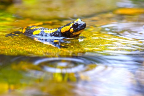
There are many animals that live year-round and at other times in the area’s rivers, lakes, ponds and streams, including beavers, otters, minks, raccoons, opossums, blue herons, Canada geese, wood ducks, mallards, minnows, native fish, turtles, salamanders, newts, crayfish, muskrats, bull frogs, eagles, hawks and redwing blackbirds.
There is the insect and microscopic world including butterflies, dragonflies, pond skaters, water beetles, damselflies, tadpoles and various insect larvae.
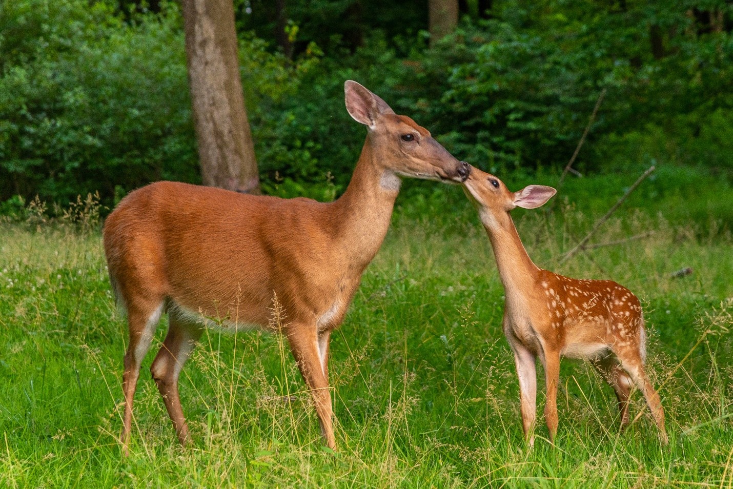
The diverse tree species create the perfect wildlife habitat. The miles of “edge effect” created between farm fields, creeks, hollows, ridges, and rock outcrops benefit all the resident wildlife. Bald eagles, white tail deer, black bear, wild turkey, squirrel, rabbit, bobcat, raccoon, fox and many species of songbirds, owls and raptors make up the resident wildlife population.
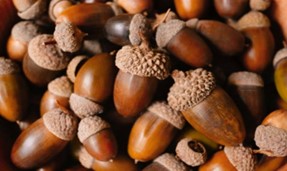
The hardwood forest provides the essential nutrient source and produces tons of hard mast including acorns, hickory nuts, beech nuts and black walnuts. Soft mast includes stag horn sumac, black cherry, tulip poplar seeds, maple seeds, autumn olive berries and blackberries.
At least seventy kinds of mammals inhabit West Virginia, including Virginia big-eared bats, West Virginia northern flying squirrels, raccoons, skunks, and black bears, the state animal. Wild turkeys, ruffed grouse, barred owls, bald eagles, cerulean warblers, and ruby-throated hummingbirds are among the three hundred species of birds that live in the state.
Fence lizards, stinkpots (a kind of turtle), rattlesnakes, and five-lined skinks are some of the reptiles that slither and skitter through West Virginia. Amphibians such as tiny cricket frogs, mountain chorus frogs (Spring peepers), Allegheny Mountain dusky salamanders, newts, and West Virginia spring salamanders also live throughout the state.
Some of West Virginia’s most common trees include oaks, poplar, hickory, maples, Black Walnut, and hemlock. The state also has many native wildflowers such as Black-Eyed Susan’s, Joe Pie Weed, bluebells, buttonweed, Virginia potato (which has edible roots), and wild strawberry.
FOREST RESOURCES
The property contains approximately 75 acres of forestland. Around one hundred years ago, the present forest came into being when the steeper and rockier farmland was abandoned and no longer maintained.
The 75-acre timber resource is well positioned for future timber income as well as value appreciation over the coming decades. With an attractive species mix, adequate stocking levels, and favorable diameter class distribution, the timber amenity represents a strong component of value to the investor.
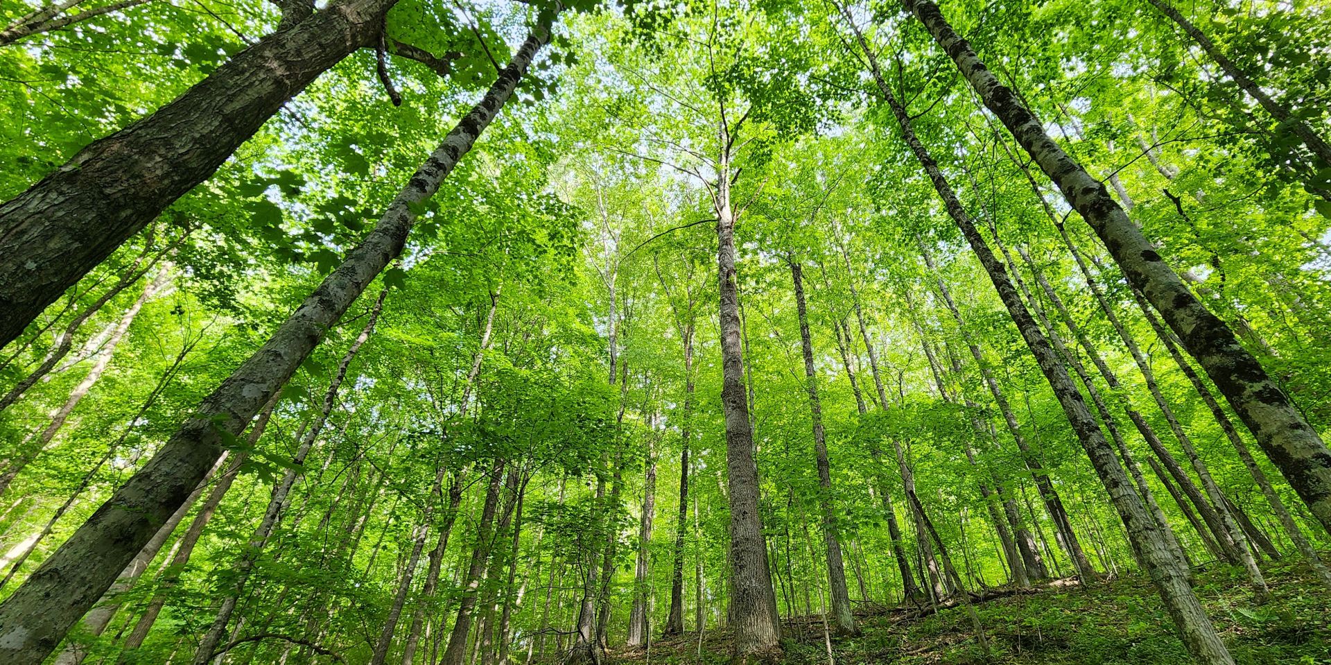
The forest has trees in the 10–80-year-old range. The forest resource is composed of upland Appalachian hardwoods species. The composition consists primarily of Maple, Poplar, Red Oak, White Oak, Hickory, and a host of associated species (Sourwood, Black Walnut, Locust, Black Gum, Beech, Ironwood and Hop Hornbeam).
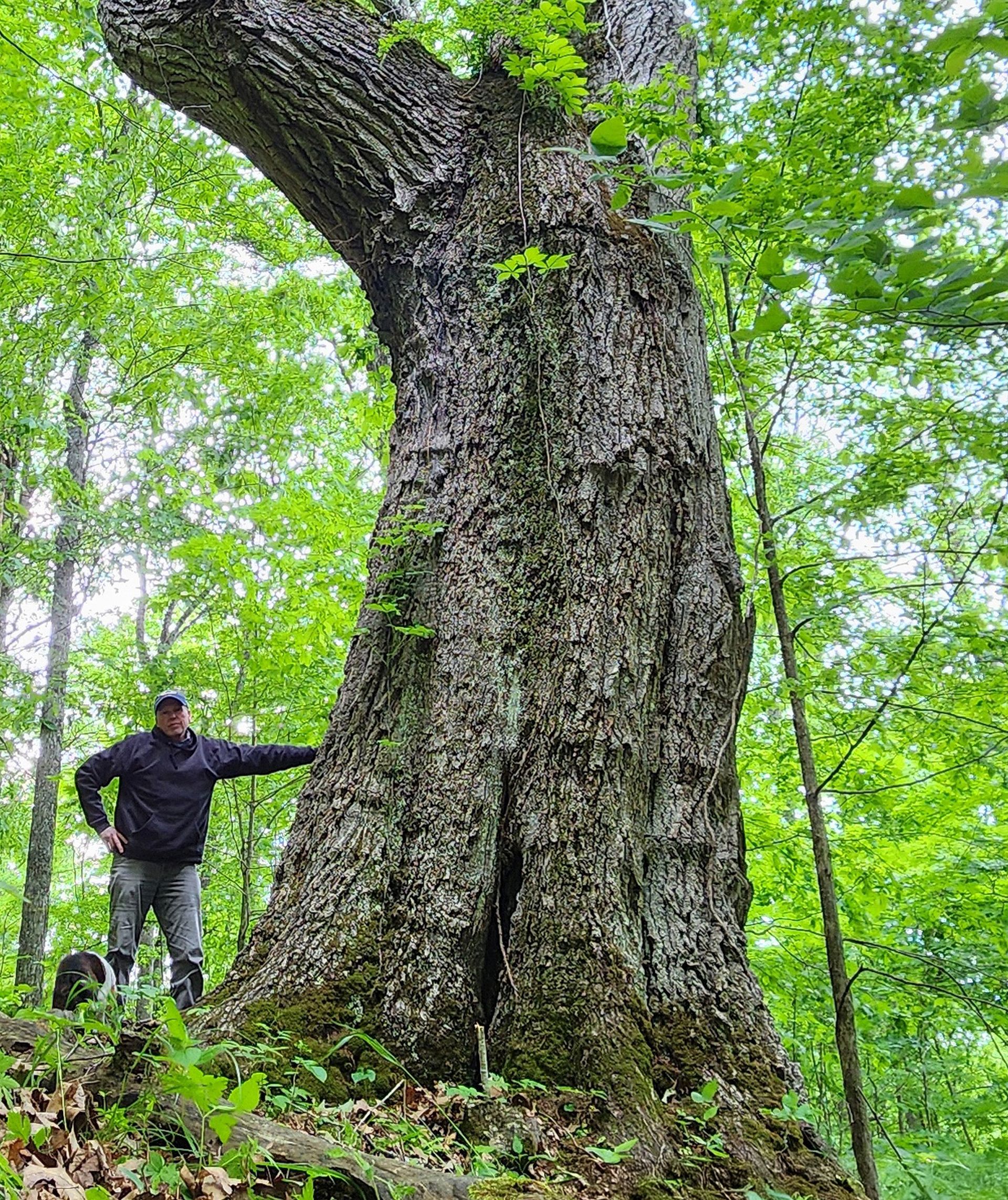
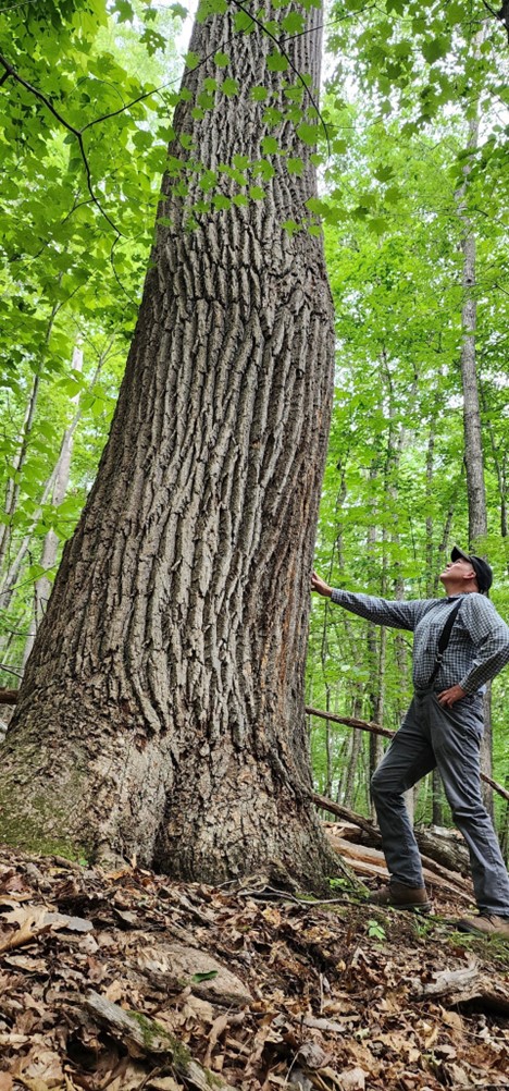
A few “Legacy Trees” are scattered throughout the forest and old field edges. These ancient trees, some 100-150 years old, have withstood the test of time, weathering, ice, wind, lightning strikes and fire.
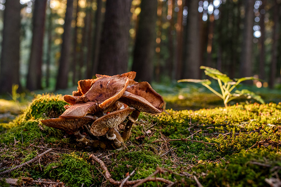
The forest floor is home to several types of mushrooms, medicinal plants, wild ginseng, ferns, and cool green mosses. There are a few fruit trees scattered about, which were part of the early homestead. Honeybees will do very well here.
A MOST PLEASANT CLIMATE
The property experiences an enjoyable four-season climate ideal for growing grapes, berries, apples, peaches, flowers, gardens, hay, and all kinds of row crops. The elevation and surrounding mountains contribute favorably to their growth. Honey, maple syrup, and molasses production all thrive exceptionally well in this climate, as do livestock, poultry, and people.
Summers are noticeably cooler than areas to the east, with average high temperatures in the seventies and eighties. During the winter, high temperatures reach the 50s and 60s, with lows dropping to the teens. Spring and fall feature spectacular weather that highlights the brilliant colors of the changing seasons, and temperatures average in the sixties. Annual rainfall is approximately forty-four inches, while annual snowfall is approximately thirty-nine inches.
BUTTERFLIES

The property is an exceptional habitat for all butterflies, especially the Monarch. The monarch is highly dependent on the milkweed plant and will always return to areas rich in milkweed to lay their eggs upon the plant. The milkweed they feed on as caterpillars is actually a poisonous toxin and is stored in their bodies. This is what makes the monarch butterfly taste so terrible to predators
The property is an exceptional habitat for all butterflies, especially the Monarch. The monarch is highly dependent on the milkweed plant and will always return to areas rich in milkweed to lay their eggs upon the plant. The milkweed they feed on as caterpillars is actually a poisonous toxin and is stored in their bodies. This is what makes the monarch butterfly taste so terrible to predators.
Of course, other butterflies visit the property, including the eastern tiger and spicebush swallowtails, silver-spotted skipper, and a variety of sulphurs and whites.
One other interesting insect to visit the property is the Black Saddlebag Dragonfly, a regular guest of the creeks and wetlands with all the frogs, salamanders, crawdads, and turtles.
RECREATION
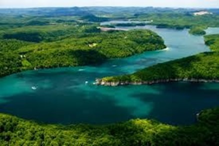
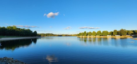
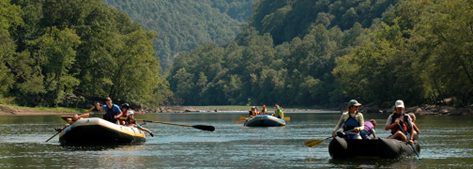
The property offers unparalleled recreational opportunities. Numerous soft recreational activities are anchored by the proximity to the Greenbrier River, New River, Bluestone Lake, Lake Moomaw, Lake Anna, Bluestone River, and Summersville Lake.
Nature viewing is first in line of recreational activities. Attentive wildlife management has been geared not to just game animals. Equal consideration has been extended to increasing the numbers and diversity of species including neo-tropical songbirds, butterflies, turtles, frogs, rabbits, chipmunks, dragonflies, owls, and hawks.

Stargazing-Planet Observation
Complete or near darkness can still be found on most of the property, thereby affording the opportunity to view the night sky in all its brilliant wonder.
Water-sports enthusiasts will find the nearby Greenbrier River and New River ideal for swimming, canoeing, fishing, kayaking, tubing, snorkeling, paddle boarding and windsurfing.

Shooting-sports devotees find all the land and privacy needed to enjoy:
- Paintball-Airsoft-Laser Tag-Archery tag
- Shotgun sport shooting including Skeet, Trap, Double Trap and Sporting Clays
- Rifle & Handgun shooting: bullseye, silhouette, western, bench rest, long-range, fast draw
- Archery and Crossbow competition shooting
- Plain ole’ plinking: Grandpa’s old 22 single shot rifle and a few tin cans make a fun day
All Terrain Motorsports
The property is perfect for experiencing the property from an ATV or UTV. Riders are welcome to ride all public roads that do not have a painted dividing line and there are miles and miles of open roads in the area. These exciting machines handle the wide variety of the forest’s terrain.
Dirt bikes can also be a lot of fun and they come in all sizes and horsepower to fit anyone who enjoys the adrenaline rush offered on forest trails.

Mountain Biking, Horseback Riding and Hiking
The land may be used for mountain biking, hiking or horseback riding and the area offers several state and national parks geared for these activities.
Hunting is a first-class experience. White tail deer, black bear, red/gray fox, bobcat, wild turkey, grouse, duck, squirrel, raccoon, fox and rabbit make up the resident wildlife population. It is hard to find a property that has a better mix of wildlife.
SURROUNDING AREA
Lewisburg, Greenbrier County seat, was voted the Coolest Small Town in America, combining the warmth of a close community with the sophistication of more urban locations. The thriving downtown historic district offers year-round live productions presented at the State Professional Theatre of WV, Carnegie Hall, distinctive dining venues, antique shops, award-winning galleries/boutiques, a year-round farmer’s markets.
Greenbrier Valley Medical Center is a modern hospital with all attendant medical facilities, along with the many big box stores.

The county and city host several fairs & festivals throughout the year including The WV State Fair, a professional 4-weekend Renaissance Festival, Chocolate Festival, Taste of our Town Festival (TOOT), antique car shows, Jeep Rally, Airstream Rally, WV Barn Hunt Competition, and numerous fun parades.
Lewisburg is the home to the Greenbrier Country Public Library, a fantastic, ultra-modern public library that is open 7 days a week. The library’s services include Reading Areas, References, Notary Public, Local History Room, Tax Forms, Fax Service, Photocopies, Digital Printing, Inter Library Loans, Internet/Computer Access, Audio Books, eBooks, Story Hour, Video & DVD’s, Paperback Book Exchange, Literacy Tutoring, Databases, Computer Classes, Book Discussions, Children’s Programming and Online Catalogue.
Lewisburg is also home to modern Robert. C Byrd Medical Clinic (three hundred employees), the WV Osteopathic Medical School (eight hundred students) and the New River Community and Technical College. The area is a strong economic generator with a solid workforce employed in county/state government, tourism, hospitality, medical, education, retail, construction, wood products, mining, and agriculture.
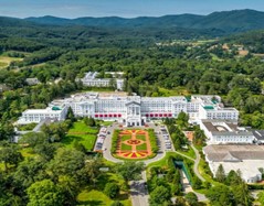 The world-renowned Greenbrier Resort, with eight hundred rooms and 1600 employees, is in White Sulphur Springs. The Four-Star resort has a subterranean casino and is at times the home to the NFL Summer Practice Event, and Tennis Exhibitions. Several other area golf courses are available in the area – including Oakhurst Links, America’s first golf course, where guests play using old style hickory-handled clubs and ground-burrowing golf balls.
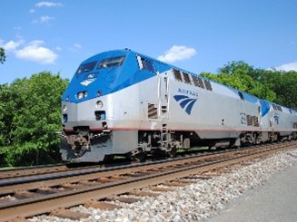
A picturesque Amtrack train ride from White Sulphur Springs connects the area to DC, Philadelphia, Chicago, and many other locations. By car, DC is four hours away and Charlotte is four.
Within a two-hour drive are located some of the finest recreational facilities in West Virginia. Winterplace Ski Resort, whitewater rafting / fishing on the New River and Gauley River, 2000-acre Bluestone Lake, Pipestem State Park, and Resort and the 80,000-acre New River Gorge National Park & Preserve. Five other area state parks and state forests offer unlimited hiking, horseback riding, ATV riding and rock-climbing opportunities. Snowshoe Ski Resort is a 90-minute drive through some of the most scenic country on the East Coast. The new 12,000-acre Boy Scout High Adventure Camp and home to the US and World Jamboree is an hour’s drive.
SIX RIVERS AND FIVE LAKES
The property is in the heart of a biological, historic, and recreational mecca.
The New River Gorge was a vast and largely unsettled wilderness until the C&O railroad was built on the eastern side of the river in the 1880’s. The railroad opened up the rich coalfields and virgin timber stands of the region. Early “mountaineers” settled the area and soon were carving out mountain farms and raising families.
 All rivers and lakes are within a two hour’s drive from the property. The area encompasses the New River, Greenbrier River, Gauley River, Cherry River, Meadow River and Bluestone River. Within this vast watershed lies the 2000-acre Bluestone Lake and 3000-acre Summersville Lake. Lake Moomaw, and Lake Anna.
The rivers and lakes are major contributors to the local ecosystem richness and diversity for both plants and animals. There are many animals that live year round and at other times in the water and around the edges of the rivers/lake, including beavers, otters, minks, raccoons, opossums, blue herons, Canada geese, wood ducks, mallards, king fishers, minnows, native fish, turtles, salamanders, newts, crayfish, muskrats, bull frogs, eagles, owls, hawks and redwing blackbirds.

Great fishing is found in the river and lakes with small and large mouth bass, crappie, catfish, muskie, walleye, pike and bluegill present in good numbers.
The New River is the second oldest river in the world, preceded only by the Nile; it is the oldest river in North America. The New River is unique because it begins in Blowing Rock, N.C. and flows north through Virginia into West Virginia. The Nile and Amazon are the only other major rivers that also flow north. Year after year, it produces more citation fish than any other warm water river in WV. Smallmouth bass, largemouth bass, crappie, catfish, sunfish, hybrid striped bass, and muskie are all common species of fish found in the New River and Bluestone Lake.
Bluestone Lake is over two thousand acres at summer pool and is the state’s third largest body of water. Great hunting and fishing opportunities abound at the 17,632-acre Bluestone Wildlife Area adjacent to the park and nearby Camp Creek State Forest. Summersville Lake is over three thousand acres at summer pool and is the state’s largest body of water.
ARCHEOLOGY AND GEOLOGY
The property is nestled between the folded Ridge and Valley Province to the east and the younger Allegheny Plateau to the west. The Greenbrier River flows 162 miles southwest through the valley and empties into the world’s third oldest river, the New River.
The area’s rich farmland is made fertile by the Greenbrier Limestones, known locally as the “Big Lime”. These limestones were formed from shallow seas some 350 million years ago during the Mississippian geological period. The quarrying of limestone for dimension stone, fill-rock, construction aggregate, riprap, sand, and agricultural lime is an important industry in the area.
Just a few miles west of the property, you can take a trip through time riding on I-64 from Dawson to the WV/VA boundary highlighting outcrops from the younger Mississippian formations to the older Devonian mountains.
 The rich coal fields lying a few miles to the north were formed about three hundred million years ago during the Pennsylvanian and Permian periods when the West Virginia area was south of the equator and moving north. Coal, a combustible sedimentary rock, formed when the area was covered with huge, tropical, swampy forests where plants – giant ferns, reeds, and mosses – grew. When the plants died, they piled up in swamps. Over time, heat and pressure transformed the buried materials into peat and into various forms of coal. These prehistoric coalfields continue to provide energy and industry to residents of West Virginia, the nation, and the world.
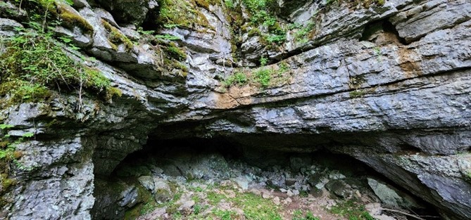
The area exhibits a karst topography due to the underlying Greenbrier Limestone. Karst is characterized by numerous caves, sinkholes, fissures, and underground streams. This interesting topography forms in regions of plentiful rainfall where bedrock consists of carbonate-rich rock, such as limestone, gypsum, or dolomite, which is easily dissolved. Mildly acidic rainwater slowly dissolves the soft limestone over millions of years creating geological fascinations like Lost World Caverns and Organ Cave, carved from the Greenbrier Limestone.
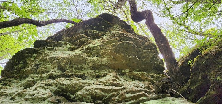
The property has many interesting “riches from the earth” in the form of limestone, agates, fossils, geodes, and curious rock outcrops.
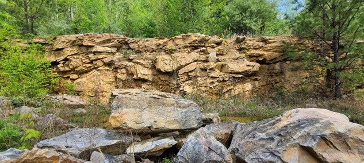
The Droop Sandstone, an extremely hard, quartz-rich rock originally deposited as sand beaches along an ancient shoreline, is especially prominent in the area. The erosion-resistant Droop Sandstone creates numerous sheer rock cliff formations. Locally, the Muddy Creek Mountain quarry produces decorative sandstone from the Droop that is known worldwide for its beauty and durability.
The area is well known for the healing waters of the numerous “Sulphur Springs”. During the 1800’s and early 1900’s, several “Sulphur Springs Resorts” flourished in the area. Most notably and still in existence are White Sulphur Springs, Warm Springs, and Hot Springs. Others included, Sweet Springs, Blue Sulphur Springs, Red Sulphur Springs, Green Sulphur Springs, Salt Sulphur Springs, Pence Springs and Sweet Chalybeate Springs.
GREENBRIER RIVER
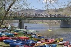
At 162 miles long, the Greenbrier is the longest untamed (unblocked) river left in the Eastern United States. It is primarily used for recreational pursuits and well known for its fishing, canoeing, kayaking and floating opportunities. Its upper reaches flow through the Monongahela National Forest, and it is parallelled for seventy-seven miles by the Greenbrier River Trail, a rail trail which runs between the communities of Cass and North Caldwell.
It has always been a valuable water route, with many of the important cities in the watershed established river ports. The river gives the receiving waters of the New River an estimated 30% of its water volume. Over three-fourths of the watershed is an extensive karstic (cavern system), which supports fine trout fishing, cave exploration and recreation. Many important festivals and public events are held along the river throughout the watershed.
The Greenbrier is formed at Durbin in northern Pocahontas County by the confluence of the East Fork Greenbrier River and the West Fork Greenbrier River, both of which are short streams rising at elevations exceeding 3,300 feet and flowing for their entire lengths in northern Pocahontas County.

From Durbin the Greenbrier flows generally south-southwest through Pocahontas, Greenbrier and Summers Counties, past several communities including Cass, Marlinton, Hillsboro, Ronceverte, Fort Spring, Alderson, and Hinton, where it flows into the New River.
Along most of its course, the Greenbrier accommodated the celebrated Indian warpath known as the Seneca Trail (Great Indian Warpath). From the vicinity of present-day White Sulphur Springs, the Trail followed Anthony’s Creek down to the Greenbrier near the present Pocahontas-Greenbrier County line. It then ascended the river to the vicinity of Hillsboro and Droop Mountain and made its way through present Pocahontas County by way of future Marlinton, Indian Draft Run, and Edray.
GREENBRIER RIVER TRAIL
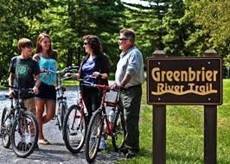
The 77-mile-long Greenbrier River Trail State Park is operated by the West Virginia State Parks and is a former C&O railroad grade now used for hiking, bicycling, ski-touring, horseback-riding, and wheel-chair use. The trail passes through numerous small towns and traverses thirty-five bridges and two tunnels as it winds its way along the valley. Most of the trail is adjacent to the free-flowing Greenbrier River and is surrounded by peaks of the Allegheny Mountains.
THE MONONGAHELA NATIONAL FOREST
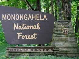
The Monongahela National Forest was established in 1920 and encompasses about one million acres. Located in the north central highlands of West Virginia, the Monongahela straddles the highest ridges in the State. Elevation ranges from just under 1000′ to 4863′ above sea level. Variations in terrain and precipitation have created one of the most ecologically diverse National Forests in the country.
Visitors to this beautiful forest enjoy breathtaking vistas, peaceful country roads, gently flowing streams, and glimpses of the many species of plants and animals that inhabit the Forest. You will also see a ‘working’ forest, which produces timber, water, grazing, minerals and recreational opportunities for the region and nation.
The landscape goals for management of the Monongahela are for a natural appearance and diverse forest, which provides outstanding dispersed recreation opportunities and supporting developed facilities. Dispersed recreation opportunities abound for hiking, backpacking, fishing, hunting, and mountain biking. Developed sites provide tourism destination facilities and base camps so important to the efforts of local Convention and Visitor Bureaus, local communities, and other non-government agencies. Forest Plan Management Prescriptions favor non-motorized recreation for ecological reasons.
The forest is noted for its rugged landscape with spectacular views, blueberry thickets, highland bogs and “sods,” and open areas with exposed rocks. In addition to the second-growth forest trees, the wide range of botanical species found includes rhododendron, laurel on the moist west side of the Allegheny Front, and cactus and endemic shale barren species on the drier eastern slopes.
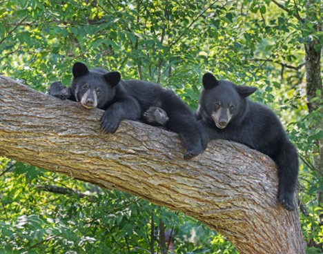 Larger animals and game species found in the forest include black bear, wild turkey, white-tailed deer, gray and fox squirrels, rabbits, snowshoe hare, woodcock, and grouse. Limited waterfowl habitat exists in certain places. Furbearers include beaver, red and gray fox, bobcat, fisher, river otter, raccoon, and mink. Other hunted species include coyotes, skunks, opossums, woodchucks, crows, and weasels. There are twelve species of game (pan) fish and 60 species of non-game or forage fish. Some 90% of the trout waters of West Virginia are within the forest.
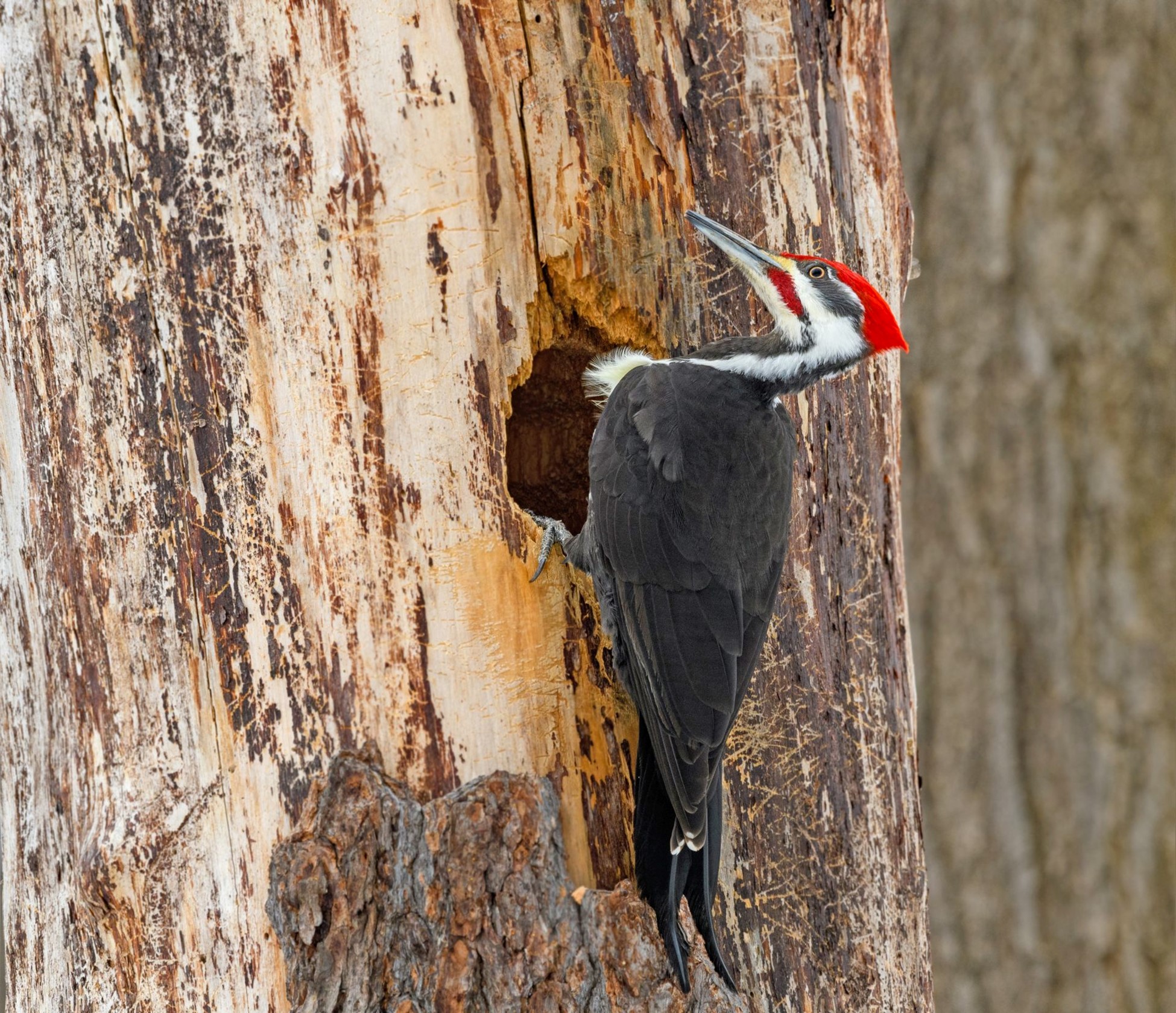
There are 230 known species of birds inhabiting the MNF: 159 are known to breed there, eighty-nine are Neotropical migrants; seventy-one transit the forest during migration, but do not breed there, and 17 non-breeding species are Neotropical. The Brooks Bird Club (BBC) conducts an annual bird banding and survey project in the vicinity of Dolly Sods Scenic Area during migration (August – September). The forest provides habitat for 9 federally listed endangered or threatened species: two bird species, two bat species, one subspecies of flying squirrel, one salamander species, and three plant species. Fifty other species of rare/sensitive plants and animals also occur in the forest.
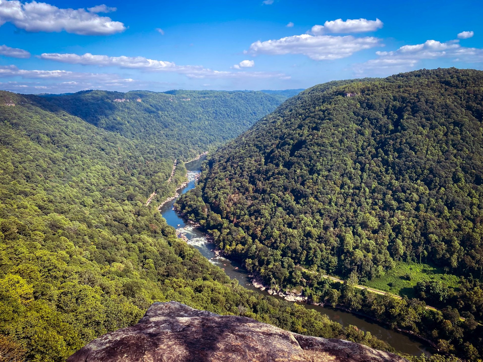
THE NEW RIVER GORGE NATIONAL PARK and PRESERVE
The 80,000-acre New River Gorge National Park and Preserve is a unit of the United States National Park Service (NPS) designed to protect and maintain the New River Gorge in southern West Virginia in the Appalachian Mountains. Established in 1978 as a national river, the NPS-protected area stretches for fifty-three miles (85 km) from just downstream of Hinton to Hawks Nest State Park near Ansted. The Park was officially named America’s 63rd national park, the U.S. government’s highest form of protection, in December of 2020, amid the COVID-19 pandemic as part of a relief bill.
West Virginia is home to parts of the Appalachian National Scenic Trail, a footpath that stretches more than 2,100 miles between Maine and Georgia; the Lewis & Clark National Historic Trail, which cuts through 16 states for 4,900 miles; the Bluestone National Scenic River; and Harpers Ferry National Historic Park. Now, over 70,000 acres of land, bordering fifty-three miles of the gorge, has earned the government’s protection.
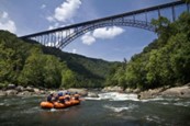
The New River Gorge National Park and Preserve is rich in cultural and natural history and offers an abundance of scenic and recreational opportunities. New River Gorge is home to some of the country’s best whitewater rafting, from the Cunard put into the Fayette Station take-out and is also one of the most popular climbing areas on the East Coast.
Home to the New River, which drops 750 feet over sixty-six miles, with its Class V rapids, has long drawn adventuresome rafters and kayakers to this whitewater area. The New River, which flows northward through low-cut canyons in the Appalachian Mountains, is one of the oldest rivers on the planet.
Rock climbing on the canyon walls, mountain biking and hiking on trails that flank the river, and wildlife viewing—bald eagles, osprey, kingfishers, great blue herons, beavers, river otters, wild turkeys, brown bats, snakes, and black bears—are all popular activities within the park.
Visitors should begin their experience with a stop at Canyon Rim Visitor Center, which is situated on the edge of the gorge, for maps, current information, and chats with a park ranger. You can learn any pertinent safety protocols and visit the bookstore.
The New River Gorge Bridge is a work of structural art. Construction of the bridge began in 1974 and was completed in 1977. The Bridge spans 3,030 feet in length and is the third highest bridge in the U.S., at 876 ft. During Bridge Day, an annual one-day festival celebrating the construction of the Bridge, BASE jumpers launch off the 876-foot bridge and parachute down to the New River. New River Gorge is the only national park in the U.S. that permits this extreme activity.
NEW RIVER REGION OVERVIEW
The New River is shared by boaters, fishermen, campers, park visitors, and local neighbors. The waters of the New River system contain a mosaic of hydrologic features and aquatic habitats that support a highly productive aquatic ecosystem that includes distinct populations of native fish, mussels, crayfish, and a broad array of other aquatic life, including rare amphibians, reptiles, birds, and mammals.
The 320-mile New River rises in the Blue Ridge region of North Carolina and flows northeastward through the Appalachian uplands to Radford, Va., where it turns northwestward and passes through a series of narrow valleys and gorges into southern West Virginia. It ends where it joins the Gauley River to form the Kanawha River. In WV, the New River is entrenched in a steep and narrow valley, the narrowest part of which is known as the “New River Gorge.”
In 1998, because of historical, economical, and cultural importance, President Clinton signed into law the New River as one of the very first American Heritage Rivers. Much of the river’s course through West Virginia was designated as the New River Gorge National River. In 2021, the area was designated as the United States’ newest National Park.
The New River is recognized as the “second oldest river in the world” and is estimated to be between ten and 360 million years old. Its headwaters begin near Blowing Rock, NC, and is one of the few rivers in North America that flows northerly.
Class I, II, III, IV, and V rapids dot the entire 320 miles of New River making it a great paddling, tubing, and white rafting adventure. Beautiful cliffs, bluffs, and mountain views make it one of the most scenic rivers on the east coast.
The New River Gorge National Park includes fifty-three miles of free-flowing New River, beginning at Bluestone Dam, and ending at Hawks Nest Lake. The New River typifies big West Virginia-style whitewater. Within the park, it has two quite different characters. The upper (southern) part of the river consists primarily of long pools and easy rapids up to Class III. It is a big powerful river, but incredibly beautiful, always runnable, and providing excellent fishing and camping. There are several different river access points, and trips can run from several hours to several days.
The lower (northern) section of the river is often referred to as “the Lower Gorge.” In a state that is justifiably renowned for colossal rapids, the Lower Gorge has some of the biggest of the big with rapids ranging in difficulty from Class III to Class V. The rapids are imposing and forceful, many of them obstructed by large boulders which necessitate maneuvering in powerful currents, crosscurrents, and hydraulics. Some rapids contain hazardous undercut rocks.
Prior to the rise of the Appalachian Mountains, the New River cut its bed at a time when the land sloped to the northwest. Amazingly so, as the Appalachians gradually rose around the river, the New River wore away the bedrock at the same rate the mountains formed, leaving behind towering cliffs and prominences that hover hundreds of feet about the water level.
Accounts claim that Indians referred to the New River as the “river of death,” however this origin story is legend. Native Americans and early European settlers regarded the New and Kanawha rivers as being one single waterway. The name “New” may have been derived when the river upstream was discovered by European explorers as the first “new” river found flowing westward.
Native American Indians used the New River as they traveled west years before the pioneers arrived. In the 1600s explorers navigating the New River thought they were close to the Pacific Ocean because of its westerly flow.
In 1671 the Batts-Fallam expedition, by way of the New River, came through to the Lurich area and ended there because the Indian guides refused to take them any farther. They carved their initials in a tree and claimed the territory for King Charles II of England. This was the first proclamation of English territory west of the Alleghenies making the New River the first gateway into the west.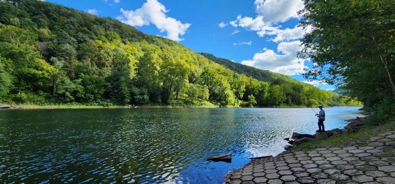 Fast water, big rocks, and lazy/slow stretches are features of the New River. Water sports enthusiasts will find the New River ideal for swimming, canoeing, fishing, kayaking, tubing, snorkeling, paddle boarding, and windsurfing. Great fishing is found in the New River with bass (largemouth, smallmouth, and rock), flathead catfish, channel catfish, muskie, walleye, and bluegill present in good numbers. Year after year, it produces more citation fish than any other warm water river in WV.
The New River Gorge was a vast and unsettled wilderness until the C&O railroad was built on the eastern side of the river in the 1880s. The railroad opened the rich coalfields and virgin timber stands of the region. Early “mountaineers” settled the area and soon were carving out mountain farms and raising families.
The gorge was impassable before the completion of the New River Gorge Bridge, near Fayetteville, WV, in 1978. The river within its gorge is one of the most popular whitewater rafting destinations in the eastern U.S. Much of the New between Hinton and Gauley Bridge is managed by the National Park Service as the New River Gorge National River.
Principal tributaries of the New in West Virginia include, from south to north, the East River, the Bluestone River, and the Greenbrier River.
Many former mining communities located on the New River in its gorge have since become ghost towns. These include Sewell, Nuttalburg, Kaymoor, Fayette, South Fayette, Hawks Nest, Cotton Hill, and Gauley, Beury, and Claremont.
SNOWSHOE SKI & RESORT DESTINATION

From Richlands 338 Snowshoe Mountain Resort is an hour and thirty minutes’ drive and is among the most popular ski resorts in the east-central U.S. The resort, at 4848’ elevation, includes two ski areas, two terrain parks, and fifty-seven downhill slopes that uniquely descend from the ski villages at the top of the mountain. The resort is also among the chief destinations for mountain biking in the Virginias. The International Mountain Bicycling Association has designated the Snowshoe Highland Ride Center as a silver-level destination. The resort boasts twenty-three restaurants and pubs, thirty-four lodges and cabin villages, and supports many off-mountain lodging venues year-round.
CARBON SEQUESTRATION
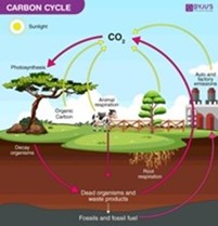
The property is a wonderful producer of Oxygen and Carbon Sequester. Carbon Sequestration is the act of processing carbon dioxide through sinks and stores and releasing them into the atmosphere as oxygen. The vigorously growing forest is sequestering thousands of tons of Carbon Dioxide each per year and producing like tonnage of life sustaining Oxygen.
SELF-SUSTAINING LIFE OFF THE GRID
Just like two hundred years ago, when the first mountaineers settled the area, the property would be self-sustaining in times of necessity – even without electricity.
- Fresh water for drinking and cooking would come from drilled water wells (hand drawing water from the wells using a cylinder well bucket). Mountain spring can be developed.
- The forest would provide fresh food (deer and turkey).
- The agricultural land’s flat to rolling topography would be used to raise livestock of all kinds (chickens, pigs, cows, sheep, goats, rabbits etc.) and could be farmed with horse drawn equipment. The land would support vegetable gardens, berry patches, fruit orchards, and row crops of corn, oats and barley.
- Beehives would provide honey and beeswax for candles.
- The forest would provide firewood for heating and cooking, lumber for building, basket splints, maple syrup and pounds of nuts (walnuts, beechnuts and hickory nuts).
FOREST FARMING
The most common crops are medicinal herbs and mushrooms. Other crops that can be produced include shade-loving native ornamentals, moss, fruit, nuts, other food crops, and decorative materials for crafts. These crops are often referred to as special forest products.
Here are some specific examples of crops in each category that are currently being cultivated:
- Medicinal herbs: Ginseng, goldenseal, black cohosh, bloodroot, passionflower, and mayapple
- Mushrooms: Shiitake and oyster mushrooms
- Native ornamentals: Rhododendrons and dogwood
- Moss: Log or sheet moss
- Fruit: Pawpaws, currants, elderberries, and lowbush blueberries
- Nuts: Black walnuts, acorns, hazelnuts, hickory nuts, and beechnuts
- Other food crops: Ramps (wild leeks), maple syrup, and honey
- Plants used for decorative purposes, dyes, and crafts: Galax, princess pine, white oak, pussy willow branches in the spring, holly, bittersweet, and bloodroot and ground pine (Lycopodium)
PERMACULTURE FARMING
The three core tenets of permaculture are:
- Care for the earth: Provision for all life systems to continue and multiply. This is the first principle, because without a healthy earth, humans cannot flourish.
- Care for the people: Provision for people to access those resources necessary for their existence
- Setting limits to population and consumption: By governing our own needs, we can set resources aside to further the above principles. This includes returning waste back into the system to recycle into usefulness. The third ethic is sometimes referred to as Fair Share, which reflects that each of us should take no more than what we need before we reinvest the surplus.
Permaculture design emphasizes patterns of landscape, function, and species assemblies. It determines where these elements should be placed so they can provide maximum benefit to the local environment. Permaculture maximizes useful connections between components and constructive interaction of the final design. The focus of permaculture, therefore, is not on each separate element, but rather on the relationships created among elements by the way they are placed together; the whole becomes greater than the sum of its parts. Permaculture design therefore seeks to minimize waste, human labor, and energy input by building systems, and maximizes benefits between design elements to achieve an elevated level of interaction. Permaculture designs evolve over time by considering these relationships and elements and can evolve into extremely complex systems that produce a high density of food and materials with minimal input.
The design principles, which are the conceptual foundation of permaculture, were derived from the science of systems ecology and study of pre-industrial examples of sustainable land use. Permaculture draws from several disciplines including organic farming, agroforestry, integrated farming, sustainable development, and applied ecology. Permaculture has been applied most commonly to the design of housing and landscaping, integrating techniques such as agroforestry, natural building, and rainwater harvesting within the context of permaculture design principles and theory.
THE VALUE OF WETLANDS

Once regarded as impediments to economic growth, wetlands drained and filled to make way for farmland and development. Now, however, they are prized for their recreational and environmental value. Located nearby is one of the state’s largest wetlands, these “swamp forests,” as such areas were once called, are attracting increased attention. While scientists celebrate the ecological benefits, outdoor enthusiasts, such as hikers, hunters, and paddlers, are visiting them in ever-increasing numbers. Kayakers can now be found paddling the meandering waterways with cameras and binoculars in hand. Several wildlife observation areas have been opened, and local travel bureaus are approaching the Big Meadows as a tourist destination.
Wetlands are now recognized as being among the world’s most productive ecosystems, comparable to rain forests and coral reefs. The combination of shallow water and elevated levels of nutrients is ideal for organisms that form the base of the food web and feed many species of bird, fish, insects, and amphibians, which explains the enormous population of wildlife that visits and inhabits the area permanently and seasonally.
Scientists now understand that wetlands store carbon within their soil and plant communities instead of releasing it to the atmosphere as carbon dioxide. Thus, wetlands help moderate global climate. They also function as natural sponges that trap and slowly release surface water, rain, and snowmelt, slowing the speed of flood waters and distributing them more slowly over the floodplain, preventing flooding in urban areas downstream.
RIPARIAN ZONES
In earlier times, before the environmental and societal values of riparian zones (RZ’s) were discovered, the RZ was commonly called a “swamp”. These enchanting areas are biologically rich and wildlife diverse, being akin to the world’s largest swamps found in the Florida Everglades and the Amazon River Basin. The mighty RZ works to provide “ecosystem services”—non-monetary benefits like clean water, clean air, carbon sequestration, and recreation for everyone.
These areas are the best of both worlds. Here you can watch for deer, squirrels, raccoon, and turkey while exploring for butterflies, turtles, frogs, crawdads, songbirds, salamanders, newts, and a host of other aquatic invertebrates, migratory birds, reptiles, and amphibians.
RZ’s are a very productive part of the environment, more productive of vegetation, in fact, than some agricultural soils. This vegetation serves important purposes. It shelters and feeds many wildlife species that cannot survive elsewhere. Almost 35 percent of all rare and endangered species depend, in some way, on RZ’s. More common riparian zone species provide enjoyment to many by serving educational, research and recreational needs. Waterfowl and many fur bearers such as beaver, mink and muskrat provide both consumptive and no consumptive recreation and are dependent on the zones. Many fringe RZ’s provide the food that young fish need to survive. By slowing the flow of water, RZ’s help keep banks from eroding and they trap and settle suspended silt before it smothers fish eggs and covers the insects and other animals that fish eat.
Riparian zones add visual diversity and offer an opportunity to see many different plant and wildlife species seen nowhere else on the property.
WEST VIRGINIA – A BRIEF OVERVIEW
- Nickname: The Mountain State
- Statehood: 1863; 35th state
- Population 2025: 1,770,071
- Capital: Charleston
- Biggest City: Charleston
- Abbreviation: WV
- State bird: Cardinal
- State flower: Rhododendron
- State Animal: Black Bear
- The most forested state
HISTORY
After archaeologists discovered spear points used to hunt extinct species such as mastodons and mammoths, they realized that people have lived in what’s now West Virginia for at least 10,500 years. Many thousands of years after these ancient people lived, Native American tribes including the Cherokee, Iroquois, Manahoac, Meherrin, Monacan, Nottaway, Shawnee, Occaneechi, Tutelo, and Saponi populated the land.
After the British arrived in the 1600s, the area that now encompasses West Virginia, Virginia, Kentucky, and parts of North Carolina, Delaware, Pennsylvania, and New York was all called Virginia. In 1730, Virginia’s British-controlled government offered a thousand acres free to each European family willing to move to the area that would become West Virginia. As a result, Native Americans’ homelands were taken, and tribes began supporting the French in a land war against the British (often called the French and Indian War) from 1756 until 1763.
The British won that battle, so West Virginia was still part of Virginia during the Revolutionary War of 1775 to 1783. But at the beginning of the Civil War (1861-1865), West Virginia refused to secede (withdraw) from the Union along with the rest of the state. John Brown, an abolitionist, someone who wanted to abolish slavery, staged a famous raid on Harpers Ferry in 1859. Brown hoped weapons gained in the raid would be used in the fight against slavery, but his raid failed. West Virginia separated from Virginia in 1861, and two years later, it became its own state.
WHY IS IT CALLED THE MOUNTAIN STATE?
West Virginia was originally going to be called “Kanawha,” a name that honors a Native American tribe. However, even though the region separated from Virginia, officials still wanted that as part of its new name. (Virginia was named after a nickname of Queen Elizabeth I, who ruled in the late 1500s.)
West Virginia is called the Mountain State because it is the only state completely within the Appalachian Mountain region, and its average elevation is higher than any other state east of the Mississippi River!
GEOGRAPHY AND LANDFORMS
Some people think this state’s shape looks like a leaping frog, with its nose in the southwestern corner. WV is bordered by Ohio, Pennsylvania, and Maryland in the north; Maryland and Virginia in the east; Virginia and Kentucky in the south; and Kentucky and Ohio in the west. The Ohio River creates its wiggly western border, while its winding eastern border is created by the Appalachian Mountains. It can be divided into two geographical regions.
The Appalachian Ridge and Valley Region includes the Appalachian and Blue Ridge Mountains, which start in the northeast and run southwest. This region is known for its parallel ridges that were cut by streams, as well as canyons called “water gaps.” Forests, caves, and high peaks dot this area, including the state’s highest point, Spruce Knob.
The Allegheny Plateau spreads across the rest of the state and has flat-topped hills and rounded peaks. Deep, stream-cut gorges and a wall of mountains called the Allegheny Front separate the state’s two regions.
WILDLIFE
 At least seventy kinds of mammals inhabit West Virginia, including Virginia big-eared bats, West Virginia northern flying squirrels, raccoons, skunks, and black bears, the state animal. Wild turkeys, ruffed grouse, barred owls, bald eagles, cerulean warblers, and ruby-throated hummingbirds are among the three hundred species of birds that live in the state.
Fence lizards, stinkpots (a kind of turtle), rattlesnakes, and five-lined skinks are some of the reptiles that slither and skitter through West Virginia. Amphibians such as tiny cricket frogs, mountain chorus frogs (Spring peepers), Allegheny Mountain dusky salamanders, newts, and West Virginia spring salamanders also live throughout the state.
Some of West Virginia’s most common trees include oaks, poplar, hickory, maples, Black Walnut, and hemlock. The state also has many native wildflowers such as Black-Eyed Susan’s, Joe Pie Weed, bluebells, buttonweed, Virginia potato (which has edible roots), and wild strawberry.
NATURAL RESOURCES
As the United States’ third most-forested state, West Virginia is known as a Resource State for its coal, timber, natural gas, quarry stone, rivers, and protected woodlands. It is also famous for its salt: Wild buffalo and deer gathered to lick natural salt deposits, and Native Americans and colonists gathered salt to cure butter and preserve meats. Today salt deposits are still mined for rock salt, which is then used to create chemicals such as chlorine.
Coal, oil, timber, and natural gas, chemicals, and tourism are major contributors to the state’s economy.
DIRECTIONS
From Lewisburg, West Virginia: 13.1 miles +/- (approximately 20 minutes)
From the intersection of US 60 and US 219 in the center of Lewisburg, travel US 60 West for 7.2 miles; turn right onto Raders Valley Road; travel 5.9 miles; the home’s driveway is on the right.
REGIONAL INFORMATION
STATE INFORMATION
- State of West Virginia
- West Virginia Explorer
- West Virginia Government
- West Virginia State Parks
- West Virginia Tourism
- Wonderful West Virginia Magazine
- WV Department of Natural Resources
- Virginia – Commonwealth of Virginia
- Virginia is for Lovers
- Virginia Museum of History & Culture
- Virginia Museum of Natural History
- Virginia National Park Service
- Virginia Recreation
- Virginia State Parks

Contact Foxfire
304.645.7674
Gallery


