ROBINSON FARM ON THE WATERS OF MUDDY CREEK

| Price: | |
|---|---|
| $600,000 | |
| ID: | 1228 |
| Acres: | 112 acres +/- |
| Address: | 3602 State Route 12, Alderson, WV 24910 |
Agent Contact:
Randy S. "Riverbend" Burdette , 304-667-2897


MAPS & DOCUMENTS-CLICK LINKS TO VIEW
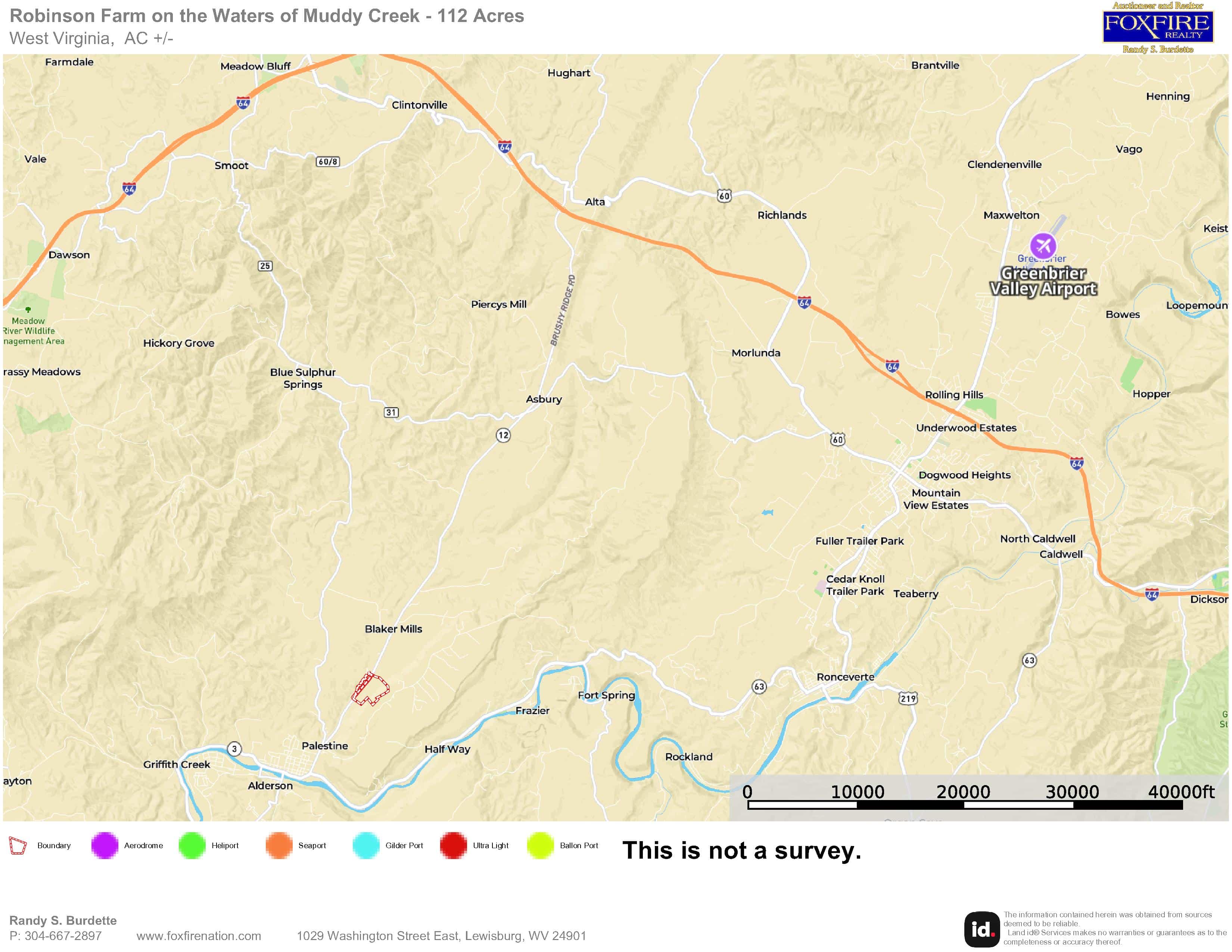
1- Aerial Map For The Robinson Farm
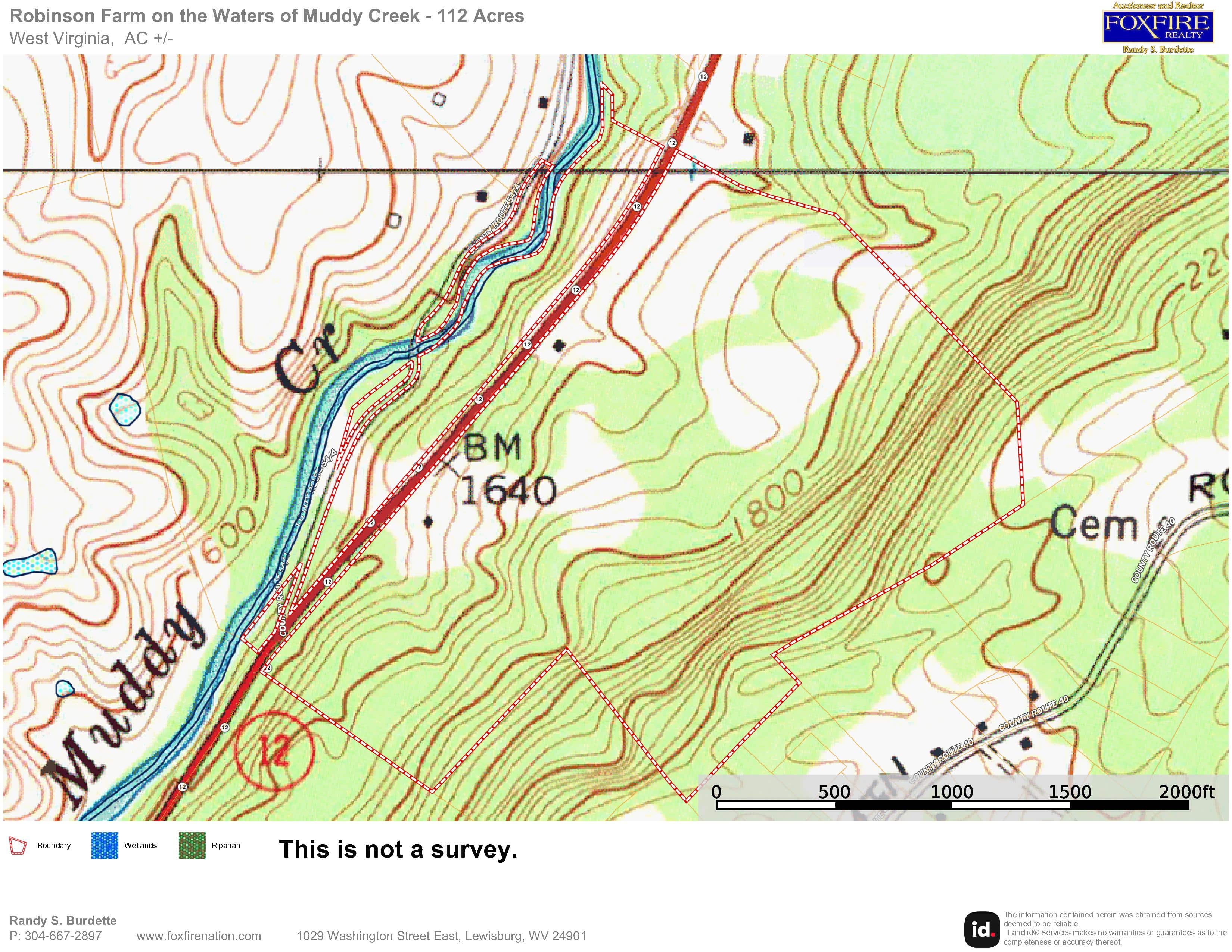
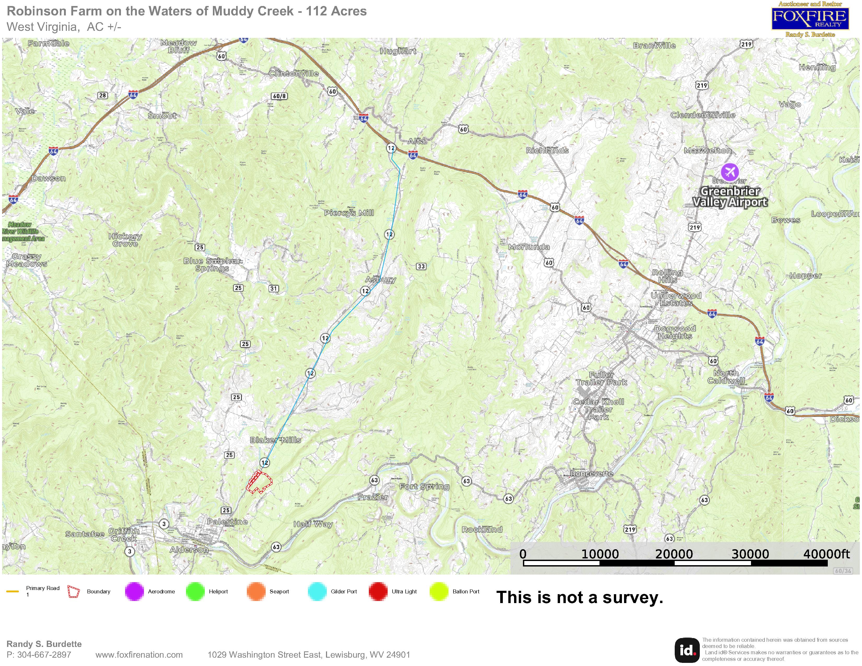
2- Topo Map For The Robinson Farm
3- Aerial Map With Contour Lines For The Robinson Farm
4- Aerial Map With Alderson For The Robinson Farm
5- Street Map For The Robinson Farm
7-Aerial Map With Labels For The Robinson Farm
8-WV Flood Tool Topo Map The Robinson Farm
9-WV Flood Tool Aerial LOMA Map The Robinson Farm
OVERVIEW
ROBINSON FARM — 112 ACRES ±
On the Waters of Muddy Creek | Alderson, Greenbrier County, West Virginia
A Classic Greenbrier County Farm Offering Creek Frontage, Timber, Pasture, Wildlife, Multiple Dwellings, Exceptional Accessibility, and a Superb Location.
Rarely does a property combine this much acreage, water, timber, open land, improvements, and convenient access in such a desirable Greenbrier Valley location.
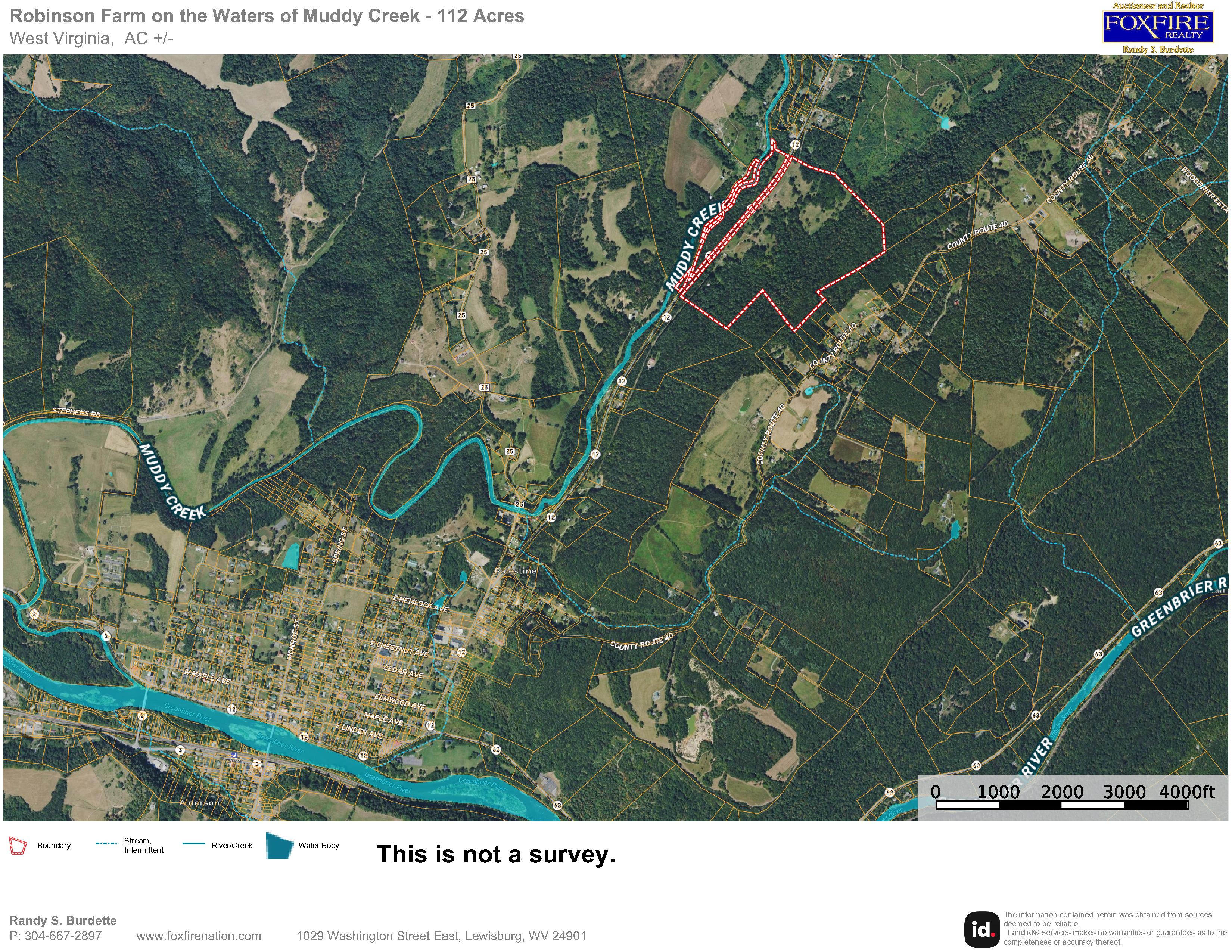
The Robinson Farm, containing approximately 112 acres ±, lies just outside historic Alderson, West Virginia, along the waters of beloved Muddy Creek. CLICK HERE FOR AN INTERACTIVE MAP
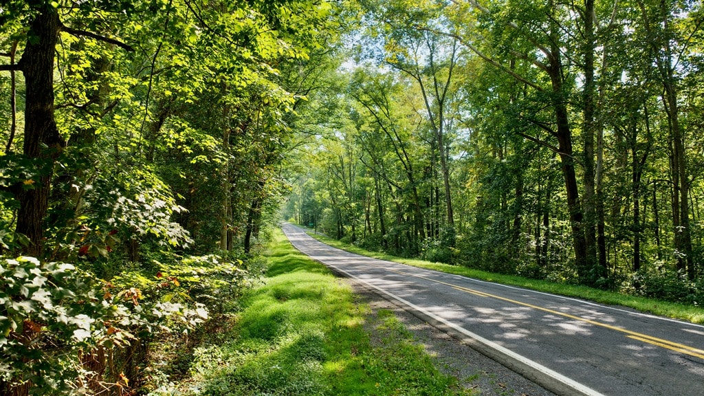
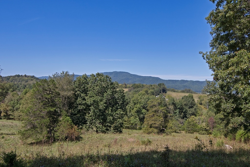
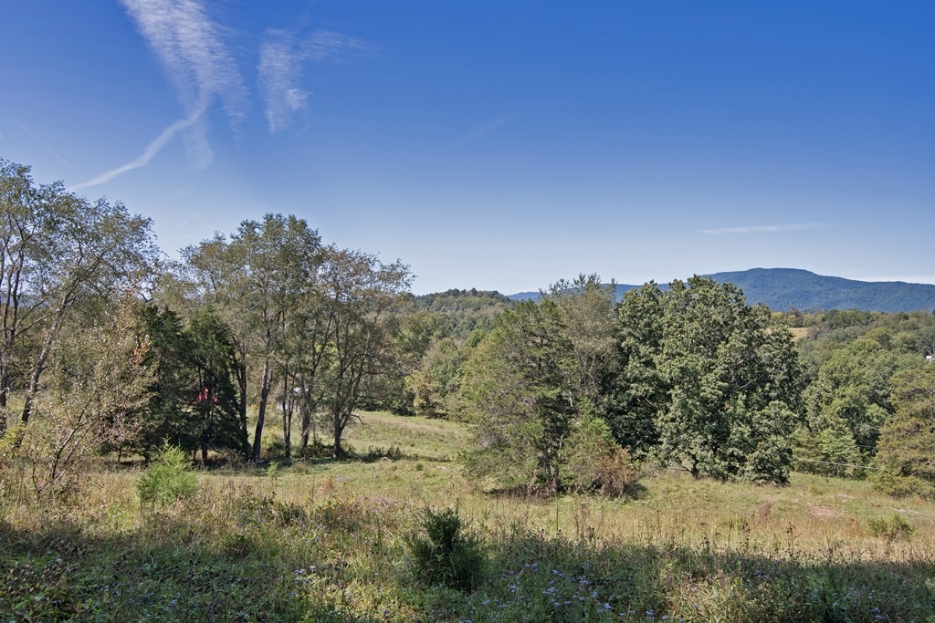
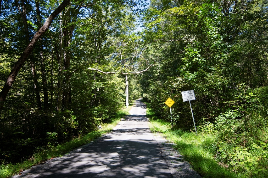
This is the kind of property that immediately feels like West Virginia: rolling pasture, mature hardwood forest, a flowing mountain creek, a big, rugged mountainside of forestland, abundant wildlife, and room to roam—yet without sacrificing accessibility. The farm enjoys excellent paved access from state-maintained highways. It includes land on both sides of West Virginia State Route 12, making access to various portions of the property particularly convenient.

IMPORTANT DETAILS
- Approximately 2700 feet of Rt. 12 road frontage heading towards Lewisburg
- Approximately 2500 feet of Rt. 12 road frontage heading towards Alderson
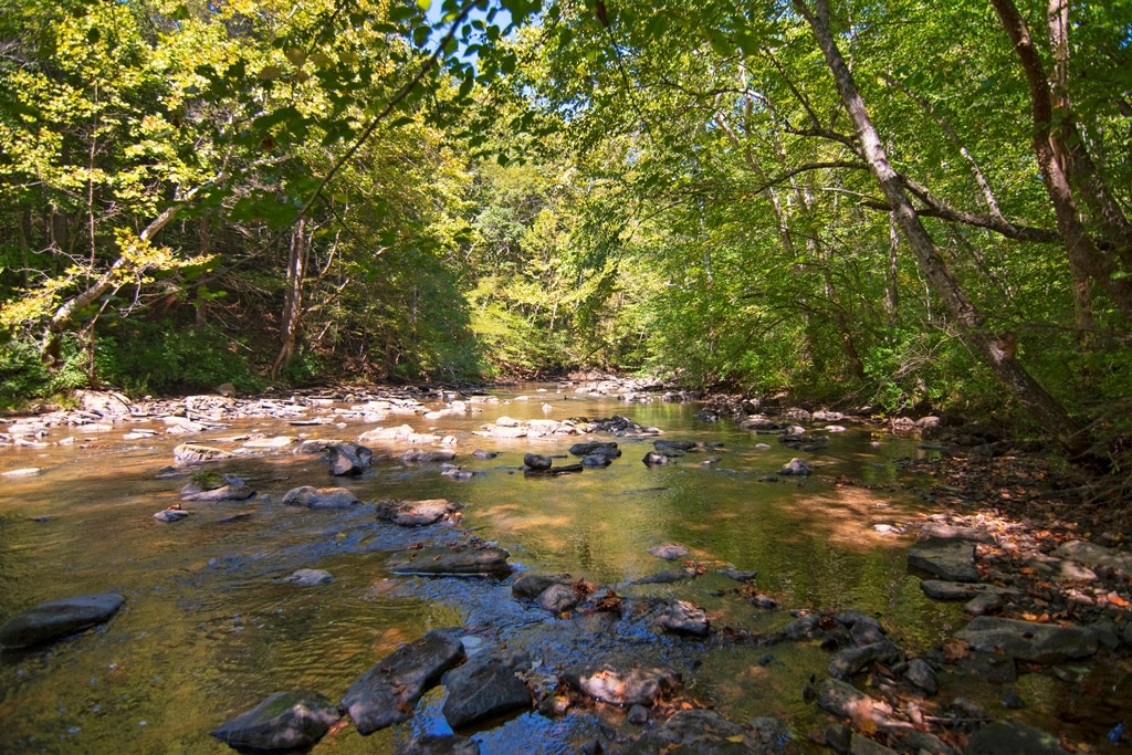
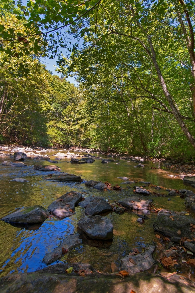
- Approximately 1400 feet of frontage on the waters of Muddy Creek
- Approximately 40 acres in open pastures
- Approximately 72 acres in woodland, forest, creek front, and the home places
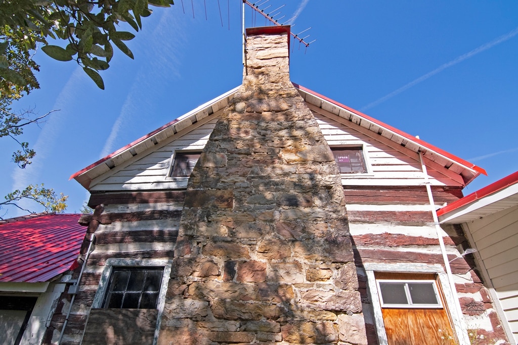
The historic Kincaid Log Cabin (rear view)

The historic Kincaid Log Cabin (front view)
Address: 3802 Alta Drive, Alderson, WV 24910
The following is per public records:
- Original log cabin circa 1890: 20 x 25, two stories
- Drilled well near the log cabin, Honaker Well Drilling, Date 11/14/1999, Depth 75 feet, Yield 12 gallons per minute
- Approximate 1874 square feet
- 3 Bedrooms
- 1 Full Bath
- Septic system
- Heating oil
- Roof: modern metal
- Huge sandstone chimney on the rear of the cabin
- Covered front porch, 46 x 6.8 and L-section 18 x 6.8
- Crawl space
- Grey outbuilding behind the house 10 x 14
- Green outbuilding on upper side of the house 12 x 12
*Note: Many local folks know this farm as Buzzy Kincaid’s property. Upon Roy H. “Buzzy” Kincaid’s passing, the property was deeded to his daughter Bonnie Robinson. The Kincaid Family were early American Revolutionary-Era pioneer settlers to the Virginia frontier on the waters of Muddy Creek. The entire Blue Sulphur Springs area, now Greenbrier County, is filled with deep history.
LAND, WATER & TIMBER
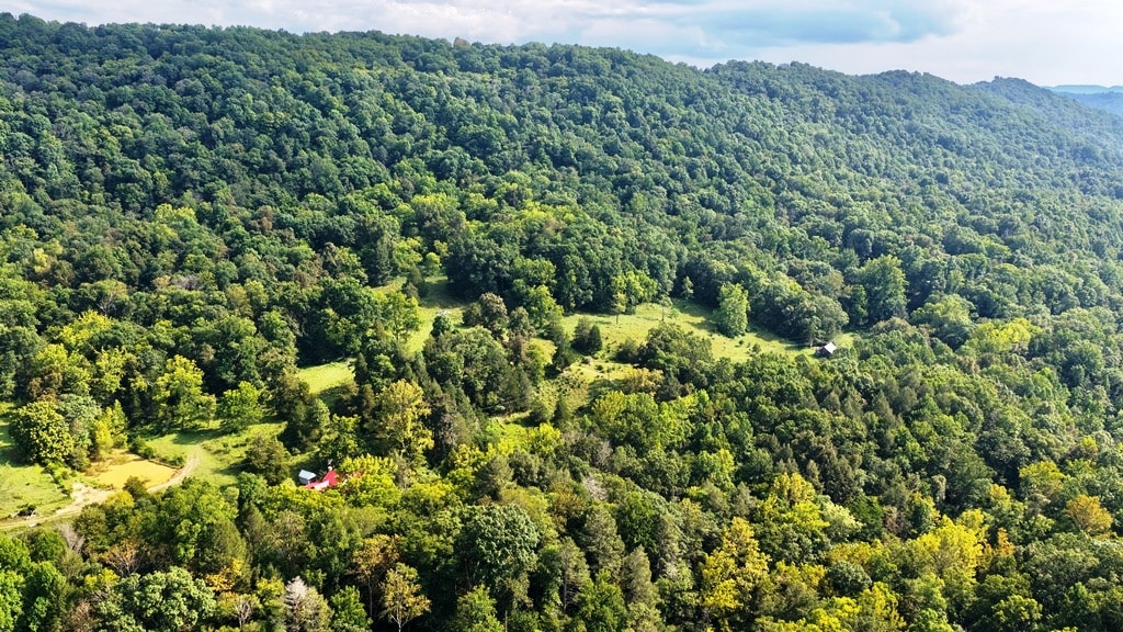
The Robinson Farm offers an appealing mixture of productive open ground, creek-bottom acreage and substantial mountainside forestland.
FENCING
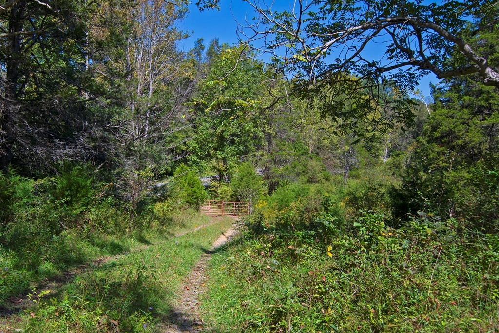
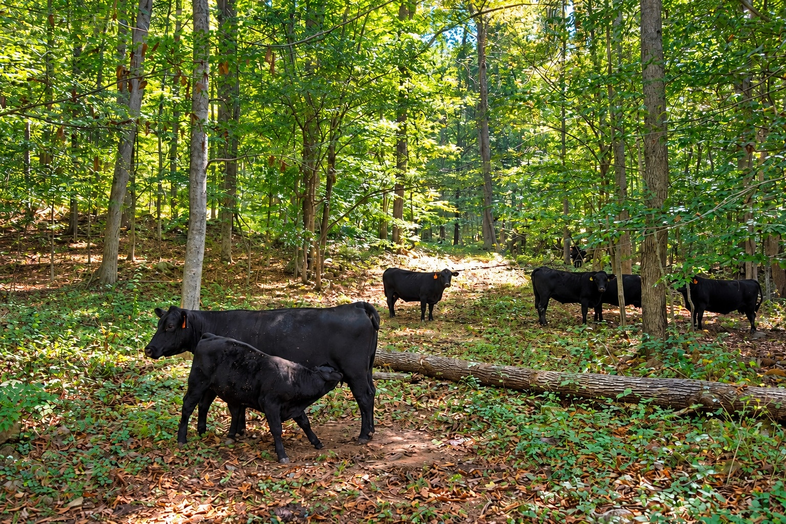
The large tract with the homeplaces is currently used for grazing cattle. The property has fencing and multiple gates along Route 12 and along both ends of the 99 acres. Currently no cattle are kept across the highway and fencing would be required.
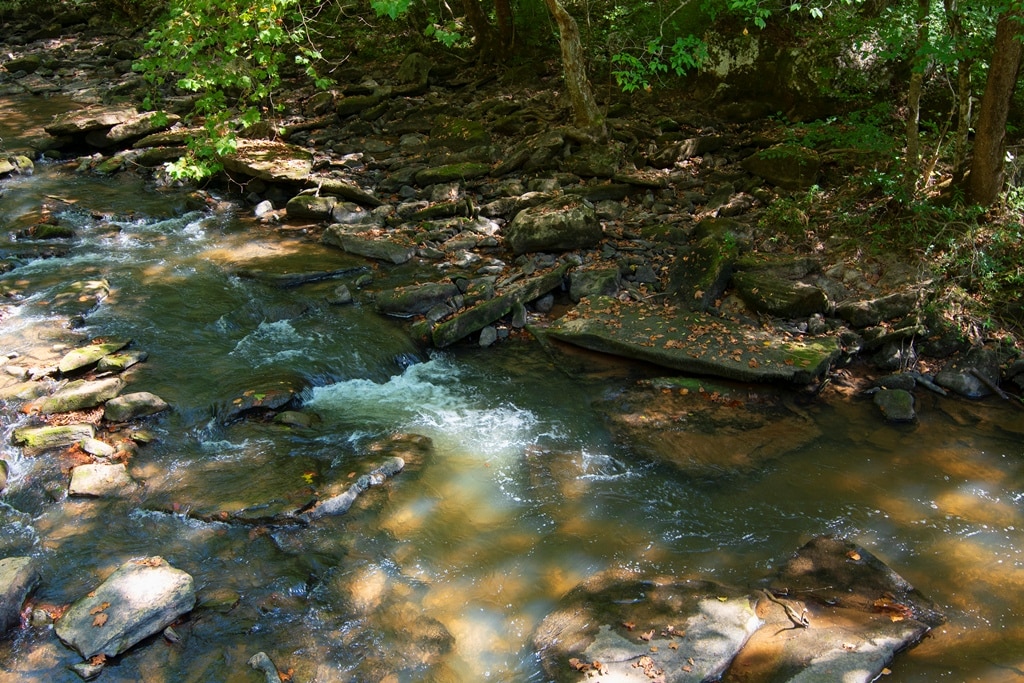
Approximately 13 acres lie along the Muddy Creek side of the property, providing direct creek frontage for much of the parcel. A beautiful setting for recreation, agriculture, livestock, or simply enjoying the sights and sounds of flowing water. An income-producing lease on Muddy Creek is presently of public record for a portion on the creek.
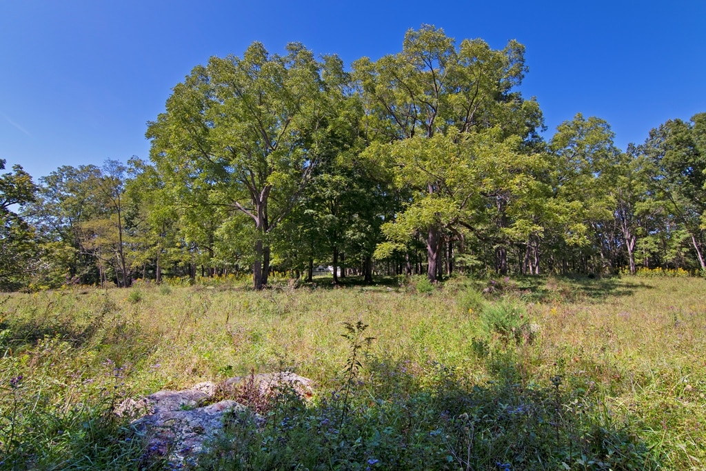
A significant portion of the remaining acreage is wooded, including 72 +/- acres of woodland and timberland with a substantial reserve of mature Appalachian hardwoods. The timber represents both an important natural resource and a major component of the property’s character. The forest provides privacy, recreation, wildlife habitat, and the long-term value associated with quality hardwood timber.
No timber cruise has taken place.
Open pasture areas provide additional versatility for cattle, horses, livestock, hay production, gardening, or other agricultural pursuits.
HIGHLIGHTS
- Approx. 112 acres +/- selling by the boundary
- Direct access to the waters of beloved Muddy Creek
- Presently a cattle grazing farm
- Excellent hunting
- 15-minute drive to historic Lewisburg, “The Coolest Town in America”
- Development and investment opportunity
- Low property taxes
- Good access
- Trails on the property
- Only minutes to shopping in Alderson
- Outstanding hardwood standing timber
- Drilled wells are already in place
- Septic systems
- Alderson hosts the state’s “Best Independence Celebration.”
- Farmers Market in Alderson on Tuesdays, May – October
- Almost Heaven, Greenbrier County, West Virginia
- Superior state highway with excellent maintenance by the WV DOT
- Three project homes
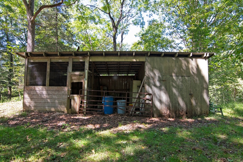
- Numerous outbuildings
- Near the Greenbrier River: fishing, floating, camping, boating, and kayaking
- Historical sites nearby
- Short drive to the Federal Ladies Camp at Alderson “Camp Cupcake.”
- 30-minute drive to the Greenbrier Resort

MULTIPLE DWELLINGS & IMPROVEMENTS
Unlike many large-acreage offerings that consist solely of raw land, the Robinson Farm includes multiple dwellings, buildings, and structures, opening the door to numerous possibilities. The property could serve as a traditional family farm, recreational retreat, hunting property, multi-generational homestead, rental or investment holding, or a combination of uses.
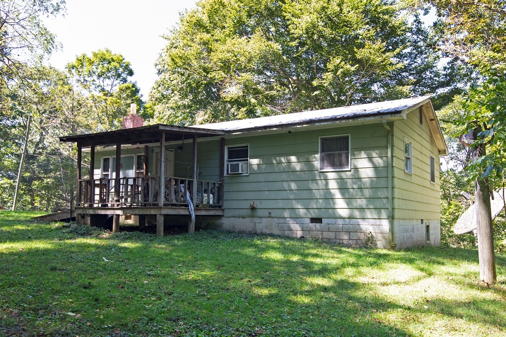
BUZZY’S HOMEPLACE AREA
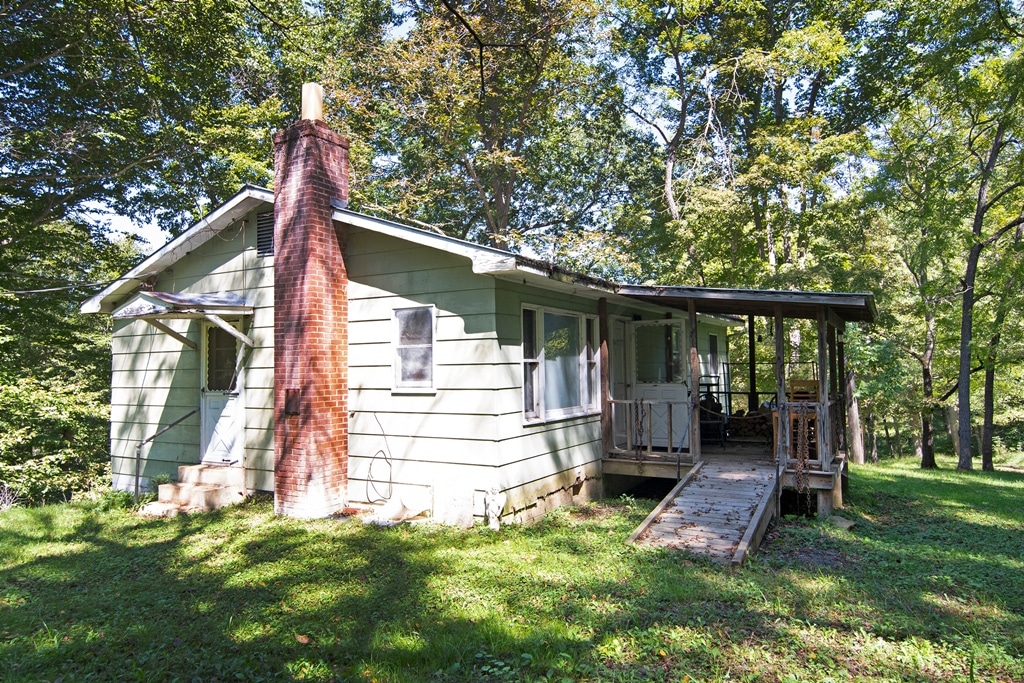

- Circa 1975 ranch-style home
- 3 Bedrooms
- 1 Full bath
- Approximately 960 square feet
- Flooring: carpet and vinyl
- Heating: electric baseboard and wall mount propane
- AC Window air unit
- Covered porch 9 x 9
- Metal roof
- Brick chimney
- Block foundation
- Crawl space
- 200-amp service
- 50-gallon Rudd water heater
GARAGE
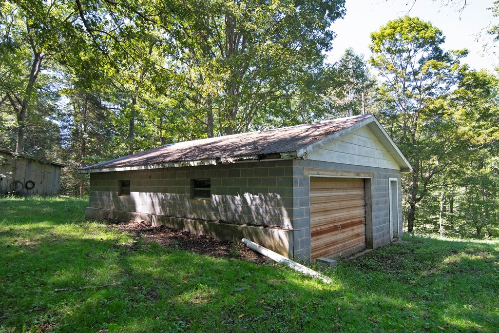
- Concrete block construction 24 x 32
- Metal roof
WOODEN SHED

- Wood construction
- 30 x 12
- Metal roof
SMALL WOODEN SHED
- 8 x 8
- Single door
- Metal roof
CHICKEN COOP
- Wood frame 7 x 6
- Metal roof
COVERED WOOD SHED
- 8 x 9
- Metal roof
NEWER PORTABLE SHED
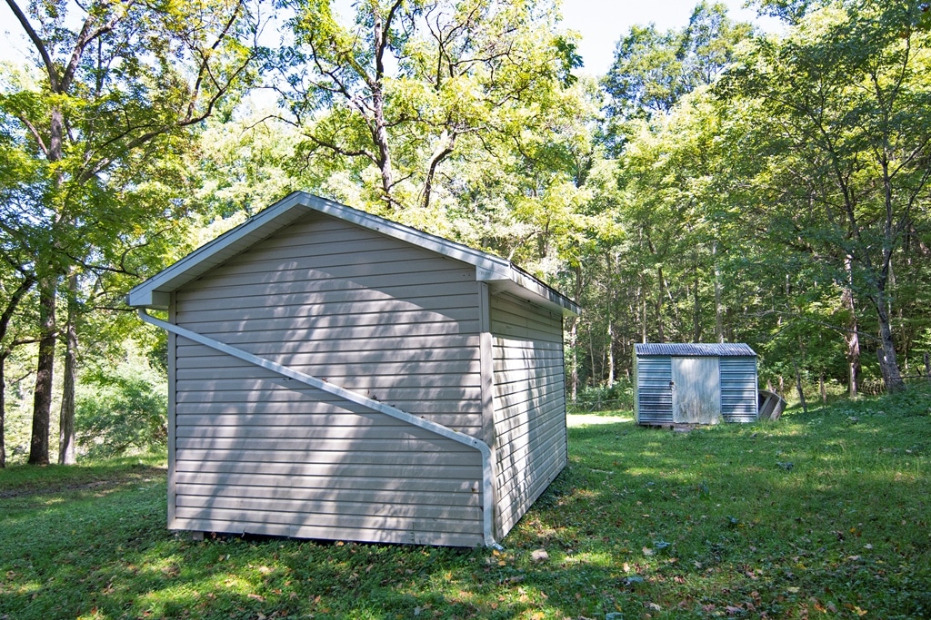
- Stick-built
- 12 x 16
- Roll-up end garage door 8.6 x 7
- Side passage door
- Vinyl siding
SMALL METAL BUILDING
- 10 x 8
FARM AREA STRUCTURES
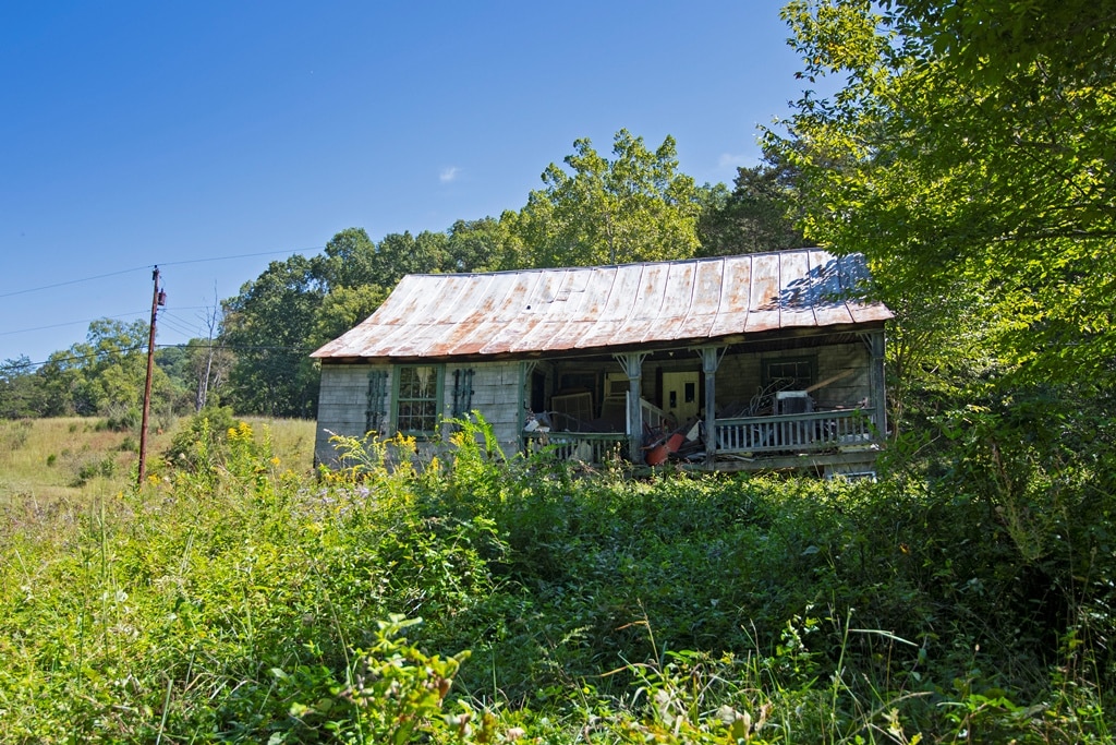
Old Ginny Lynn style cabin
- Rough condition, tear down or major restoration
- Wood siding with batten board
- 28 x 35
- Covered back porch 6 x 17
- Covered front porch 7 x 21
NEWER STICK-BUILT BARN IN THE FIELD
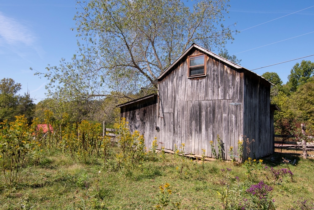
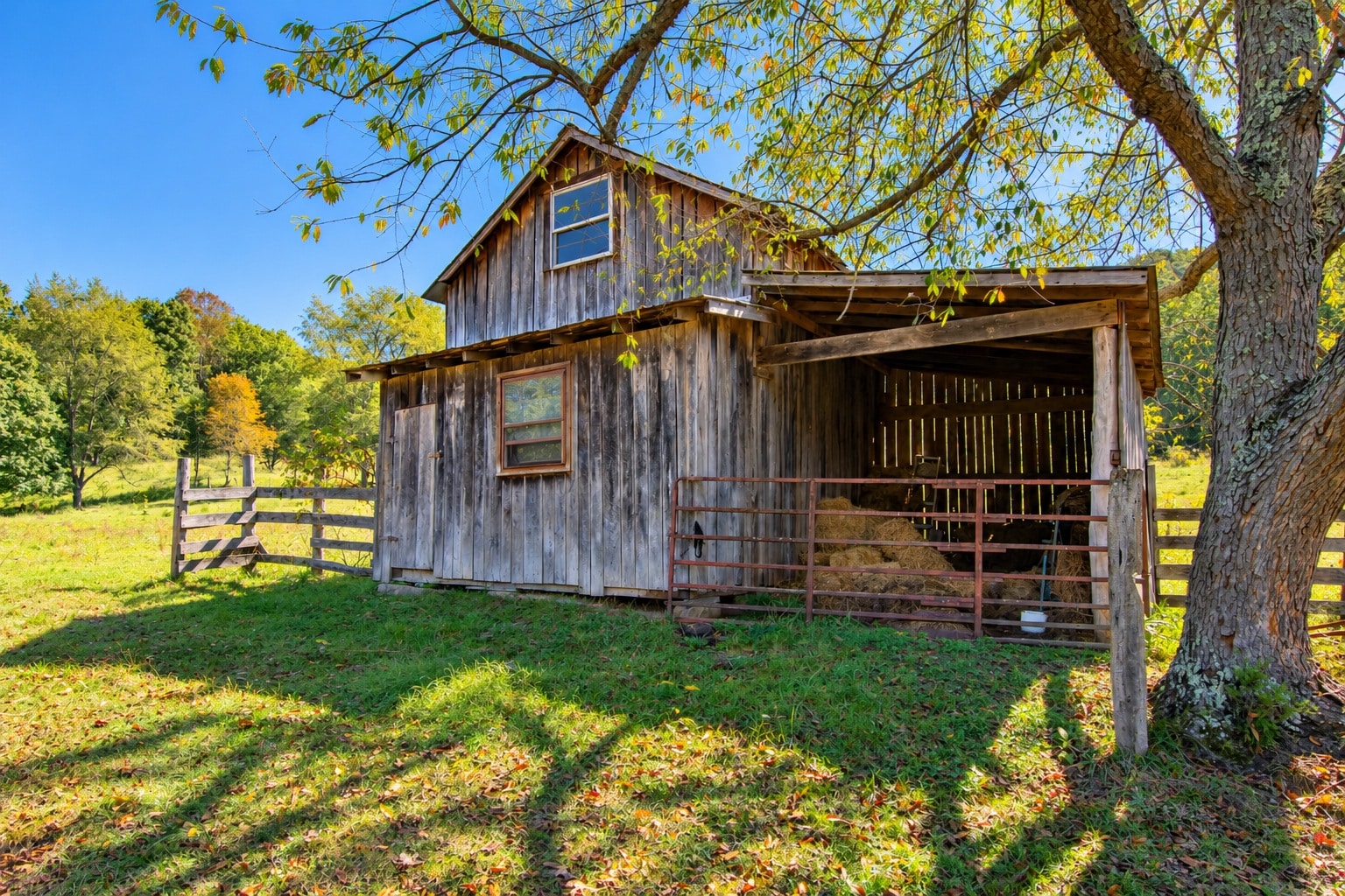
- 9 X 16
- Covered lean to 10 x 13
- Metal roof
The existing improvements, along with the acreage and excellent highway access, give a future owner a strong foundation to create a distinctive Greenbrier County estate.
A SPORTSMAN’S PROPERTY
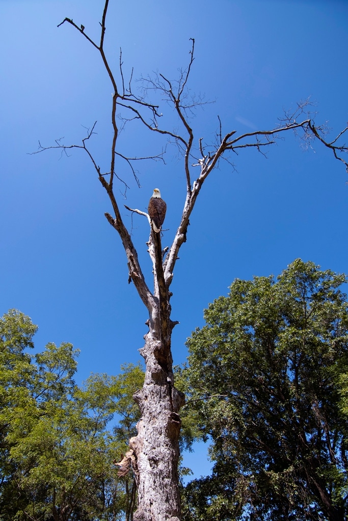
For the hunter and outdoorsman, the Robinson Farm offers outstanding habitat. The combination of hardwood ridges, wooded hollows, open pasture, creek bottom, and dependable water creates the diverse environment wildlife needs to flourish. You will often see white-tailed deer, wild turkey, black bear, rabbits, squirrels, and many other species throughout this part of the Greenbrier Valley. Every now and then, you may catch a glimpse of a majestic bald eagle hunting on Muddy Creek.
Whether your interests include hunting, hiking, ATV riding, wildlife observation, photography, exploring the woods, or fishing, simply sitting along Muddy Creek, there is plenty of room here to enjoy the outdoors
COUNTRY LIVING WITHOUT ISOLATION
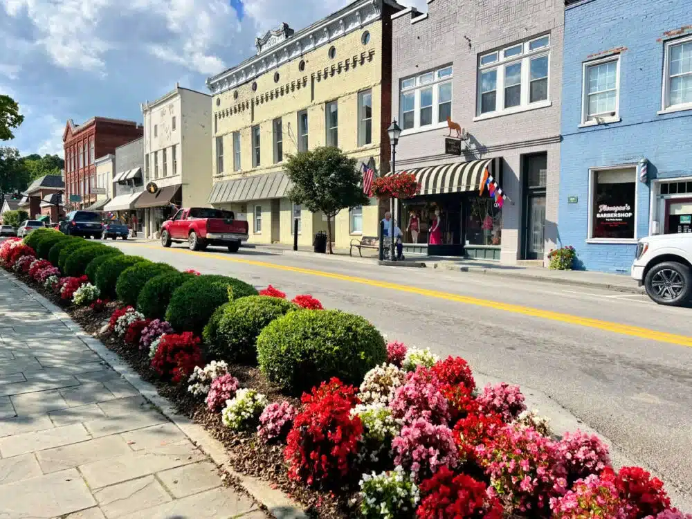
Lewisburg, West Virginia
Perhaps one of the Robinson Farm’s strongest attributes is its location.
The property is approximately five minutes from the historic Town of Alderson, affectionately known as the “Gem of the Hills.” Alderson lies along the beautiful Greenbrier River and is a historic community whose roots date to the 18th century.
Travel about 15 minutes in the other direction to reach Lewisburg, the Greenbrier County seat and one of West Virginia’s best-known small towns. Budget Travel readers selected Lewisburg as America’s Coolest Small Town in 2011, an honor the community celebrated on its 15th anniversary in 2026.
Lewisburg offers an impressive collection of restaurants, boutiques, galleries, antique shops, cafés, professional services, medical facilities, and cultural attractions while maintaining the atmosphere of a traditional Appalachian small town. Downtown Lewisburg is also only about one mile from Interstate 64, providing convenient regional connectivity.
Greenbrier County itself is well known for its blend of historic communities, outdoor recreation, art, restaurants, caves, the Greenbrier Valley Theater, Carnegie Hall, the Greenbrier River Trail, and the annual State Fair of West Virginia.
A PROPERTY WITH MANY POSSIBILITIES
The Robinson Farm is difficult to place into a single category—and that is one of its greatest strengths. It has the ingredients for:
- A working farm or gentleman’s farm
- A private country estate
- A multi-generational family compound
- A hunting and recreational retreat
- An equestrian property
- A timber investment, black walnut, white oak, sugar maple, cherry, red oak, poplar, and more
- A livestock or grazing operation
- A weekend or vacation retreat
- A long-term land investment
- Or simply a place to own a substantial piece of the beautiful Greenbrier Valley
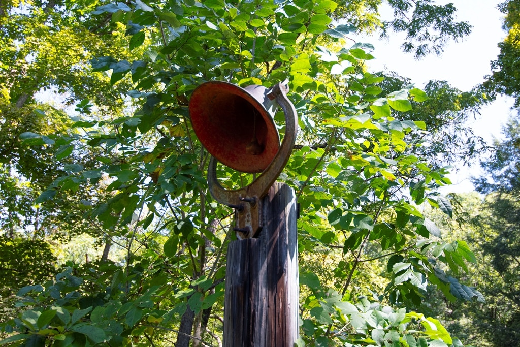
With approximately 112 acres more or less, and the 1400 feet of direct Muddy Creek frontage, substantial hardwood timber, pastureland, multiple dwellings and structures, abundant wildlife, and excellent paved highway access, the Robinson Farm represents an increasingly difficult-to-find type of West Virginia property.
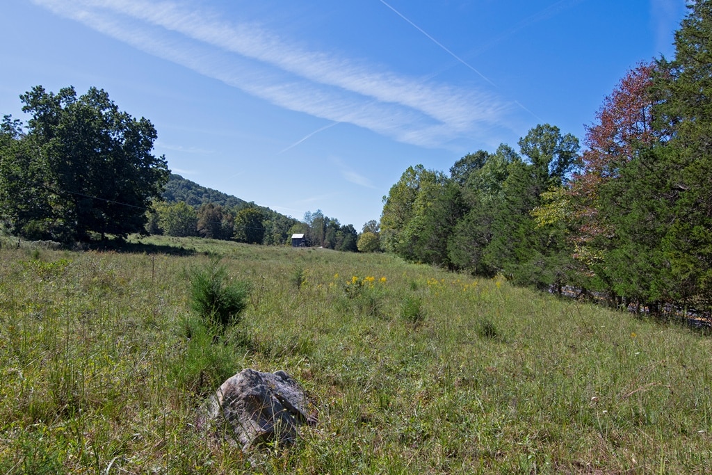
THE MILLS OF MUDDY CREEK
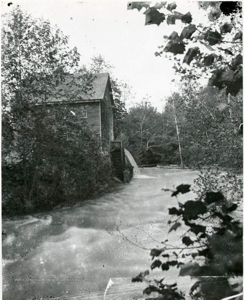

Rookstool Mill on Muddy Creek
Alderson, Greenbrier County, West Virginia
Long before electric motors, paved highways, and modern farm machinery reached the Greenbrier Valley, Muddy Creek’s flowing waters powered a remarkable collection of small industries. Among the most important was Rookstool Mill, located only a few miles north of Alderson along what is now Route 12/Rookstool Road. Historical accounts state that nine water-powered mills once lined Muddy Creek between Piercy’s Mill near Asbury and Alderson, making the creek an important corridor of commerce and rural industry. Rookstool Mill was one of those nine.
A Working Mill of the 1800s
Available historical sources describe Rookstool Mill as established during the 1800s and operating until sometime in the 1920s. It was considerably more than a simple gristmill. The complex reportedly included a grist mill, a woolen operation, and an old-fashioned up-and-down sawmill, all powered by Muddy Creek.
For families living along Muddy Creek, Blue Sulphur Springs, Asbury, and the surrounding countryside, such a mill was essential to everyday life. Farmers could bring wheat and corn to be ground into flour and meal; local sheep wool could be processed; and logs cut from the surrounding Appalachian forests could be converted into lumber. Before trucks and modern commercial supply chains, a water-powered mill such as Rookstool’s helped turn what the land produced into the necessities homes, barns, farms, and families needed.
The mill therefore was not merely a building beside a stream. It was a community gathering place and an early center of commerce. Farm wagons, horses, timbermen, farmers, and neighbors traveled the country roads leading to the mill, making the site familiar enough to become a geographic landmark.
By the late 1890’s, documentary evidence for the mill is particularly strong. In July 1897, a published account of the Greenbrier County Court proceedings reported that road officials in the Blue Sulphur District had been directed to contract for rebuilding the bridge over Muddy Creek at Rookstool’s Mill.
That short entry is historically significant. It confirms that by 1897, “Rookstool’s Mill” was well known enough to be used as an official location in county business. The public bridge there also shows the mill’s importance to the surrounding road network and farming community.
The Rookstool family itself had deep roots along Muddy Creek. A historical genealogy of Greenbrier County families records that Lee Rookstool, a son of John Rookstool, lived on a portion of his father’s estate on Muddy Creek. Period tax records also list John Rookstool as a landholder in the Blue Sulphur District.
Harnessing the Power of Muddy Creek
The site choice was no accident. Muddy Creek gathered water from a substantial portion of the surrounding Greenbrier Valley watershed, providing enough dependable flow to turn mill machinery. The mill dam would have impounded or diverted water and directed it through the mill’s power system, converting the creek’s natural fall into mechanical energy.
The arrangement represented the renewable energy technology of its day. Falling water could turn the machinery that ground grain, sawed timber, and powered other equipment—all without gasoline, diesel fuel, or electricity.
One later historical account described the old Rookstool Mill operation as drawing its energy from a Muddy Creek drainage area then estimated at 152 square miles.
The Mill Era Comes to an End
Like thousands of small water-powered mills across Appalachia, Rookstool Mill eventually faced technological change. Improved highways, commercial flour production, portable sawmills, gasoline engines, and widespread electrical service steadily reduced the need for community water mills.
According to the surviving historical account, Rookstool Mill continued operating into the 1920s before eventually falling silent.
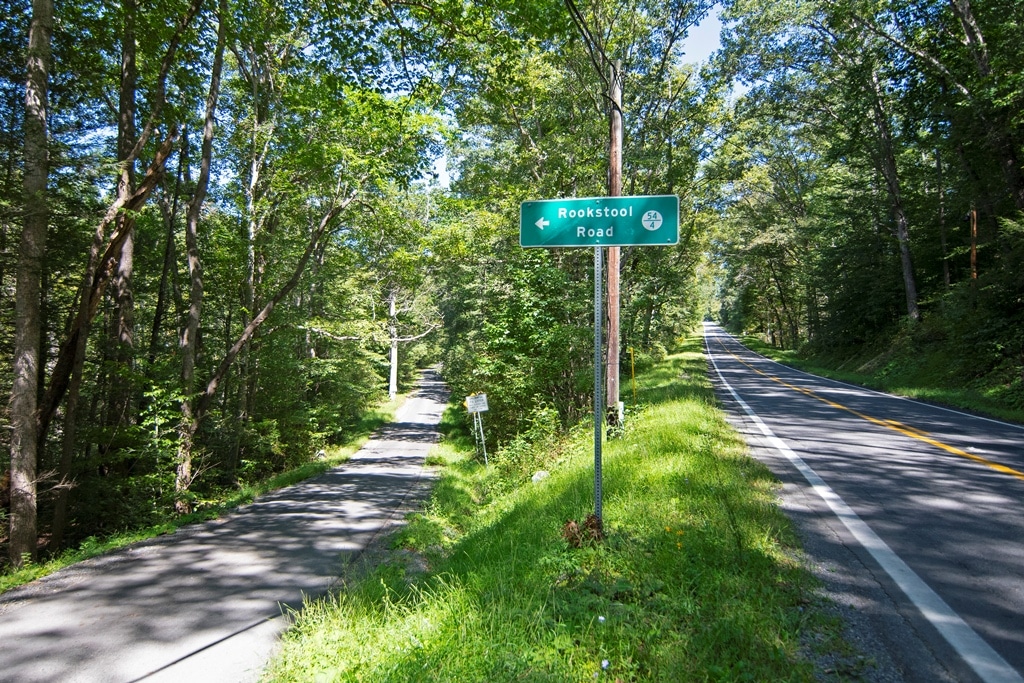
Yet the mill left a permanent imprint upon the landscape. Even after the machinery stopped turning, the location remained associated with the Rookstool name. Today, Rookstool Road preserves that name.
GENERAL LOCATION
Google Coordinates: 37.74670, -80.61330
Address: 3602 and 3802 Alta Drive, Alderson, WV 24910.
Elevation Range: 1585 ft. to 2209
THE HISTORIC WATERS OF MUDDY CREEK
Greenbrier County, West Virginia
Muddy Creek is more than a picturesque Appalachian stream flowing through Greenbrier County. Its waters pass through one of the oldest and most historically significant settlement areas in the Greenbrier Valley, a landscape whose recorded story reaches back to when present-day West Virginia was the western frontier of colonial Virginia.
The Waters of Muddy Creek
Flowing through one of Greenbrier County’s oldest settled valleys, Muddy Creek winds through a landscape of Appalachian hardwood forests, limestone valleys, productive farms and historic homesteads before joining the Greenbrier River at Alderson. Its watershed encompasses nearly 79,000 acres of the Greenbrier Valley and has played a prominent role in the region’s history since the Virginia frontier days of the 1700s. Old mills, mineral springs, family farms, and generations of settlement have occupied its valley, while the creek itself remains an enduring natural feature of this beautiful rural landscape.
Muddy Creek is a substantial tributary of the Greenbrier River, draining a surprisingly large part of southwestern Greenbrier County before entering the Greenbrier at Alderson. It is much more than a small local creek: the West Virginia Department of Environmental Protection has delineated the Muddy Creek watershed at roughly 78,500–79,000 acres, or about 123 square miles. The watershed includes portions of the Williamsburg, Blue Sulphur Springs, and Alderson areas.
Physical character
The WVDEP describes Muddy Creek as a predominantly meandering, relatively slow-moving stream. The main stem averages only about 25 feet of elevation drop per mile, which helps explain the broad bottoms, gentle bends, pastoral valleys, and agricultural land associated with much of the creek. The watershed’s average elevation is approximately 2,250 feet, although its terrain ranges from broad lower valleys to steep, confined headwater hollows and mountain ridges.
Long before permanent European settlement, Native peoples traveled and used the region’s mountains and valleys. Game trails, mountain gaps, rivers, springs, and streams formed natural transportation corridors through an otherwise rugged wilderness. The Greenbrier River and tributary valleys such as Muddy Creek became important geographic features in this vast Appalachian landscape.
THE VIRGINIA FRONTIER
By the middle of the eighteenth century, European-descended settlers were beginning to establish homes west of the Allegheny Mountains. What is now Greenbrier County was then remote frontier country—far removed from the established settlements east of the mountains.
The Muddy Creek valley offered many of the things an early settler needed: water, fertile bottomland, timber, abundant game, and land suitable for farming and livestock.
By the early 1760s, pioneer families had settled along Muddy Creek. Among the names associated with this early community were Frederick See, Felty Yocum, and their families.
These pioneers lived at the very edge of colonial settlement.
No modern towns, paved roads, or convenient supply centers existed. The surrounding country consisted largely of enormous forests broken by streams, natural clearings, and scattered homesteads. Families depended upon the land, their livestock, hunting, and one another for survival.
THE MUDDY CREEK ATTACK OF 1763
Muddy Creek became permanently associated with West Virginia frontier history in 1763.
That year brought widespread conflict along the western frontier during the struggle commonly known as Pontiac’s War. Native nations resisted the expanding British presence and colonial settlement following the French and Indian War.
A Shawnee party associated with the young leader Cornstalk entered the Greenbrier settlements.
The Muddy Creek settlement was attacked.
Historical accounts record that settlers were killed and others, particularly women and children, were taken captive. The Shawnee party subsequently moved toward the settlement of Archibald Clendenin in the Big Levels, near present-day Lewisburg, where another devastating attack occurred.
The events at Muddy Creek and the Clendenin settlement became among the best-known episodes in the early frontier history of the Greenbrier Valley.
For a period afterward, settlement of the region was severely disrupted. Families withdrew from exposed settlements, and the Greenbrier country again became an exceptionally dangerous place for permanent settlement.
But the settlers eventually returned.
ARBUCKLE’S FORT AND THE RETURN TO MUDDY CREEK
As settlement resumed, frontier families recognized their need for places of refuge during periods of danger.
In 1774, frontier families built Arbuckle’s Fort nearby at the junction of Muddy Creek and Mill Creek.
The fort was associated with Captain Matthew Arbuckle, a notable frontier figure in the Greenbrier Valley. Arbuckle was an experienced woodsman, surveyor, militia officer, and frontier leader who understood the country extending from the Greenbrier Valley toward the Ohio River.
Arbuckle’s Fort became part of a network of forts and fortified homes that helped protect the scattered settlements of the Greenbrier frontier.
These structures were not castles in the European sense. They were practical frontier fortifications—places where neighboring families could gather for protection when warnings of attack reached the settlements.
The presence of such a fort illustrates just how important the Muddy Creek settlement had become by the eve of the American Revolution.
MUDDY CREEK AND THE ROAD TO POINT PLEASANT
The year 1774 was also important because of Lord Dunmore’s War.
Captain Matthew Arbuckle accompanied the Virginia militia commanded by Colonel Andrew Lewis as it traveled from the Greenbrier country toward the Ohio River.
The campaign culminated in the Battle of Point Pleasant on October 10, 1774, where Virginia frontier militia fought Native forces led principally by Cornstalk.
The battle became one of the major military engagements in the early history of what would eventually become West Virginia.
Thus, the story of Muddy Creek intersects with several defining chapters of the eighteenth-century frontier: early settlement, the conflicts of 1763, frontier forts, Lord Dunmore’s War, and the opening of the western country to expand settlement.
FROM WILDERNESS TO FARMLAND
Following the frontier period and the American Revolution, the character of the Muddy Creek valley gradually changed.
The wilderness became farm country.
Families cleared the more level, productive ground, while much of the surrounding hillsides remained covered with native Appalachian Forest. Log homes, barns, mills, fences, and wagon roads appeared across the landscape.
The forests surrounding Muddy Creek contained the hardwoods for which the Appalachian region became famous—white oak, red oak, black walnut, wild cherry, sugar maple, yellow poplar, and numerous other species.
The valleys provided pasture and cropland.
The forests supplied lumber, firewood and game.
And Muddy Creek supplied something essential to every generation: WATER!
As decades became centuries, farms were divided, inherited, sold and assembled again. Roads improved. Nearby communities developed. Railroads eventually followed the Greenbrier River. Alderson grew into an important river and railroad community, while Lewisburg developed as Greenbrier County’s governmental and commercial center.
Through all those changes, Muddy Creek continued flowing through the same ancient Appalachian valley.
THE WATERS REMAIN
That continuity is what makes Muddy Creek particularly compelling today. The creek witnessed a remarkable transformation of the Greenbrier Valley—from Native travel country to colonial frontier, from isolated pioneer settlements to established farms, and ultimately into the Greenbrier County landscape we recognize today.
More than 260 years have passed since the dramatic events of 1763. The wilderness cabins are gone. The frontier forts have disappeared from the landscape. The wagon trails became roads. Generations of farmers have come and gone.
But Muddy Creek remains.
Its waters still move through the farms and forests of Greenbrier County before ultimately joining the Greenbrier River watershed, just as they did when the first frontier families entered this valley.
For properties such as the Robinson Farm on the waters of Muddy Creek, the creek therefore represents far more than frontage on a beautiful West Virginia stream. It represents a connection to the earliest recorded chapters of Greenbrier County history—a time of pioneers, wilderness, frontier forts, and extraordinary hardship and perseverance.
Owning land along Muddy Creek means owning a small piece of a landscape that helped write the early history of the Greenbrier Valley.
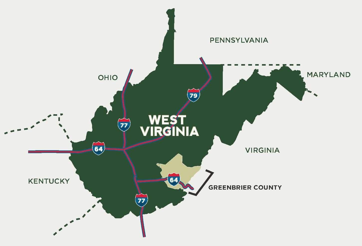
Drive Times (approximate)
Highways/Local Towns
I-64 Alta-Alderson Exit 161: 10 minutes
I-64 Hinton-Sandstone Exit 139: 30 minutes
Alderson: 5 minutes
Athens and Concord University: 45 minutes
Beckley: 45 minutes
Charleston: 2 hours
Hinton: 25 minutes
Lewisburg: 15 minutes
Princeton: 60 minutes
Roanoke, VA: 2 hours
Union: 35 minutes
White Sulphur Springs: 30 minutes
AIRPORTS
Pence Springs Grass Field – Hinton/Alderson Airport: 15 minutes
Beckley – Raleigh County Memorial Airport: 45 minutes
Charleston – West Virginia International Yeager Airport: 2 hours
Roanoke – Roanoke-Blacksburg Regional Airport: 2 hours
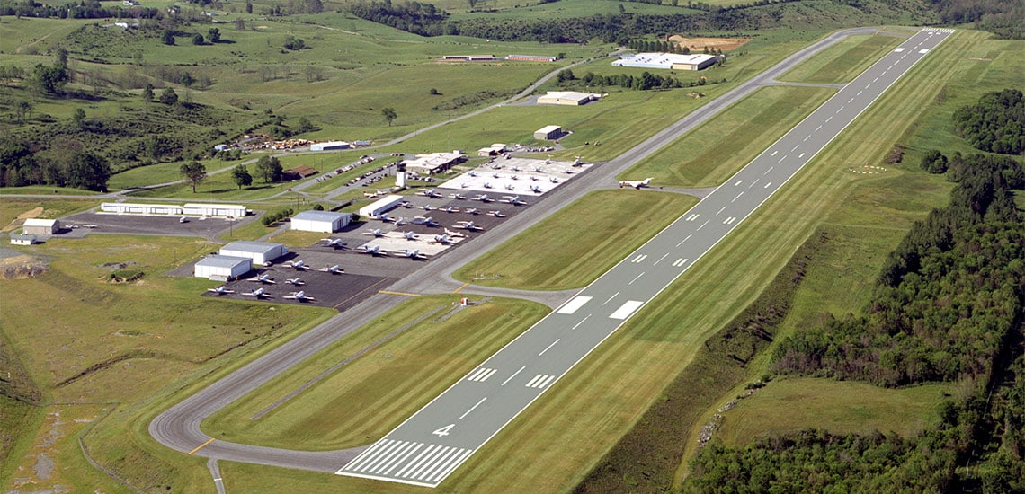
Lewisburg – Greenbrier Valley Airport: 20 minutes
Providing Daily Jet Service
RECREATION
Outdoor recreation, historic attractions, family activities, and nearby destinations in the Greenbrier Valley.
Alderson is situated along the scenic Greenbrier River and offers easy access to a wide range of outdoor, historic, cultural, and family-oriented activities. The surrounding Greenbrier Valley also places visitors within a short drive of state forests, caves, trails, lakes, and mountain recreation.
IN AND AROUND ALDERSON
Greenbrier River Recreation: Enjoy kayaking, canoeing, tubing, swimming, wading, fishing, wildlife watching, photography, and leisurely float trips on the Greenbrier River. The river is the centerpiece of outdoor recreation in Alderson.
Fishing: The Greenbrier River is especially popular for smallmouth bass fishing, along with other warm-water species. Anglers can enjoy bank fishing, wading, and float fishing where access is available.
Alderson Memorial Bridge: Walk across the historic pedestrian bridge for excellent views of downtown Alderson and the Greenbrier River. It is a favorite location for sightseeing and photography.
Downtown Alderson Walking and Sightseeing: Explore the historic downtown area, riverfront streets, older commercial buildings, churches, and railroad heritage that reflect Alderson’s long history in the Greenbrier Valley.
Alderson Train Depot: Visit the restored historic C&O Railway depot and learn more about the importance of the railroad to Alderson and the surrounding Greenbrier River communities.
Alderson Parks and Family Recreation: Local parks provide space for picnicking, playground activities, ball fields, community recreation, and other family activities.
Riverfront Picnicking and Relaxation: Spend time along the river at local public areas and parks for a picnic, a quiet afternoon, bird watching, or photographs of the river and town.
Alderson Artisans and Local Shopping: Browse locally made arts, crafts, gifts, antiques, books, collectibles, and West Virginia merchandise in the Alderson area.
Fort Arbuckle and Frontier History: Explore one of the area’s important frontier-history sites and learn about the early settlement period of the Greenbrier Valley.
Seasonal Farm Activities: Local farms and seasonal attractions may offer berry picking, special events, family activities, and other agricultural experiences.
Camping and Outdoor Stays: The Alderson area offers riverfront camping, cabins, and other outdoor lodging options for visitors who want to stay close to the Greenbrier River.
NEARBY GREENBRIER VALLEY RECREATION
Greenbrier River Trail: The Greenbrier River Trail is a nationally recognized rail-trail extending for approximately 78 miles. It is popular for bicycling, hiking, horseback riding, fishing access, wildlife watching, and scenic river travel.
Greenbrier State Forest: Located near Caldwell, the forest provides hiking, mountain biking, camping, cabins, picnicking, fishing, disc golf, and miles of woodland trails.
Lost World Caverns: Near Lewisburg, this well-known cavern offers an underground adventure featuring impressive stalactites, stalagmites, and other cave formations.
Organ Cave: This historic cave is associated with both natural history and Civil War-era saltpeter mining. Visitors should verify current tour availability before traveling.
Island Park in Ronceverte: Enjoy riverfront recreation, walking areas, playground facilities, picnicking, and seasonal community activities along the Greenbrier River.
Historic Lewisburg: Spend a day exploring historic downtown Lewisburg, with locally owned restaurants, shops, galleries, historic architecture, cultural attractions, and community events.
Blue Bend Recreation Area: Located in the Monongahela National Forest beyond White Sulphur Springs, Blue Bend is known for mountain scenery, picnicking, hiking, and a popular clear-water swimming area.
Lake Sherwood: Enjoy swimming, fishing, camping, hiking, picnicking, and seasonal paddling opportunities at this mountain lake recreation area.
OUTDOOR AND SCENIC ACTIVITIES
Scenic Driving: Take a scenic drive through Alderson, Ronceverte, Fort Spring, Caldwell, Lewisburg, and the surrounding countryside. The Greenbrier River corridor offers beautiful farmland, mountain views, historic communities, and excellent fall foliage.
Wildlife Watching and Photography: The river valleys, forests, and farms of Greenbrier and Monroe counties provide opportunities to see white-tailed deer, wild turkey, waterfowl, songbirds, and occasionally bald eagles.
Hunting: The surrounding countryside offers hunting opportunities for deer, turkey, squirrel, and other legal game on appropriate public and private lands during established West Virginia hunting seasons.
Hiking and Mountain Biking: In addition to the Greenbrier River Trail and the newly established 14 mile Meadow River Trail, visitors can find hiking and mountain-biking opportunities in nearby state forests and national forest lands.
Canoeing, Kayaking, and Tubing: The Greenbrier River provides some of the region’s most accessible paddling opportunities, ranging from relaxed family floats to sections with riffles and mild rapids.
FESTIVALS AND COMMUNITY EVENTS
Alderson Fourth of July Celebration: Alderson is widely known for its long-standing Independence Day celebration, with community events, entertainment, river activities, and fireworks.
Seasonal Festivals and Local Events: Throughout the year, Alderson and nearby communities host festivals, fairs, markets, music events, holiday activities, and other local celebrations.
Why the Alderson Area Appeals to Outdoor and Recreational Buyers
The strongest recreational advantages of the Alderson area include the Greenbrier River, fishing and paddling opportunities, proximity to historic Lewisburg, Greenbrier River Trail, nearby state and national forest recreation.
FOREST/TIMBER RESOURCES
Most of the property is forest land with black walnut, cherry, white oak, hickory, maples, red oak. poplar and many more No cruise or value has been conducted for the timber.
AGRICULTURAL RESOURCES

The property has about 40 acres of cleared pasture that could be used for a variety of farming and livestock purposes. The property’s soil is suitable for many types of gardens, small crops, and fruit trees. The four seasons of climate and topography provide the necessary elements for a permaculture lifestyle.
WILDLIFE
The Robinson Farm is an ideal wildlife preserve. The property provides an overall habitat for wildlife. Many animals are native to the land, including whitetail deer, black bears, wild turkeys, squirrels, rabbits, raccoons, opossums, and other game species. One can occasionally see a beautiful bald eagles hunting along Muddy Creek. You can see many other bird species daily.
WATER

Drilled wells are located near both homes. The farm has spring-fed pond and a smaller pond, a concrete water trough with a frost-free faucet, and a long run on the waters of Muddy Creek.
MINERAL RESOURCES
All rights the owner has in title will convey with the property.
BOUNDARIES AND SURVEY
The property is comprised of multiple tracts all described in Deed Book 606 Page 236 in the records of the Clerk of Greenbrier County, West Virginia. The property is being sold by the boundary and not by the acre.
UTILITIES
Water: Two drilled wells are located at the two homes, 2 ponds, one trough and frontage on Muddy Creek
Sewer: Existing septic systems are in place
Electricity: In place and crosses much of the farm
Telephone: Frontier and numerous cellular providers
Internet: Starlink, and the possibility of high speed cellular service could be available
Cellphone Coverage: Excellent; a tower is within sight
ACCESS/FRONTAGE
The property has frontage on State Route 12 and on Rookstool Road 54/4.
ZONING
Greenbrier County is subject to some zoning and subdivision regulations. All prospective buyers should consult the County Commission and Health Department for details regarding zoning, building codes, and installation of wells and septic systems.
Information can be found at the county website: http://greenbriercounty.net/ordinances
DEED and TAX INFORMATION
Deed Information: DB 606 Pg. 236
Greenbrier County (13), West Virginia
Acreage: 112 acres +/- area being sold by the boundary
REAL ESTATE TAX ID/TAXES:
Greenbrier County (13), West Virginia
Blue Sulphur Tax District (3)
Tax Map 40 Parcel 20
Class 2, Class II: Owner-occupied residential property used exclusively for residential purposes and all farm land used for agricultural purposes by its owner or bona fide tenant.
2025 Total Real Estate Taxes: $832.00
PUBLIC SCHOOLS
Greenbrier County School District
Alderson Elementary School
6-8 Eastern Greenbrier Middle
9-12 Greenbrier East High School
Colleges:
Concord University, New River Community, WVU Tech
THE TOWN OF ALDERSON
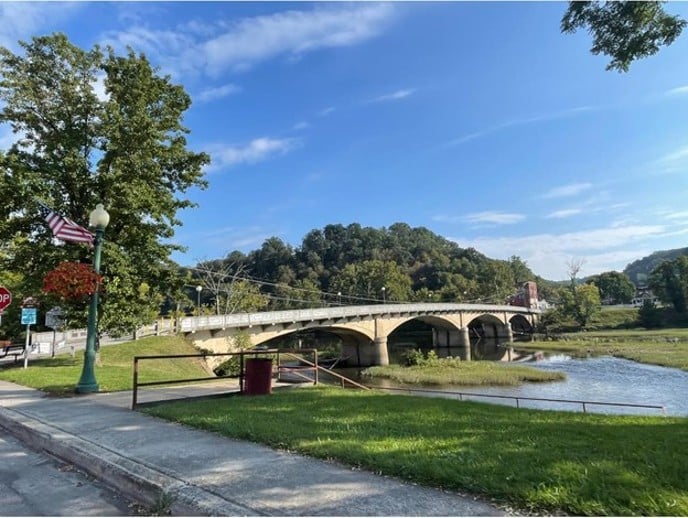
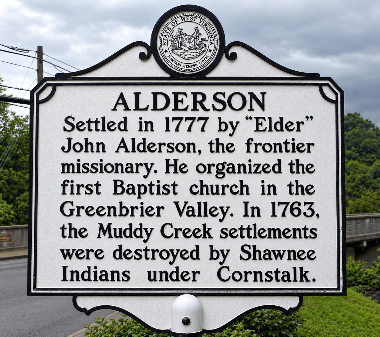
Alderson, West Virginia, is a quaint small town on the free-flowing Greenbrier River in Greenbrier, Monroe, and Summers counties; it was settled in 1777 by John Alderson, a frontier missionary Gospel preacher for whom the town was named. Later, an Alderson descendant founded a Baptist seminary that was moved north during the Great Depression and became Alderson-Broaddus College in Philippi, WV. The Federal Reformatory for Women was the first federal prison for women, established here in the 1920s after a group of local businessmen visited Washington, D.C., to propose that the federal government place the institution in Alderson. The town is famous for its annual “Best” Independence Day Celebration and the Strawberry Festival, held every May. Camp Greenbrier for Boys has been a staple in the community since 1898, and every summer is busy with campers from across the United States.

POINTS FOR THE TOWN OF ALDERSON
- Known as “The Gem Of The Hills”
- Located in three counties, Greenbrier, Monroe, And Summers
- Voted “best fourth of July Celebration” by West Virginia Living Magazine in 2012. Alderson is the place to be to celebrate America’s Independence Day! Yet, there are so many more events that we want you to attend…so explore below and…save the date!
- 2020 population of approximately 1200
- Leagues: Alderson basketball league – Greenbrier girls softball league – Alderson Chiefs youth football – chiefs cheerleading – Chiefs country tumbling
- Numerous civic clubs and groups
- Active Main Street Association
- Active Veterans Of Foreign Wars
- Home of the annual May Strawberry Festival
- Located on the beautiful Greenbrier River
- Well-known for fishing, boating, swimming, canoeing, and kayaking
- Home of Camp Greenbrier, since 1898
- French The Lion Is The Town Mascot
- Amtrak stop at the historic C & O Depot
- Excellent town park
- The Alderson Mini Park on the river
- The historic Alderson Memorial Pedestrian Bridge
- Home of Old Greenbrier Baptist Church which was founded in the 1700s By Elder John Alderson, a frontier preacher
- A scenic walking trail is established in the town
- Weekly farmers market, Tuesday afternoon during warm months
- Two full-time volunteer fire departments
- A full-time town police force
- Full-time hometown ambulance service
- Home of “Camp Cupcake” Federal Ladies’ Camp

- The Town of Alderson, affectionately known as the “Gem of the Hills,” is tucked away in the lush Greenbrier Valley of southeastern West Virginia. It is situated along the beautiful Greenbrier River and includes Greenbrier, Monroe, and Summers Counties.
- In 1763, the nearby Muddy Creek settlements were destroyed by Shawnee Indians under Chief Cornstalk. It was not until 1777 that the town was settled by “Elder” John Alderson, a frontier missionary for whom the town was named. Here, he founded the first Baptist church in the Greenbrier Valley. In the early 1900s, a descendant of John Alderson started a Baptist seminary that was later moved north to become Alderson-Broaddus College in Philippi, WV.
- The Federal Reformatory for Women, the first federal prison for women, was established here in 1927.
- The town is renowned for its annual Independence Day celebration, which West Virginia Living Magazine acknowledged as the state’s “Best Independence Day Celebration” in 2012.
- Alderson, WV, today is primarily a residential community with retail establishments in its downtown historic district. These serve the many camps and vacation homes along the Greenbrier River, as well as tourists visiting the surrounding countryside. Commerce and property values are rising due to growing tourism, the river’s sheer beauty, and the surrounding farms. Alderson contains many fine homes from the turn of the 20th Century, many of which are in mint condition, always the same as their well-tended, original appearance.
- The town of Alderson has been an active community for generations. Alderson’s amenities include churches, a brand new multi-million dollar elementary school, a motel, a national bank, Dollar General, Family Dollar, gas/convenience stores, a medical clinic, an outstanding hometown hardware and builders supply, a brand new fitness center, an artisan’s studio, a farmers market, two funeral homes, antique shop, mechanics garages, full service tire and auto service, restaurants, electrical and general contractors, a veterinarian, an insurance agent, US Post Office, Two great fire departments and EMS service, and several Airbnb for lodging.
HISTORIC GREENBRIER COUNTY
Lewisburg (a 15-minute drive), the Greenbrier County seat, was voted the Coolest Small Town in America, combining the warmth of a close-knit community with the sophistication of more urban locations. The thriving downtown historic district offers year-round live productions presented at the State Professional Theatre of WV, Carnegie Hall, distinctive dining venues, antique shops, award-winning galleries/boutiques, and a year-round farmer’s market. Greenbrier Valley Medical Center is a modern hospital and all attendant medical facilities, along with the many big-box stores.
The county and city host several fairs & festivals throughout the year, including The WV State Fair, a professional 4-weekend Renaissance Festival, Chocolate Festival, Taste of our Town Festival (TOOT), antique car shows, Jeep Rallys, Airstream Rally, WV Barn Hunt Competition, and PGA Tour @The Greenbrier.
Lewisburg is also home to the modern Robert. C Byrd Medical Clinic (300 employees), the WV Osteopathic Medical School (600 students), and the New River Community and Technical College. The area is a strong economic generator with a solid workforce employed in county/state government, tourism, hospitality, medical, education, retail, construction, wood products, mining, and agriculture.
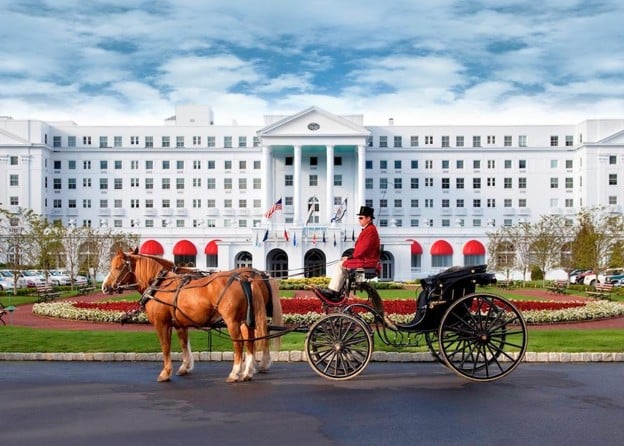
The world-renowned Greenbrier Resort, with 800 rooms and 1600 employees, is in the sleepy little town of White Sulphur Springs. The 4-Star resort has a subterranean casino and is home to the NFL Summer Practice Event, and Tennis Exhibitions (Venus Williams, John McEnroe, etc.). Several other area golf courses are available in the area – including Oakhurst Links, America’s first golf course, where guests play using old-style hickory-handled clubs and ground-burrowing golf balls.
A picturesque Amtrak train ride from Hinton connects the area to DC, Philadelphia, Chicago, and many other locations. By car, DC is 5 hours away, and Charlotte is only 3.
Within a two-hour drive are located some of the finest recreational facilities in West Virginia. Winterplace Ski Resort, whitewater rafting/fishing on the New River and Gauley River, 2000-acre Bluestone Lake, Pipestem State Park, and Resort, and the 80,000-acre New River National Gorge National Park. Five other area state parks and state forests offer unlimited opportunities for hiking, horseback riding, ATV riding, and rock climbing. Snowshoe Ski Resort is a 90-minute drive through some of the most scenic country on the East Coast. The new 12,000-acre Boy Scout High Adventure Camp, which is home to the US and World Jamboree, is an hour’s drive.
THE GREENBRIER RIVER
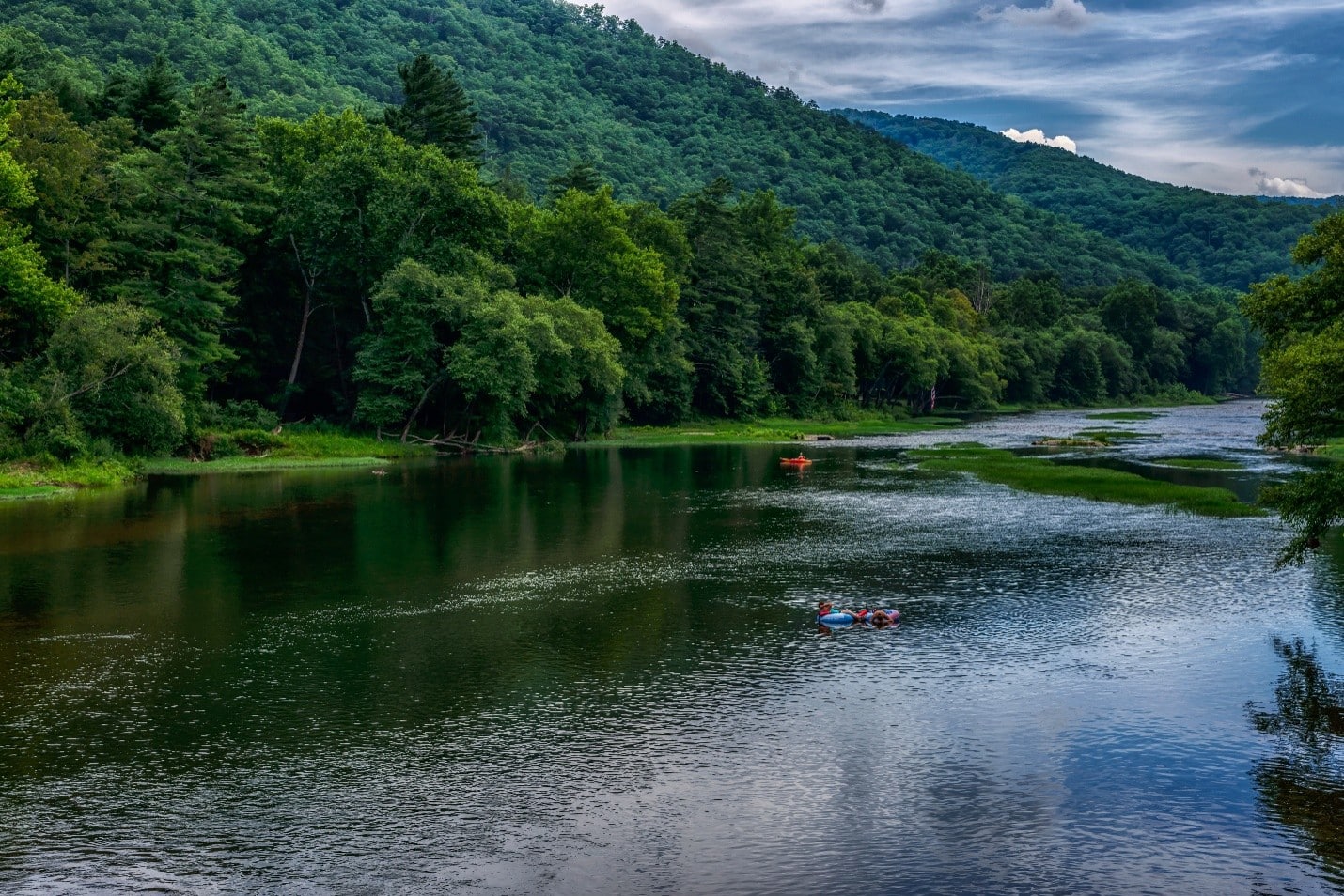
The lower Greenbrier River possesses the excitement of life on one of the nation’s great wild rivers. The focus of a vast outdoor-recreation destination, it flows untamed out of the lofty Alleghenies, attracting anglers, paddlers, and naturalists from across the globe.
At 172 miles long, the Greenbrier drains over 1.5 million acres and is the longest undammed river left in the Eastern United States. It is primarily used for recreational pursuits and is well known for its fishing, canoeing, kayaking, and floating opportunities. Its upper reaches flow through the Monongahela National Forest, and it is paralleled for 77 miles by the Greenbrier River Trail, a rail trail which runs between the communities of Cass and North Caldwell.
It has always been a valuable water route, with most of the important cities in the watershed established as river ports. The river supplies the New River’s receiving waters with an estimated 30% of its water volume. Over three-fourths of the watershed is a karst region (cavern system), which supports fine trout fishing, cave exploration, and recreation. Many important festivals and public events are held along the river throughout the watershed.
The Greenbrier forms at Durbin in northern Pocahontas County at the confluence of the East Fork Greenbrier River and the West Fork Greenbrier River, both short streams that rise at elevations exceeding 3,300 feet and flow their entire lengths in northern Pocahontas County. From Durbin, the Greenbrier flows generally south-southwest through Pocahontas, Greenbrier, and Summers Counties, past several communities including Cass, Marlinton, Hillsboro, Ronceverte, Fort Spring, Alderson, and Hinton, where it flows into the New River.
Along most of its course, the Greenbrier accommodated the celebrated Indian warpath known as the Seneca Trail (Great Indian Warpath). From the vicinity of present-day White Sulphur Springs, the Trail followed Anthony’s Creek down to the Greenbrier near the present Pocahontas-Greenbrier County line. It then ascended the River to the vicinity of Hillsboro and Droop Mountain and made its way through present Pocahontas County via future Marlinton, Indian Draft Run, and Edray.
The WV DNR has a public river access location in Alderson.
THE NEW RIVER AND BLUESTONE LAKE

The subject property is a 25-minute drive from the New River, the 80,000-acre New River Gorge National River Park, and the 2,000-acre Bluestone Lake in Hinton. The New River is the second-oldest river in the world, after the Nile; it is the oldest river in North America. The New River is unique because it begins in Blowing Rock, N.C., and flows north through Virginia into West Virginia. The Nile and Amazon are the only other major rivers that also flow north. Year after year, it produces more citation fish than any other warm-water river in WV. Smallmouth bass, largemouth bass, crappie, catfish, sunfish, hybrid striped bass, walleye, pike, and muskellunge are common fish species in the New River and Bluestone Lake.
Bluestone Lake is over 2000 acres at summer pool and is the state’s third-largest body of water. Great hunting and fishing opportunities abound at the 17,632-acre Bluestone Wildlife Area adjacent to the park.
MEDICAL
Alderson has a medical clinic. The closest hospital is Greenbrier Valley Medical Center in Fairlea/Lewisburg, a 15-minute drive away. To the south, in Hinton, Summers County, ARH Hospital is about a 20-minute drive away.
The area is also blessed with the amazing service of Health Net helicopters. A helipad is located at the River of Life Church.
VETERANS HOSPITALS/CLINICS

West Virginia has VA Hospitals in Clarksburg, Martinsburg, Beckley, and Huntington. Nearby Salem, VA, has a Veterans Hospital. Nearby Community-Based Clinics in Lewisburg and Princeton
DIRECTIONS
From Alderson City National Bank: 1.5 Miles +/- (approximately 5 minutes)
911 Addresses 3602 and 3802 Alta Drive, Alderson, WV 24910 From the Alderson branch of City National Bank take Route 12 North for approximately 1.5 miles. And the property is on both sides of Route 12. Signs are posted.
From Lewisburg Wal-Mart Super Center (approximately 15 minutes)
Take US Route 219 for a few hundred feet and turn onto Interstate 64 West and travel 8 miles to exit 161 Alta/Alderson, turn left onto Route 12 South for 9.3 miles and the property is located on both sides of Route 12. Signs are posted
REGIONAL INFORMATION
STATE INFORMATION
- State of West Virginia
- West Virginia Explorer
- West Virginia Government
- West Virginia State Parks
- West Virginia Tourism
- Wonderful West Virginia Magazine
- WV Department of Natural Resources
- Virginia – Commonwealth of Virginia
- Virginia is for Lovers
- Virginia Museum of History & Culture
- Virginia Museum of Natural History
- Virginia National Park Service
- Virginia Recreation
- Virginia State Parks
DISCLAIMER Information provided by Foxfire Realty is believed to be reliable but is not guaranteed and should be independently verified by potential purchasers. Foxfire Realty and the Seller(s) make no representations or warranties about the property or the accuracy or completeness of the Information concerning the property, including, but not limited to, title, mineral rights, condition, access, acreage, zoning, taxes, square footage, measurements, protective covenants, forest resource information, timber appraisals. Information concerning the property is provided for marketing purposes only and is subject to change, withdrawal, or correction. Foxfire Realty is not responsible for any inaccuracies, errors, or omissions concerning Information about the property, and provided information is not a substitute for inspections, surveys, title searches or other due diligence by potential purchasers. Photographs may be digitally enhanced and may be representative of the property but not an actual depiction thereof. Maps are provided for informational purposes only.

Contact Foxfire
Gallery