UPPER CAIN 835 +/- ACRES ON LITTLE KANAWHA RIVER

835+/- acres multi-use, timber investment, agricultural, recreational and residential, with 3 miles of direct frontage on the Little Kanawha River
| Price: | |
|---|---|
| $1,650,000 | |
| ID: | 1084 |
| Acres: | 835 +/- |
| Address: | |
Agent Contact:
Richard Grist, 304-645-7674

MAPS & DOCUMENTS-CLICK LINKS TO VIEW
OVERVIEW
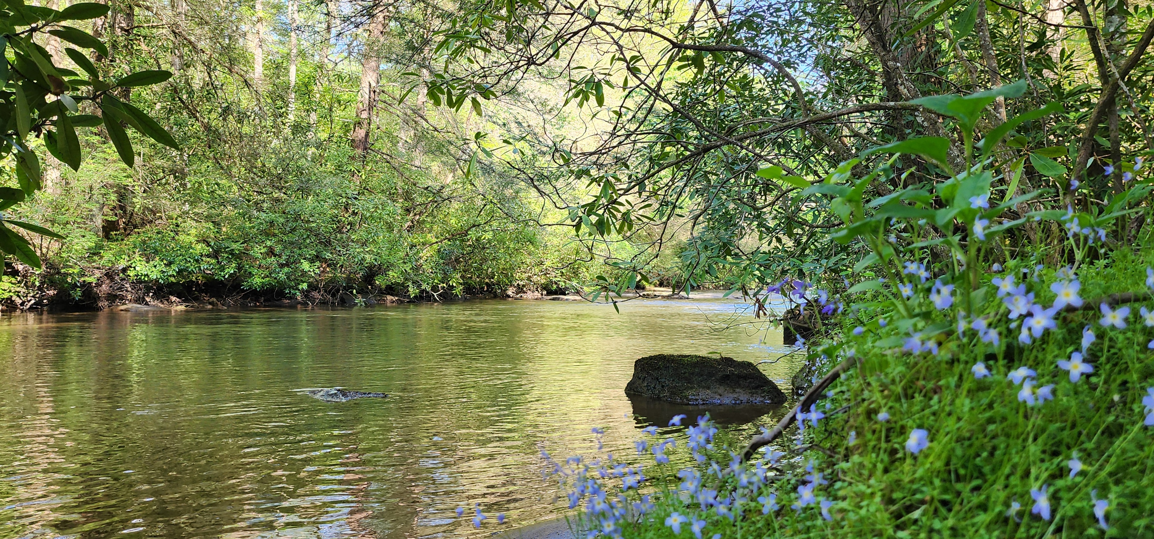
Sit quietly by the lazy river, embrace the forest’s stillness, own the shade beneath an ancient oak………….
Upper Cain on The Little Kanawha River is an 835+/- acre multi-use, recreational, residential, and timber investment opportunity. With its vast, contiguous acreage, and three miles of direct river frontage, Upper Cain presents an opportunity to create a lasting generational legacy.
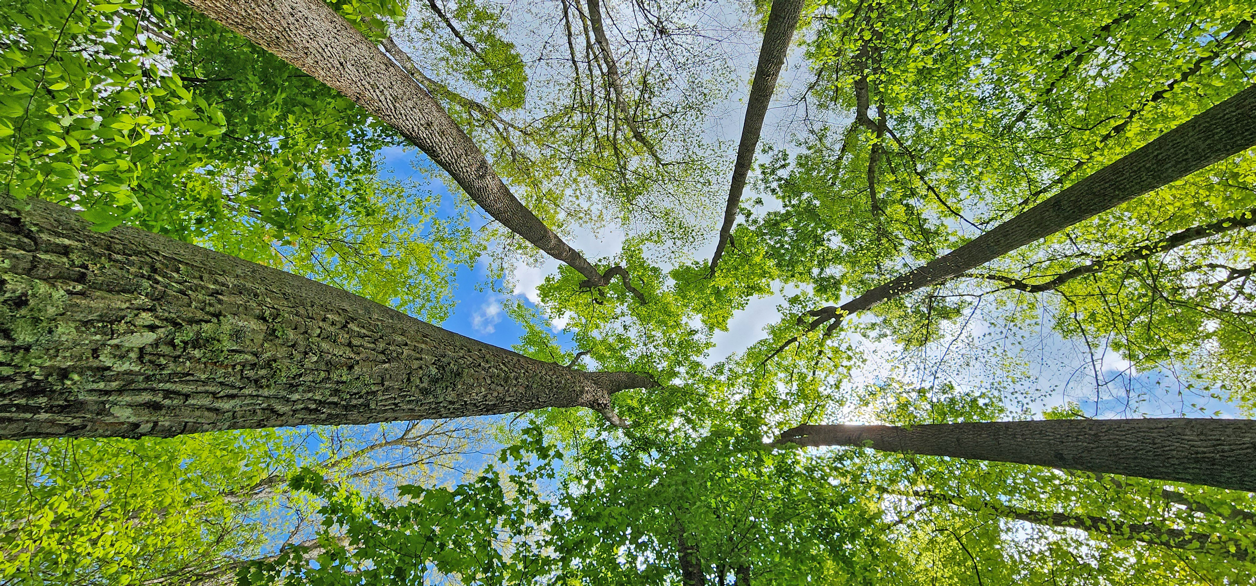
Estimated $517,000 in ready to harvest timber, thereby producing a strong cash flow to offset purchase and holding costs. The vigorously growing forest is a tremendous Carbon Sink. Carbon Credits could possibly be leased to provide additional income.
Upper Cain’s extensive ecological and conservational values provide many essential ecosystem services, including rainwater filtration, carbon dioxide sinking, oxygen production, and wildlife habitat enhancement.
HIGHLIGHTS
- Three miles of direct frontage on the Little Kanawha River
- 835+/- acres multi-use, timber investment, agricultural, recreational and residential
- Upper Cain presents an opportunity to create a lasting generational legacy
- Estimated $517,000 of timber ready for immediate harvest producing a strong cash flow to offset purchase and holding costs
- Carbon Credits are intact and have not been sold or leased and will convey
- Proximity to America’s newest national park, the 80,000-acre New River Gorge National Park & Preserve
- Miles of forest trails for ATV riding, hiking, camping, hunting and nature viewing
- Electric available at roadside, good cell coverage, StarLink available for high-speed internet
- Dark skies with little or no light pollution for star gazing and planet observation
- Large size lends itself to create a wonderful country retreat – very private but not remote
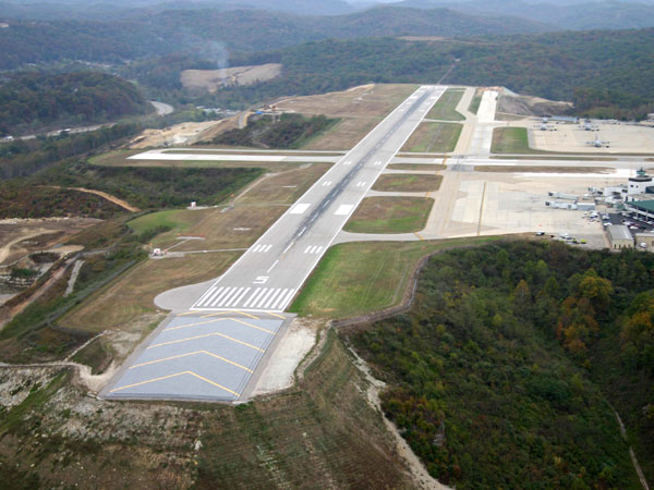
- Jet airport service to major cities in Charleston
- The mature forest is comprised of Red Oak, White Oak, Hickory, Poplar and Maple
- Perfect for all water sport activities supported by the Little Kanawha River
- Town amenities are 10 minutes to Grantsville, the Calhoun County seat
- 90 minutes to Charleston, the State Capitol and WV’s largest metro area
- Amazing resident wildlife population rich in diversity and ever changing
- Fur bearing – deer, black bear, squirrel, rabbit, bobcat, raccoon, fox, chipmunk, opossum
- Area winged wildlife includes Neotropical songbirds, turkey, grouse, eagles, herons, hawks, owls, ravens, king fishers, ravens, crows, and hummingbirds
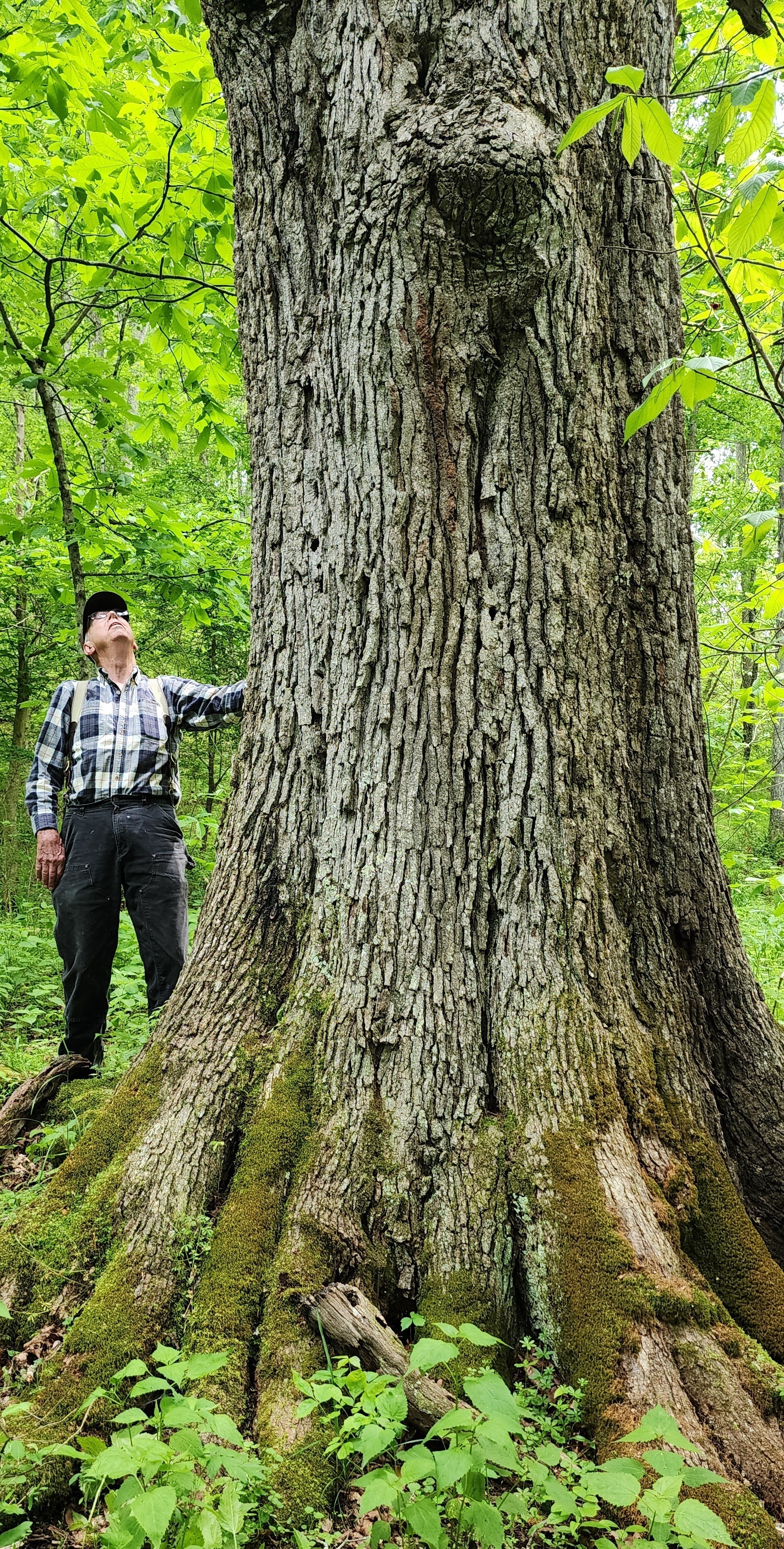
- Dynamic forest with some old growth trees estimated to be 150-200 years old
- Rock outcroppings for rock climbing, bouldering and exploring
- Forest soaks up tons of Carbon Dioxide and produces tons of life-giving oxygen
- A rewarding off-grid permaculture lifestyle can be easily developed
- Several interstates provide access to higher population areas of Charleston, Morgantown, Pittsburg, Cincinnati
- Surrounded by high mountain farms and large timber tracts in a quiet rural neighborhood
- Low taxes, low population density
- The 600+ mile long Hatfield-McCoy ATV trail recreation area is 90 minutes
- The mineral rights have been reserved in previous deeds in the chain of title: the property will convey Surface Only
LOCATION
Google Coordinates: 38.924231°(N), -81.099743°(W)
Address: Pine Creek Road, Grantsville, WV 26147. No 911 address is assigned to property without structures.
Elevation Range: 699 ft. to 1128 ft. +/-
DRIVE TIMES
Towns/Highway
I-77, Ripley Exit 138: 1 hour 10 minutes
I-79, Burnsville Exit 79: 50 minutes
Flatwoods: 1 hour
Grantsville: 5 minutes
Glenville: 25 minutes
Parkersburg: 1 hour 5 minutes
Spencer: 40 minutes
Sutton: 1 hour 5 minutes
Charleston: 90 minutes
Airports
Yeager Airport
Braxton County Airport (small), Sutton: 1 hour
Mid-Ohio Valley Regional Airport, Parkersburg: 1 hour 10 minutes
Slate Run Airport (small), Spencer: 35 minutes
West Virginia International Yeager Airport, Charleston: 1 hour 25 minutes
Recreation Without Lakes
Cedar Creek State Park (3 small ponds): 35 minutes
Ritchie Mines Wildlife Management Area:
Lakes
Burnsville Lake and Wildlife Management Area: 1 hour 10 minutes
North Bend Lake and State Park: 40 minutes
Stonewall Jackson Lake and Resort: 1 hour 5 minutes
Sutton Lake and Elk River Wildlife Management Area: 1 hour 45 minutes
DIRECTIONS
From Grantsville: 7/10 mile (5 min) to the first entrance road; total 1.9 miles (10 min) to the second entrance road
From the intersection of Rt. 16 and Rt. 5 at Tudor’s Biscuit World near the Bernard P. Bell Memorial Bridge over Little Kanawha River, continue on Rt. 16 South crossing the bridge; after crossing the bridge, continue a short distance and turn sharp right onto Northside Road; travel 1/10 mile; just past the blue building on the left, turn slight left onto Pine Creek Road (travels uphill); travel 3/10 mile; in the sharp left-hand turn, the road that leads to the east side of the property is on the right (total 7/10 mile, 5 minutes to this road from Tudor’s). To the second entrance road, travel an additional 1.2 miles on Pine Creek Road; the road that leads to the west side of the property is on the right (total of 1.9 miles, 10 minutes to this road from Tudor’s); after turning right onto this road, immediately take the road to the right that goes down to the creek
FOREST/TIMBER RESOURCES
The 772 acres +/- timber resource is well positioned for current timber income as well as value appreciation over the coming decades. With an attractive species mix, adequate stocking levels, and favorable diameter class distribution, the timber amenity represents a strong component of value to the investor.
The forest of Upper Cain has been well managed. A 2024 forest-wide inventory shows a projected commercial harvest value of about $517,000 (the landowners share) that might be paid by forest products companies in a competitive sealed-bid sale.
The forest resource is composed of quality Appalachian hardwoods. This timber resource can provide a great deal of flexibility to the next ownership in terms of potential harvest revenue and could be managed to provide cash flow opportunities to offset holding cost and long-term asset appreciation.
The land is very productive for growing hardwoods with annual ring growth up to ½ inch. The timber runs consistently throughout. It is good quality hardwood sawtimber and veneer. There is a market for this timber in the area.
The abundant timber resource is well positioned for future timber income as well as value appreciation over the coming decades. With an attractive species mix, adequate stocking levels, and favorable diameter class distribution, the timber amenity represents a strong component of value to the investor.
The property has various ages of forestland, ranging from 40-year-old emerging forest in naturally regenerated old farm fields to 100-year-old full canopy stands of mature forest. The forest features a timber resource with impressive commercial and pole stocking with a solid basal area per acre. This stocking is average to above average for the region.
Diameters are well represented across the commercial and pre-commercial spectrum with a mature size class, as well as abundant pole size timber and growing stock. Average diameter with all products combined is considered average to above average for the area.
There are some trees well over 150 years old and classified as “Heritage Trees”. These amazing trees have withstood the test of time and lend an air of grace and permanency to the property.
The forest is healthy and there are no signs of pest infestations of Gypsy Moth. Emerald Ash Borer and the Hemlock Wooly Adelgid are present and most of the Ash and Hemlock trees are severely stressed and will continue to decline over the next decade. There have been no forest fires in recent memory.
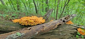
The forest floor is home to several types of mushrooms, medicinal plants, wild ginseng, ferns and cool green mosses. There may be a few fruit trees scattered about, which were part of the early homestead. Honeybees will do very well here.
TIMBER INVENTORY
Timber Value of the timber was estimated by a professional forester to be approximately $517,000 in April 2024.

Timber data in this report are based upon a 2024 timber inventory that was conducted by an experienced professional forestry consultant.
The forester took 88 systematic samples using a basal area factor of 15 across the forest. The inventory shows 18,802 trees containing 2,217,330 board feet of hardwood sawtimber and veneer 12” dbh and larger. The trees were measured for diameter at breast height (dbh) applying the Doyle Scale, Form Class 78 & 80.
The inventory shows forest wide 44,096 tons of pulpwood & future growing stock.
Species composition:
The forest’s predominately well-drained upland terrain has led to a resource dominated by hardwood species. Overall, the species composition is highly desirable and favors Appalachian hardwood types, consisting primarily of:
- 17% White Oak/Chestnut Oak – 382 MBF
- 26% Red Oak Group – 586 MBF
- 38% Poplar/Cucumber/Basswood – 873 MBF
- 7% Black Cherry – 146 MBF
- 12% A host of associate species (Birch, Beech, Sycamore, Maples, Black Gum, Locust, Hickory) with 226MBF
DISCLAIMER: The above-listed volumes are estimates only for the benefit of the owners and are not guaranteed. Due to variations in timber utilization and logging techniques, potential buyers should make their own determination of the quantity, quality and commercial value of the timber.
CARBON SEQUESTRATION
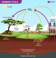
The 835 +/- acres is a tremendous producer of Oxygen and sequester of Carbon Dioxide. Carbon Sequestration is the act of processing carbon dioxide through sinks and stores and releasing them into the atmosphere as oxygen. The vigorously growing forest is sequestering thousands of tons of Carbon Dioxide each per year and producing tons and tons of life-giving Oxygen.
This natural process allows the owner (and family/friends) the opportunity to potentially enjoy a carbon neutral footprint.
The leasing of “Carbon Credits” to environmental mitigation companies is a rapidly emerging financial opportunity for the property owner to receive income without placing any burden on the land. The leases can be for as little as one year.
AGRICULTURAL RESOURCES
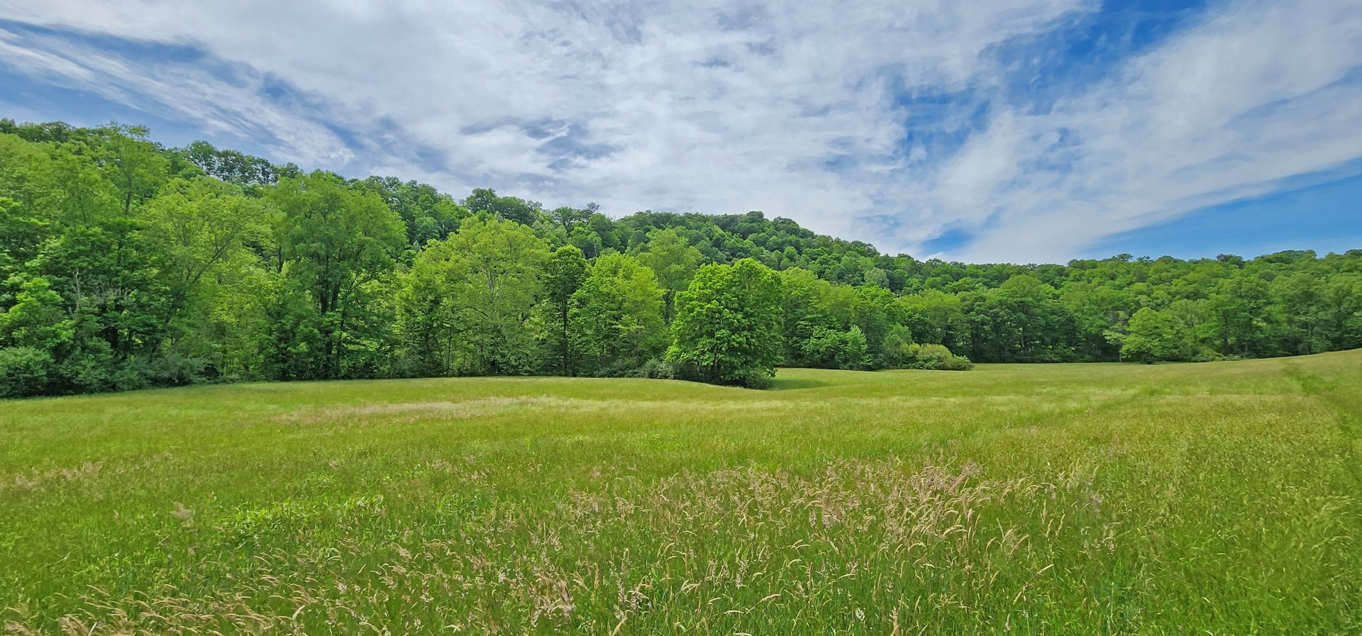
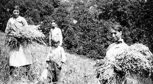
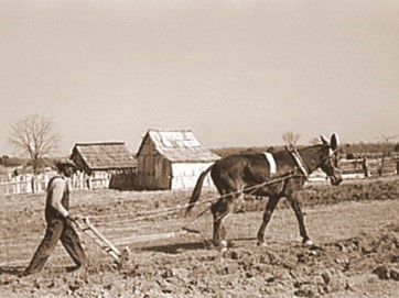
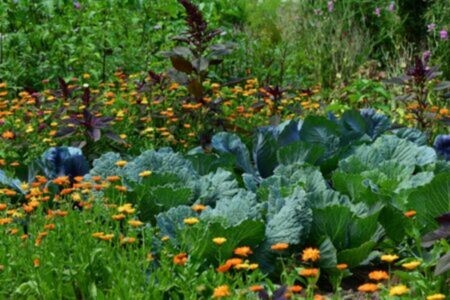
During the period between 1850 and 1920, most of the property was cleared with hand tools and animal drawn equipment. Converting timberland into farm fields required a tremendous amount of back-breaking physical labor. Piles of field stone scattered about the edges of the abandoned fields are a lasting tribute to the early mountaineers who homesteaded the land. The property contains approximately 60 acres of farm fields that were once the anchor and heartbeat of the self-sustaining lifestyle of the original homestead. Past farming history included cattle and sheep grazing, production of hay, oats, barley and corn. The soil and elevation are well suited for establishing a vineyard or fruit orchard.


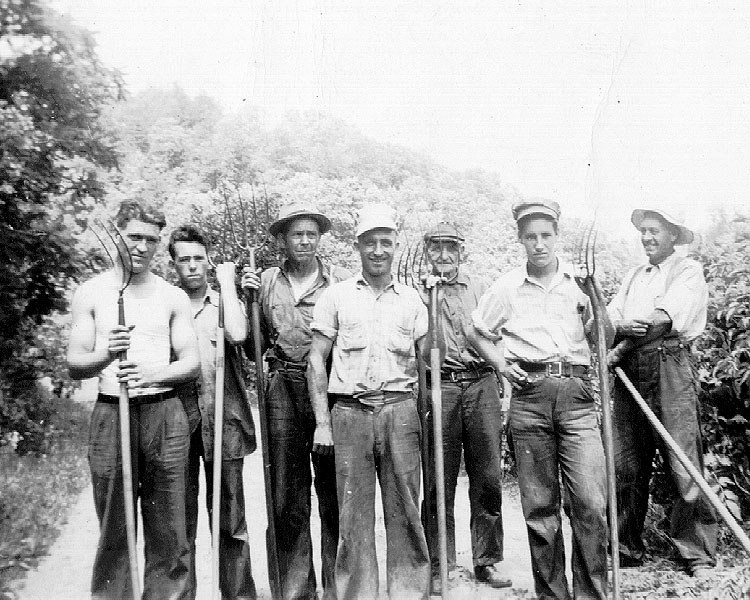
- With the advent of the modern farm tractor in the mid-1940’s, many farm workers were no longer needed and migrated to the large northern cities to work in the factories. This sweeping change resulted in the less productive and steeper areas of the farms were abandoned and were no longer being maintained. These areas eventually became today’s valued forests.
- There are about 60 acres of gently laying hayfields and of pasture. The hayfields would also be suitable for row crops like corn, wheat, pumpkins, etc.
- The property has been in continuous agricultural use for some 150 years.
- There is a considerable amount of fencing about the perimeter of the property.
- The property’s rich soil, blue line and intermittent streams, 4 seasons climate, and varied topography provide the necessary elements for a permaculture lifestyle.
- A few fruit trees are scattered about, some of which were part of the early homestead. Crops of black walnuts are produced each year from the abundant black walnut trees on the property.
- Honeybees will do well here and it may be possible to produce some maple syrup from the sugar and red maple trees growing on the property.
WILDLIFE
Years of wildlife management practices have created the ideal wildlife preserve. Early on, management goals promoted overall wildlife health, facilitated the harvest of game, developed wildlife viewing areas, increased carrying capacity, and increased species diversity.
The three miles of frontage on the Little Kanawha River (LKR) is a major contributor to the local ecosystem richness and diversity for both plants and animals. The LKR, plus the property’s associated streams, and feeders, create a water supported community with a wide variety of wildlife. Some of the margins of the river and creeks are fringed by wetlands. These wetlands support the aquatic food web, provide shelter for wildlife, and stabilize the shore of the river and streambanks. Some of the plant life associated with the wetland includes rushes, sedges, cattails, duckweed, skunk cabbage, and algae.
There are many animals that live year-round, and at other times, in the water and around the edges of the area’s lakes, rivers, ponds, creeks and streams. These include raccoons, opossums, blue herons, Canada geese, wood ducks, mallards, minnows, native fish, turtles, salamanders, newts, crayfish, muskrats, bull frogs, eagles, hawks and redwing blackbirds.
There is the insect and microscopic world including butterflies, dragonflies, pond skaters, water beetles, damselflies, tadpoles and various insect larvae.
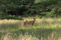
The diverse tree species, coupled with the abundant water supply, create the perfect wildlife habitat. The miles of “edge effect” created between the LKR, fields, hollows, ridges, and rock outcrops benefit all the resident wildlife. Bald eagles, white tail deer, black bear, wild turkey, squirrel, rabbit, bobcat, raccoon, fox and many species of songbirds, owls and raptors make up the resident wildlife population.
The hardwood forest provides an essential nutrient source and produces tons of hard mast including acorns, hickory nuts, beech nuts and black walnuts. Soft mast includes stag horn sumac, black cherry, tulip poplar seeds, maple seeds, autumn olive berries, and blackberries.
BUTTERFLIES

The property is an exceptional habitat for all butterflies, especially the Monarch. The monarch is highly dependent on the milkweed plant and will always return to areas rich in milkweed to lay their eggs upon the plant. The milkweed they feed on as caterpillars is actually a poisonous toxin and is stored in their bodies. This is what makes the monarch butterfly taste so terrible to predators.
Of course, other butterflies visit the property, including the eastern tiger and spicebush swallowtails, silver-spotted skipper, and a variety of sulphurs and whites.
One other interesting insect to visit the property is the Black Saddlebag Dragonfly, a regular guest of the creeks and wetlands with all the frogs, salamanders, crawdads and turtles.
RECREATION AT UPPER CAIN
RECREATION AT UPPER CAIN offers outstanding onsite recreational opportunities. Numerous activities are anchored by the LKR and supported with fields, forests, and miles of trails.
Sitting quietly by the lazy river, embrace the forest’s stillness, own the shade beneath an ancient oak………….
Nature viewing is first in line of recreational activities. Attentive wildlife management has been geared not to just game animals. Equal consideration has been extended to increasing the numbers and diversity of species including neo-tropical songbirds, butterflies, turtles, frogs, rabbits, chipmunks, dragonflies, owls and hawks.
Stargazing-Planet Observation
Complete or near darkness can still be found on many areas of the property, thereby affording the opportunity to view the night sky in all its brilliant wonder.

Water-sports enthusiasts will find the LKR ideal for swimming, canoeing, fishing, kayaking, tubing, snorkeling, paddle boarding and windsurfing.

Mountain Biking, Horseback Riding and Hiking
The property has miles of trails that may be used for mountain biking, hiking or horseback riding.

Shooting-sports devotees find all the land and privacy needed to enjoy:
- Paintball-Airsoft-Laser Tag-Archery tag
- Shotgun sport shooting including Skeet, Trap, Double Trap and Sporting Clays
- Rifle & Handgun shooting: bullseye, silhouette, western, bench rest, long-range, fast draw
- Archery and Crossbow competition shooting
- Plain ole’ plinking: Grandpa’s old 22 single shot rifle and a few tin cans make a fun day
All Terrain Motorsports
Internal roads and several forest trails that are perfect for experiencing the property from an ATV or UTV. These exciting machines handle the wide variety of terrain.
Rock Crawling & Rock Bouncing
Areas of the property afford a topographic opportunity for the Extreme Off-Road adventurist to enjoy the increasingly popular Motorsport of Rock Crawling and Rock Bouncing.
Dirt bikes and Motorcross can also be a lot of fun and they come in all sizes and horsepower to fit anyone who enjoys being on two wheels and sometimes in the air.
Hunting is a first-class experience. White tail deer, black bear, red/gray fox, bobcat, wild turkey, grouse, duck, squirrel, raccoon, fox and rabbit make up the resident wildlife population. It is hard to find a property that has a better mix of wildlife.
WATER RESOURCES
The property has two long sections of frontage on the Little Kanawha River totaling about 3.3 miles. The western section of river frontage is about 2.2 miles in length, and the eastern section of river frontage is about 1.1 miles in length. Pine Creek, a blueline stream with regular water flow, is inside the central portion of the property and along an edge of the property in two sections totaling about one mile. The western side of the property contains a dashed blueline intermittent stream that is a little over one mile in length, and should have water flow during snow melt and rain events.
MINERAL RESOURCES
The owners’ deed and real estate tax statements indicate reservations of minerals. West Virginia is one of the states in the US that has two ownership titles, those being SURFACE RIGHTS and MINERAL RIGHTS. A title search for mineral rights ownership has not been conducted. All rights the owner has will convey with the property. A mineral title search could be conducted by a title attorney at the same time when the surface title search is being conducted.
BOUNDARIES AND SURVEY
The property is being sold by the boundary and not by the acre.
UTILITIES
Water: A well may be drilled
Sewer: A private septic system may be installed
Electricity: Roadside
Internet: StarLink
Cellphone Coverage: Good
ACCESS/FRONTAGE
The property has miles of internal roads and trails reaching many parts of the property, and is accessed by two different entrance roads off Pine Creek Road Rt. 35/12.
ZONING
Calhoun County has no zoning regulations in effect other than those which are enacted and enforced within the municipalities. All prospective purchasers are encouraged to contact the County Health Department and the county commission regarding installation of septic systems, water wells, and flood insurance requirements.
PROPERTY TYPE/USE SUMMARY
The property has about 58 total acres of fields located mostly in the bottom land along the Little Kanawha River with some fields on some ridge locations. An open-area utility line contains about 5 acres. There are about 772 acres of forestland.
(This summary is an estimation of current property use as determined from aerial photography. It is made subject to the estimation of property boundaries and any errors in the interpretation of land use type from the aerial photography utilized.)
DEED and TAX INFORMATION
Deed Information: Part of DB 298 Pg. 128, and DB 309 Pg. 254.
Calhoun County, West Virginia
Acreage: 835.16 acres +/-
Real Estate Tax ID/Acreage/Taxes:
Calhoun County, West Virginia
Center District (1)
Tax Map 13 Parcels 16,46,56,64,65.3,69, a 3-acre NoMap; Tax Map 13 Parcel 58.1; Tax Map 14 Parcels 17 & 36;
Class: TP 1-13-69 is Class 3, the owners’ other tax parcels are Class 2
2023 Real Estate Taxes: $644.34
SCHOOLS
Calhoun County School District
Public Elementary School:
Pleasant Hill Elementary School
Public Middle School:
Calhoun County Middle/High School
Public High School:
Calhoun County Middle/High School
Other Public Schools:
Calhoun-Gilmer Career Center
Glenville State University, Glenville
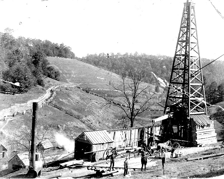
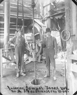
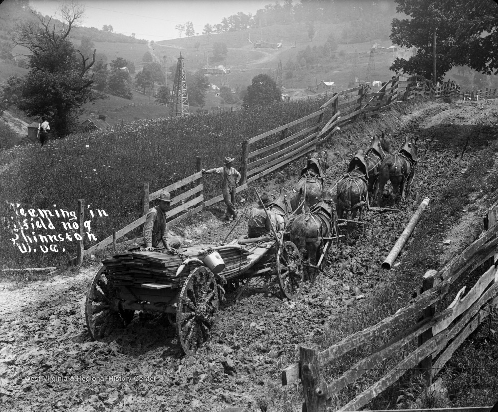
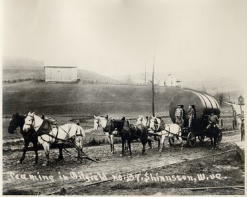
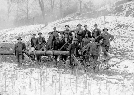
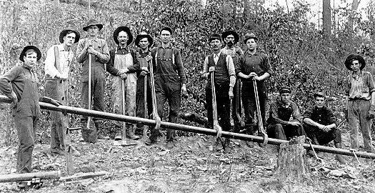
HISTORY OF THE OIL AND GAS INDUSTRY
 The oil and gas industry in West Virginia originated at Burning Springs, located in Wirt County on the Little Kanawha River upstream from Elizabeth. The community’s name was derived from two springs from which natural gas escaped and sometimes burned. William Palmer Rathbone began purchasing land here in 1840, eventually gaining more than 10,000 acres. The following year he arrived in Burning Springs with his sons.
Long before the arrival of European settlers, it is believed that the Native Americans recognized and perhaps used as a fuel source the “bu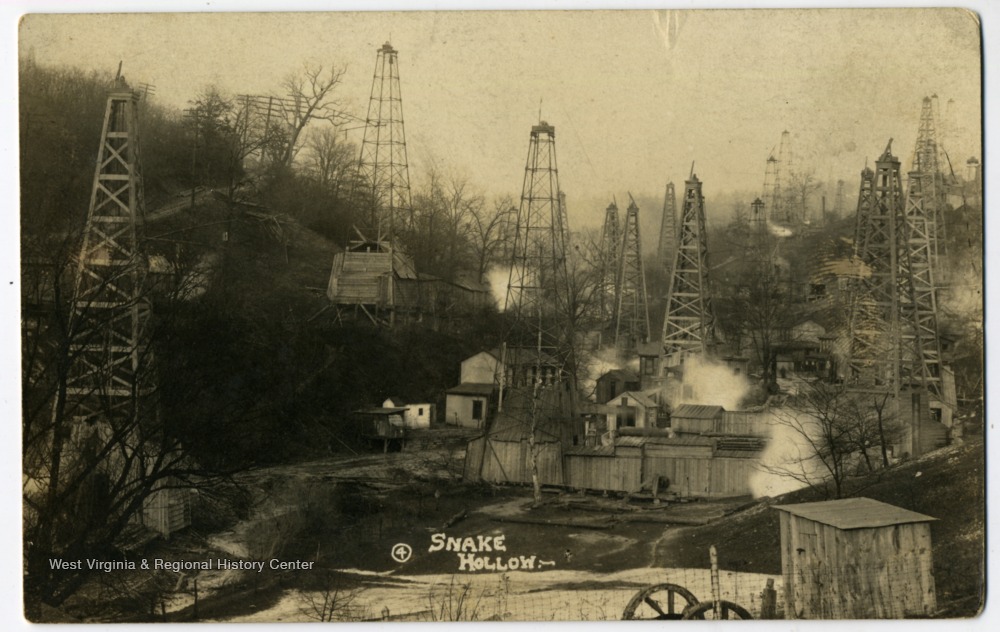 rning springs” and outflows of petroleum on the Little Kanawha, Kanawha, and Big Sandy rivers. Records show that the early settlers were also aware of the “burning springs” which were natural gas vents. One such burning spring, located on the Kanawha River, was visited by George Washington in 1775.
The oil 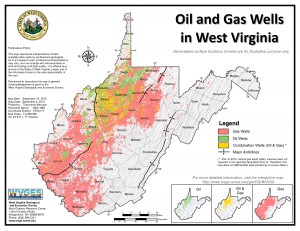 and gas industry in West Virginia began as an outgrowth of the salt industry. In the early 1800s, oil and gas had no importance in West Virginia, and though saltmakers frequently hit oil or gas in their drilling, they considered it a nuisance. In fact, so much oil was diverted to the Kanawha River by salt manufactures that it was long known as “Old Greasy” to the boatmen. Gas was first struck in a well drilled for salt at Charleston in 1815. Once the value of oil and gas was realized, the Great Kanawha Valley region became a pioneer in the discovery of petroleum by boring and in the use of oil and gas on a commercial scale. By 1826, oil was used for lamps in workshops and factories. The drilling tools, jars, and casing, first developed in 1806 by the Ruffner brothers for the salt industry, became essential equipment to the petroleum industry of the United States.
On the Little Kanawha River, near the Hughes River, was a stream called Burning Springs Run, named because there were two springs at its mouth from which natural gas escaped. As early as 1781, Thomas Jefferson described the brilliant flame which could be produced by thrusting a lighted candle into the escaping gas at this site. Because gas and salt brine were often associated, the Rathbone brothers bored a salt well near these springs. The Rathbones collected oil from the surface of the river and sold it as an elixir known as ‘‘rock oil.’’ They also began drilling for salt brine, but found the brine contaminated by oil.
However, rather than salt, at a depth of 200 feet they hit petroleum and by boring deeper, they were able to produce 200 barrels per day in 1859. Although petroleum was not the treasure that the Rathbones sought, they were encouraged by their find and drilled a second well which yielded 1,200 barrels of petroleum daily. The oil was shipped to a refinery in Parkersburg constructed by Johnson Camden.
News of the Rathbone brothers’ discovery spread rapidly and created tremendous excitement. By 1861, a town with several thousand inhabitants had sprung up. The discovery drew thousands of people to Burning Springs, turning it into ‘‘a Sodom of sin, anointed with oil.’’ Lighting in the newly formed town, including that for a brilliantly lit hotel, was provided by natural gas. The widespread use of gas in this town marked the beginning of the era of gas development in West Virginia.
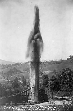
Meanwhile, hundreds of thousands of barrels of oil were being floated down the river to Parkersburg where they were then sent to other cities by rail or river. The Burning Springs oil field was one of only two oil fields in America prior to the Civil War. But by 1876, there were 292 wells in the State, producing a total of 900 barrels daily. Parkersburg was the chief oil market.
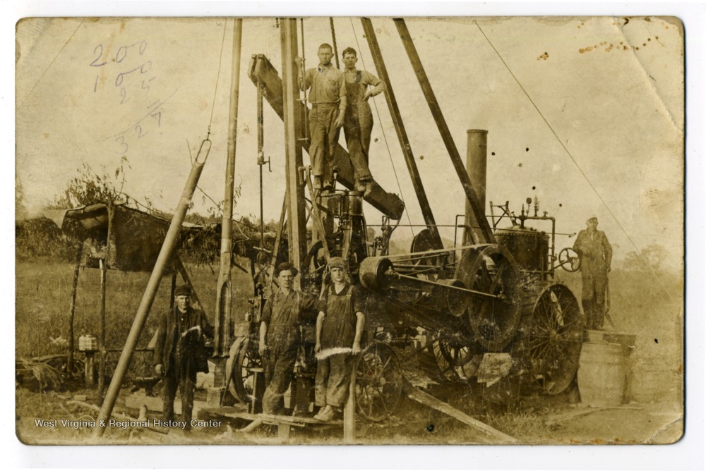
The Volcano oil field was discovered in 1860, and from 1865 to 1870 drilling was very active, producing from the Salt sand at a depth of about 360 feet. The heavy lubricants produced led to the development of West Virginia’s first oil pipeline, from Volcano to Parkersburg, in 1879. Also at Volcano, in 1874, W. C. Stiles, Jr., invented the “endless wire” method of pumping many wells from a central engine. Using wheels, belts, and cables, perhaps as many as 40 wells could be pumped by one engine. One of the systems operated until 1974.
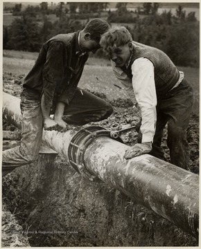
From 1879 to 1889, oil production declined steadily due in great part to the inability of the drillers to bore to the deeper sands and to deal with softer rock they encountered. But in 1889, large iron pipes were inserted to prevent clogging of the wells by crumbling walls, and with this discovery much deeper wells could be drilled. With the discovery of deeper oil sands, the Doll’s Run, Eureka, Mannington, and Sistersville fields were found and developed.
It was about this time that the anticlinal theory of gas and oil accumulation was first proposed. Dr. I.C. White, a well-known geologist who later became West Virginia State Geologist, was one of the major initiators of this anticlinal theory, insisting that the theory be tested in West Virginia. His discovery and development of the Mannington oil field in 1888 proved the theory and convinced the oil industry of its importance. The Mannington field became one of the largest in the State, with the largest well producing about 1,600 barrels per day.
Thus, from its early beginnings at Burning Springs in 1859, the oil industry in West Virginia grew to reach its peak production of 16 million barrels in 1900. Although the oil industry then started to decline, natural gas production was growing. From 1906 to 1917 West Virginia was the leader in gas production in the United States. From 1917 to 1934 the State’s output declined markedly, then increased again until about 1970.
NOW AND THE FUTURE Oil and gas production is alive and well in West Virginia. In 2021 WV produced a total natural gas output of more than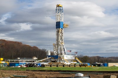 2.7 trillion cubic
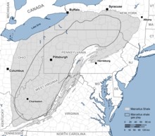 feet, which produced $318MM in severance tax revenue, created hundreds of well-paying jobs, and spurred additional job creation in associated business.
The Appalachian region (WV, OH, PA, NY) is the largest natural gas production area in the United States, and the Marcellus Shale basin, referred to as the “Fertile Cresent”, is the largest source of that regional production. The Northeast, long accustomed to being “at the end of the pipeline,” now finds itself located next to – and indeed on top of – one of the largest natural gas basins in the U.S. Chesapeake Energy estimates places as much as 411 TRILLION CUBIC FEET of shale gas is contained in the Basin.
Natural gas production will reach a combined 38.3 billion cubic feet per day by 2025, according to GlobalData, a leading data and analytics company. This shale gas formation extends from West Virginia into Ohio, Pennsylvania and New York. Its geographic area (around 95,000 square miles) is quite large, leading to great expectations for the ultimate size of the economically recoverable resource base. In a July 2011 report, the U.S. Energy information Administration (EIA) reported the share of Marcellus acreage by state as follows: Pennsylvania, 35.35%; West Virginia, 21.33%; New York, 20.06%; Ohio, 18.19%; Virginia, 3.85%; and Maryland, 1.09%.
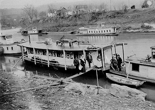
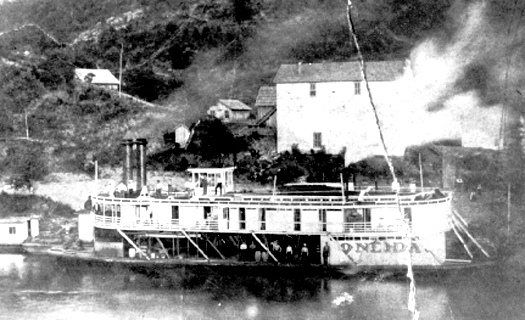
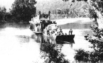
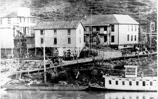
TRANSPORTATION ON THE RIVER

From the mid-1800s and into the 1930s, boats powered by steam and later by gasoline carried people, mail, and freight up and down the river. The boats that plied the Little Kanawha were much smaller than the big paddle wheelers that churned the Ohio River. A windowed cabin, sometimes two decks tall, protected passengers and freight from the weather. Divided into rooms and a galley, the cabin was home to the crew, which sometimes included the family of the captain. A wheelhouse perched atop the whole. Commercial navigation came to an end as roadways connecting the towns along the river’s banks improved.
FOREST FARMING
The most common crops are medicinal herbs and mushrooms. Other crops that can be produced include shade-loving native ornamentals, moss, fruit, nuts, other food crops, and decorative materials for crafts. These crops are often referred to as special forest products.
Here are some specific examples of crops:
- Medicinal herbs: Ginseng, goldenseal, black cohosh, bloodroot, passionflower, and mayapple
- Mushrooms: Shiitake and oyster mushrooms
- Native ornamentals: Rhododendrons and dogwood
- Moss: Log or sheet moss
- Fruit: Pawpaws, currants, elderberries, and lowbush blueberries
- Nuts: Black walnuts, hazelnuts, hickory nuts, and beechnuts
- Other food crops: Ramps (wild leeks), maple syrup, and honey
- Plants used for decorative purposes, dyes, and crafts: Galax, princess pine, white oak, pussy willow branches in the spring, holly, bittersweet, and bloodroot and ground pine (Lycopodium)
SELF SUSTAINING LIFE OFF THE GRID
Just as 150 years ago, when the first mountaineers settled the area, the property can be self-sustaining in times of necessity – even without electricity.
- Fresh water for drinking and cooking can come from mountain springs or a drilled water well (hand drawing water from the well using a cylinder well bucket).
- The creeks and forest can provide fresh food (deer, squirrel, rabbit, and turkey).
- The existing agricultural land can provide vegetable gardens, berry patches, fruit orchards, and row crops of corn, oats and barley.
- Bee hives can provide honey and beeswax for candles and pollenate the fruit trees.
- The forest can provide firewood for heating and cooking, lumber for building, maple syrup and pounds of nuts (walnuts, beechnuts and hickory nuts).
- A vineyard could be created to provide jellies, jams, juices and wines.
- Livestock can be raised including dairy cows, chickens, geese, turkey, rabbits, goats, sheep, pigs and cattle. Milk, cheese, eggs, meat, wool, leather, fur, feather pillows and down comforters can all be produced.
PERMACULTURE FARMING
The three core tenets of permaculture are:
- Care for the earth:Provision for all life systems to continue and multiply. This is the first principle, because without a healthy earth, humans cannot flourish.
- Care for the people:Provision for people to access those resources necessary for their existence
- Setting limits to population and consumption:By governing our own needs, we can set resources aside to further the above principles. This includes returning waste back into the system to recycle into usefulness. The third ethic is sometimes referred to as Fair Share, which reflects that each of us should take no more than what we need before we reinvest the surplus.
Permaculture design emphasizes patterns of landscape, function, and species assemblies. It determines where these elements should be placed so they can provide maximum benefit to the local environment. Permaculture maximizes useful connections between components and synergy of the final design. The focus of permaculture, therefore, is not on each separate element, but rather on the relationships created among elements by the way they are placed together; the whole becomes greater than the sum of its parts. Permaculture design therefore seeks to minimize waste, human labor, and energy input by building systems, and maximizes benefits between design elements to achieve a high level of synergy. Permaculture designs evolve over time by taking into account these relationships and elements and can evolve into extremely complex systems that produce a high density of food and materials with minimal input.
The design principles, which are the conceptual foundation of permaculture, were derived from the science of systems ecology and study of pre-industrial examples of sustainable land use. Permaculture draws from several disciplines including organic farming, agroforestry, integrated farming, sustainable development, and applied ecology. Permaculture has been applied most commonly to the design of housing and landscaping, integrating techniques such as agroforestry, natural building, and rainwater harvesting within the context of permaculture design principles and theory.
RIPARIAN ZONES
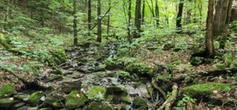
In earlier times, before the environmental and societal values of riparian zones (RZ’s) were discovered, the RZ was commonly called a “swamp”. These enchanting areas are biologically rich and wildlife diverse, being akin to the world’s largest swamps found in the Florida Everglades and the Amazon River Basin. The mighty RZ works to provide “ecosystem services”—non-monetary benefits like clean water, clean air, carbon sequestration, and recreation for everyone.
These areas are the best of both worlds. Here you can watch for deer, squirrels, raccoon, and turkey while exploring for butterflies, turtles, frogs, crawdads, songbirds, salamanders, newts, and a host of other aquatic invertebrates, migratory birds, reptiles, and amphibians.
The RZ’s are a very productive part of the environment; more productive of vegetation, in fact, than some agricultural soils. This vegetation serves important purposes. It shelters and feeds many wildlife species that cannot survive elsewhere. Almost 35 percent of all rare and endangered species depend, in some way, on RZ’s. More common riparian zone species provide enjoyment to many by serving educational, research and recreational needs. Waterfowl and many furbearers such as beaver, mink and muskrat provide both consumptive and no consumptive recreation and are dependent on the zones. Many fringe RZ’s provide the food that young fish need to survive. By slowing the flow of water, RZ’s help keep banks from eroding and they trap and settle suspended silt before it smothers fish eggs and covers the insects and other animals that fish eat.
Riparian zones add visual diversity and offer an opportunity to see many different plant and wildlife species seen nowhere else on the property.
DIRECTIONS
From Grantsville: 7/10 mile (5 min) to the first entrance road; total 1.9 miles (10 min) to the second entrance road
From the intersection of Rt. 16 and Rt. 5 at Tudor’s Biscuit World near the Bernard P. Bell Memorial Bridge over Little Kanawha River, continue on Rt. 16 South crossing the bridge; after crossing the bridge, continue a short distance and turn sharp right onto Northside Road; travel 1/10 mile; just past the blue building on the left, turn slight left onto Pine Creek Road (travels uphill); travel 3/10 mile; in the sharp left-hand turn, the road that leads to the east side of the property is on the right (total 7/10 mile, 5 minutes to this road from Tudor’s). To the second entrance road, travel an additional 1.2 miles on Pine Creek Road; the road that leads to the west side of the property is on the right (total of 1.9 miles, 10 minutes to this road from Tudor’s); after turning right onto this road, immediately take the road to the right that goes down to the creek
REGIONAL INFORMATION
STATE INFORMATION
- State of West Virginia
- West Virginia Explorer
- West Virginia Government
- West Virginia State Parks
- West Virginia Tourism
- Wonderful West Virginia Magazine
- WV Department of Natural Resources
- Virginia – Commonwealth of Virginia
- Virginia is for Lovers
- Virginia Museum of History & Culture
- Virginia Museum of Natural History
- Virginia National Park Service
- Virginia Recreation
- Virginia State Parks

Contact Foxfire
304.645.7674
Gallery


