OLD GEE FARM
Sold!

| Price: | |
|---|---|
| $325,000 | |
| ID: | 1091 |
| Acres: | 91 +/- |
| Address: | |
Agent Contact:
Richard Grist, 304-645-7674

MAPS & DOCUMENTS-CLICK LINKS TO VIEW
OVERVIEW
The Old Gee Farm is a 91 acres+/- multiuse parcel offering meadows, unspoiled forest, and homesites with views of distant mountains and pastoral farms; located in peaceful Greenbrier County near historic Lewisburg West Virginia. A forester’s recent inventory estimated there to be $107,000 +/- in ready to harvest timber, thereby producing a strong cash flow to offset purchase and holding costs. The vigorously growing forest is a tremendous Carbon Sink. Carbon Credits could possibly be leased to provide additional income.
HIGHLIGHTS
- $107,000 +/- is the estimated timber value ready for harvest to offset purchase and holding costs
- 16 acres in rolling meadows
- 75 unspoiled forested acres offering spectacular long-range views approaching 20 miles
- Multiple home sites
- There is a hidden cool cave
- Vintage 1800’s hand hewn building (partially in disrepair) on site
- Located in peaceful Greenbrier County just 20 minutes to Lewisburg, America’s Coolest Small Town and county seat
- All mineral rights in title convey
- Rich and diverse resident wildlife population
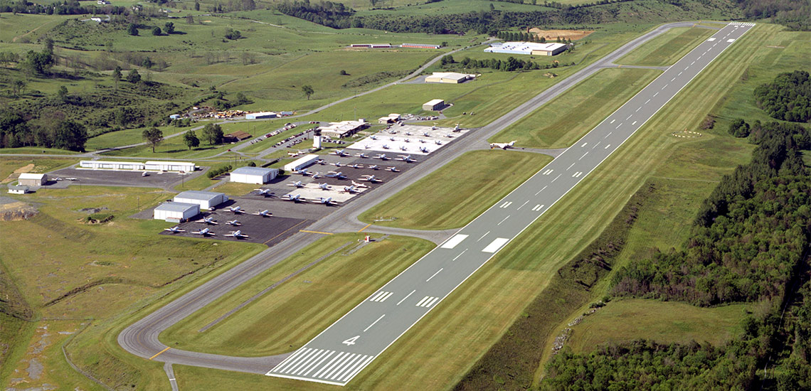
- Minutes to Lewisburg’s jet airport with flights to Chicago & Washington DC
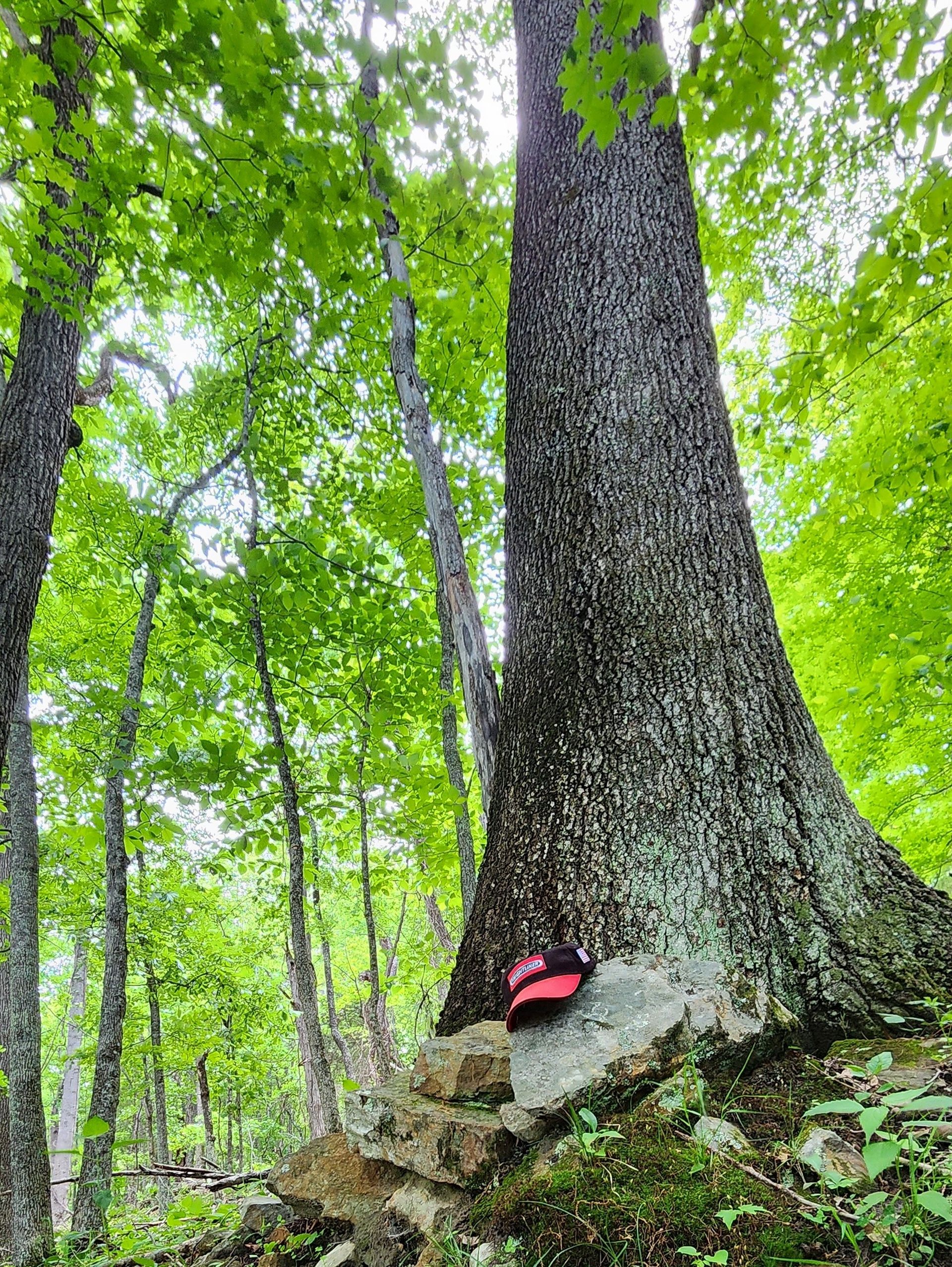
- Dynamic forest with some old growth trees estimated to be 100-200 years old.
- Wildlife program enhances habitat, increases diversity, promotes health of the resident wildlife
- A rewarding permaculture lifestyle can be easily developed
- Surrounded by large farms and timber tracts in a nice rural neighborhood
- Access by state maintained paved roads – FedEx, UPS and USPS delivery
- Timber species include beautiful oaks, black walnut, poplar, maple and hickories
- Winged wildlife includes eagles, hawks, owls, ravens, and Neotropical songbirds
- White tail deer, black bear, red/gray fox, bobcat, wild turkey, grouse, squirrel, raccoon, fox and rabbit make up the resident wildlife population.
- The forest produces life-giving Oxygen and is a sequester of carbon dioxide
- Perfect for recreational activities including shooting sports, ATV riding, horseback riding, hiking, camping, hunting and nature viewing
- Low taxes, low population density
- Greenbrier Co is the largest producer of cattle and second largest producer of sheep in WV
- Forest trails for hiking, ATVing & horseback riding accessing every part of the property
- Cellphone coverage is good, depending on the carrier
- Blue line and ephemeral streams, wide hollow, ridge & flats create interesting topography
- Mosses, ferns, wildflowers and abundant native plants cover the forest floor
- Little light pollution sets the stage for amazing star gazing and planet observation
- Sized right for incorporating a permaculture experience
- Elevation Range: 2175’ to 2596’
- Diverse topography containing a mature forest, seasonal streams and ancient trees create a fascinating natural setting
- Proximity to the Greenbrier River, 2000-acre Bluestone Lake and the New River, the gateway to awesome water recreation
LOCATION
Google Coordinates: 38.015156°(N), -80.453458°(W)
Address: Johnson Lane, Williamsburg, WV 24991. No 911 address is assigned to property without structures.
Elevation Range: 2175 ft. to 2596 ft. +/-
Drive Times
Towns and Highway
I-64 Lewisburg Exit 169 and shopping area: 30 minutes
Beckley: 1 hour
Lewisburg 30 minutes
Marlinton: 55 minutes
White Sulphur Springs and The Greenbrier Resort: 45 minutes
Airports
Greenbrier Valley Airport, Lewisburg: 30 minutes
Roanoke Regional Airport, Roanoke, VA: 2 hours
Medical
Greenbrier Valley Medical Center, Fairlea: 35 minutes
Recreation
Beartown State Park: 35 minutes
Droop Mountain Battlefield State Park: 35 minutes
Greenbrier Aquatic Center, Fairlea: 35 minutes
Greenbrier State Forest, Harts Run, WV: 40 minutes
New River Gorge Bridge, Fayetteville: 1 hour 30 minutes
New River Gorge National Park and Preserve, Sandstone: 55 minutes
State Fair of West Virginia, Fairlea: 35 minutes
Watoga State Park: 55 minutes
Recreation – Lakes
Bluestone Lake, Hinton: 1 hour 15 minutes
Lake Moomaw, Virginia: 1 hour 30 minutes
Moncove Lake State Park, Gap Mills: 1 hour 10 minutes
Summersville Lake, Summersville: 1 hour 35 minutes
DIRECTIONS
From Lewisburg, West Virginia: 20.1 miles +/- (approximately 40 minutes)
From the intersection of US 60 and US 219 in the center of Lewisburg, travel US 219 North for 10 miles; just past the Frankford Post Office, turn left onto Williamsburg Road; travel 6.3 miles; continue straight onto Trout Rd / Trout Valley; travel 2.9 miles; turn right onto Friars Hill road; travel 9/10 mile; turn sharp left onto Johnson Lane and travel Johnson Lane into the property.
FOREST RESOURCES
The 75 acres +/- timber resource is well positioned for current timber income as well as value appreciation over the coming decades. With an attractive species mix, adequate stocking levels, and favorable diameter class distribution, the timber amenity represents a strong component of value to the investor.
The forest of Old Gee Farm has been well managed. A 2024 forest-wide inventory shows a projected fully liquidated commercial harvest value of about $107,000 (the landowners share) that might be paid by forest products companies in a competitive sealed-bid sale.
The forest resource is composed of quality Appalachian hardwoods. This timber resource can provide a great deal of flexibility to the next ownership in terms of potential harvest revenue and could be managed to provide cash flow opportunities to offset holding cost and long-term asset appreciation.
The land is very productive for growing hardwoods with annual ring growth up to ½ inch. The timber runs consistently throughout. It is very good to excellent quality hardwood sawtimber and veneer. There is an excellent market for this timber in the area.
The abundant timber resource is well positioned for future timber income as well as value appreciation over the coming decades. With an attractive species mix, adequate stocking levels, and favorable diameter class distribution, the timber amenity represents a strong component of value to the investor.
The property has various ages of forestland, ranging from 40-year-old emerging forest in naturally regenerated old farm fields to a 100-year-old full canopy stands of mature forest. The forest features a timber resource with impressive commercial and pole stocking with a solid basal area per acre. This stocking is average to above average for the region.
Diameters are well represented across the commercial and pre-commercial spectrum with a mature size class, as well as abundant pole size timber and growing stock. Average diameter with all products combined is considered average to above average for the area.
There are some trees well over 150 years old and classified as “Heritage Trees”. These amazing trees have withstood the test of time and lend an air of grace and permanency to the property.
The forest is healthy and there are no signs of pest infestations of Gypsy Moth. Emerald Ash Borer and the Hemlock Wooly Adelgid are present and most all Ash and Hemlock trees are severely stressed and will continue to decline over the next decade. There have been no forest fires in recent memory.
The forest floor is home to several types of mushrooms, medicinal plants, wild ginseng, ferns and cool green mosses. There may be a few fruit trees scattered about, which were part of the early homestead. Honeybees will do very well here.
TIMBER INVENTORY
Timber Value of the timber was estimated by a professional forester to be approximately $107,000 in June 2024.

Timber data in this report are based upon a 2024 timber inventory that was conducted by an experienced professional forestry consultant.
The forester took 51 systematic samples using a basal area factor of 15 across the forest. The inventory shows 559,179 board feet of hardwood sawtimber and veneer 12” dbh and larger. The trees diameter were measured at breast height (dbh) applying the Doyle Scale, Form Class 78 & 80.
Species composition:
The forest’s predominately well-drained upland terrain has led to a resource dominated by hardwood species. Overall, the species composition is highly desirable and favors Appalachian hardwood types, consisting primarily of:
- 13% White Oak/Chestnut Oak – 74 MBF
- 32% Red Oak Group – 179 MBF
- 47% Poplar/Cucumber/Basswood – 180 MBF
- 6% Hickory – 31 MBF
- 2 % A host of associate species (Birch, Beech, Sycamore, Maples, Black Gum, Locust, Hickory, Black Cherry) – 95 MBF
DISCLAIMER: The above-listed volumes are estimates only for the benefit of the owners and are not guaranteed. Due to variations in timber utilization and logging techniques, potential buyers should make their own determination of the quantity, quality and commercial value of the timber.
AGRICULTURAL RESOURCES
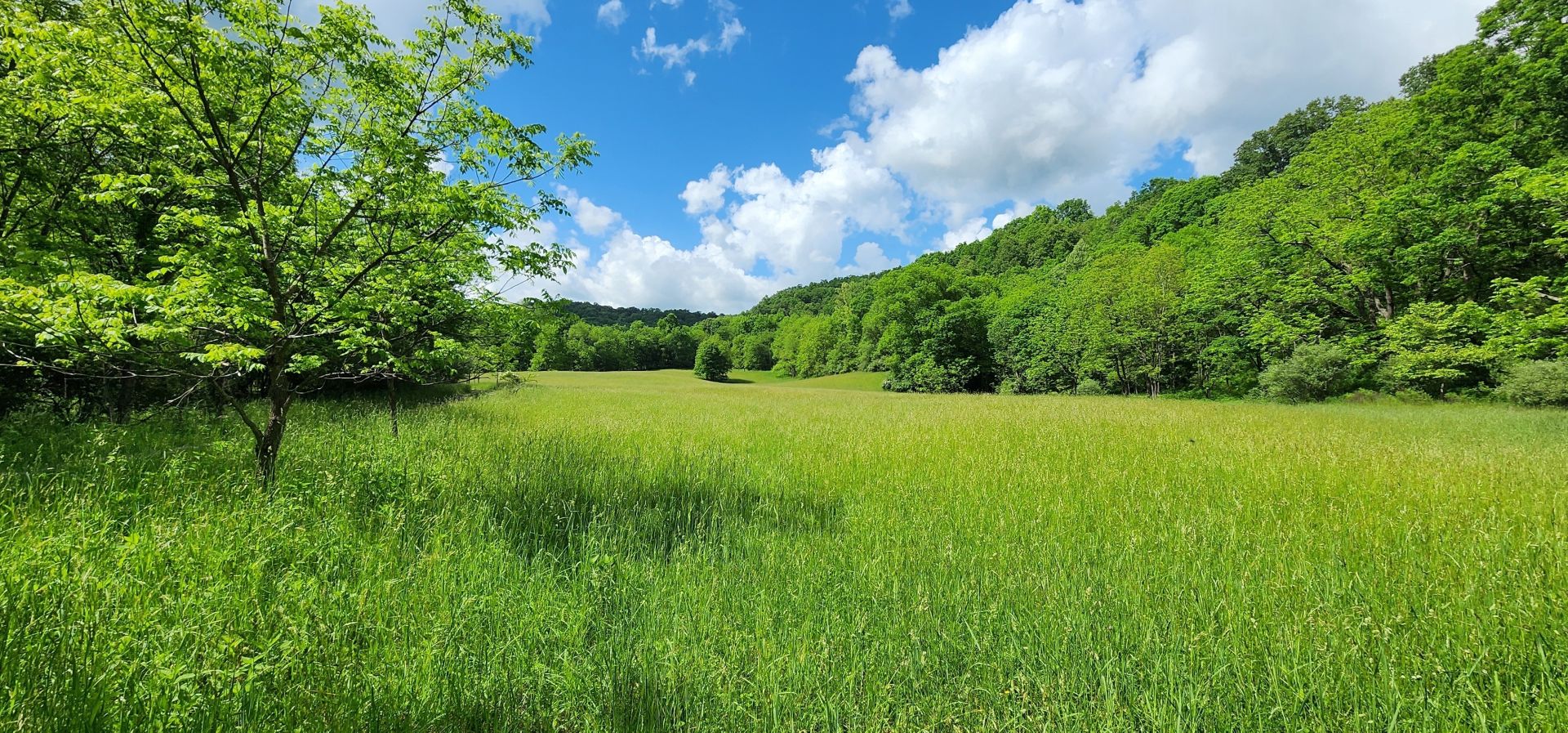
The Old Gee Farm has about 16 acres of nice laying meadows currently maintained as hay fields..
- A fruit orchard would flourish here. There may be a few fruit trees scattered about which were part of the area’s early homesteads.
- The production of Maple Syrup is popular in this region and the property has the maple tree resource to produce gallons of high-grade syrup.
- Crops of black walnuts, acorns, beechnuts and hickory nuts are produced each year.
- Making honey is also a well-established industry in the area
FOREST FARMING
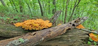
The most common crops are medicinal herbs and mushrooms. Other crops that can be produced include shade-loving native ornamentals, moss, fruit, nuts, other food crops, and decorative materials for crafts. These crops are often referred to as special forest products.
Here are some specific examples of crops in each category that are currently being cultivated:
- Medicinal herbs: Ginseng, goldenseal, black cohosh, bloodroot, passionflower, and mayapple
- Mushrooms: Shiitake and oyster mushrooms
- Native ornamentals: Rhododendrons and dogwood
- Moss: Log or sheet moss
- Fruit: Pawpaws, currants, elderberries, and lowbush blueberries
- Nuts: Black walnuts, acorns, hazelnuts, hickory nuts, and beechnuts
- Other food crops: Ramps (wild leeks), maple syrup, and honey
- Plants used for decorative purposes, dyes, and crafts: Galax, princess pine, white oak, pussy willow branches in the spring, holly, bittersweet, and bloodroot and ground pine (Lycopodium)
WILDLIFE
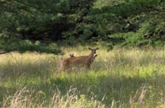
Years of progressive wildlife management practices have created the quintessential wildlife preserve. Management goals promoted overall wildlife health, facilitated the harvest of game, developed wildlife viewing areas, increased carrying capacity, and increased species diversity.
There are many animals that live year-round and at other times in the area’s rivers, lakes, ponds and streams, including beavers, otters, minks, raccoons, opossums, blue herons, Canada geese, wood ducks, mallards, minnows, native fish, turtles, salamanders, newts, crayfish, muskrats, bull frogs, eagles, hawks and redwing blackbirds.
There is the insect and microscopic world including butterflies, dragonflies, pond skaters, water beetles, damselflies, tadpoles and various insect larvae.
The diverse tree species create the perfect wildlife habitat. The miles of “edge effect” created between farm fields, creeks, hollows, ridges, and rock outcrops benefit all the resident wildlife. Bald eagles, white tail deer, black bear, wild turkey, squirrel, rabbit, bobcat, raccoon, fox and many species of songbirds, owls and raptors make up the resident wildlife population.
The hardwood forest provides the essential nutrient source and produces tons of hard mast including acorns, hickory nuts, beech nuts and black walnuts. Soft mast includes stag horn sumac, black cherry, tulip poplar seeds, maple seeds, autumn olive berries and blackberries.
CARBON SEQUESTRATION
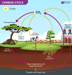
The property is a wonderful producer of Oxygen and Carbon Sequester. Carbon Sequestration is the act of processing carbon dioxide through sinks and stores and releasing them into the atmosphere as oxygen. The vigorously growing forest is sequestering thousands of tons of Carbon Dioxide each per year and producing like tonnage of life sustaining Oxygen.
SELF-SUSTAINING LIFE OFF THE GRID
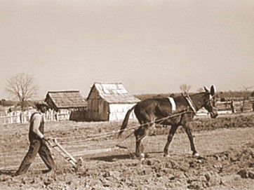
Just like 200 years ago, when the first mountaineers settled the area, the property would be self-sustaining in times of necessity – even without electricity.
- Fresh water for drinking and cooking would come from drilled water wells (hand drawing water from the wells using a cylinder well bucket).
- The forest would provide fresh food (deer and turkey).
- The agricultural land’s flat to rolling topography would be used to raise livestock of all kinds (chickens, pigs, cows, sheep, goats, rabbits etc.) and could be farmed with horse drawn equipment. The land would support vegetable gardens, berry patches, fruit orchards, and row crops of corn, oats and barley.
- Beehives would provide honey and beeswax for candles.
- The forest would provide firewood for heating and cooking, lumber for building, basket splints, maple syrup and pounds of nuts (walnuts, beechnuts and hickory nuts).
WATER
A portion of Carr Branch and a portion Walton Run, both being the headwaters of Indian Creek, and a small section of Indian Creek, all being blueline streams, run through the property for a combined total of over ½ mile. There should be regular water flow, especially during rain events and snow melt.
MINERAL RESOURCES
All rights the owner has will convey with the property.
BOUNDARIES AND SURVEY
There is a metes and bounds description of the property contained in the property deed. The property is being sold by the boundary and not by the acre.
UTILITIES
Water: Water well could be drilled
Sewer: conventional septic could be installed
Electricity: To be determined
Telephone: To be determined
Internet: Starlink Satellite or Cellular hotspot
Cellphone Coverage: Good in most places
ACCESS/FRONTAGE
The property has just under ½ mile of frontage on the “road that leads to Friars hill”. The road that travels into and through the property is Johnson Lane off of Friars Hill Road.
ZONING
Greenbrier County is subject to some zoning and subdivision regulations. All prospective buyers should consult the County Commission and the Health Department for details regarding zoning, building codes and installation of septic systems.
Information can be found at the county website: http://greenbriercounty.net/ordinances.
PROPERTY TYPE/USE SUMMARY
The property has about 16 acres in pasture fields. The balance of the property contains some old fields that are regenerating back to forest, which may considered for working back to fields. The balance of the property is mature forestland.
(This summary is an estimation of current property use as determined from aerial photography. It is made subject to the estimation of property boundaries and any errors in the interpretation of land use type from the aerial photography utilized.)
DEED and TAX INFORMATION
Deed Information: DB 226 Pg. 309
Greenbrier County, West Virginia
Acreage: 91 acres +/-
Real Estate Tax ID/Acreage/Taxes:
Greenbrier County (13), West Virginia
Williamsburg District (18)
Tax Map 33 Parcel 33; Class 3
2023 Real Estate Taxes: $650.72
ARCHEOLOGY AND GEOLOGY
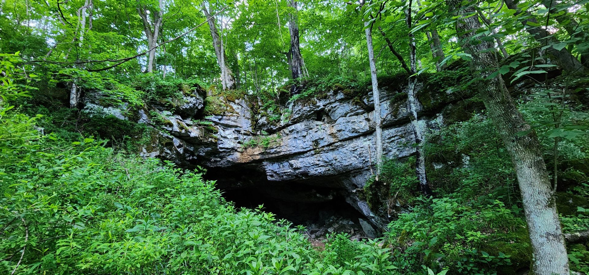
There is a hidden cave whose stream “sinks” below ground and then resurfaces just outside the mouth of the cave. The air exiting the cave is about 55 degrees in temperature.
The property is nestled between the folded Ridge and Valley Province to the east and the younger Allegheny Plateau to the west. The Greenbrier River flows 162 miles southwest through the valley and empties into the world’s third oldest river, the New River.
The area’s rich farmland is made fertile by the Greenbrier Limestones, known locally as the “Big Lime”. These limestones were formed from shallow seas some 350 million years ago during the Mississippian geological period. The quarrying of limestone for dimension stone, fill-rock, construction aggregate, riprap, sand, and agricultural lime is an important industry in the area.
Just a few miles west of the property, you can take a trip through time riding on I-64 from Dawson to the WV/VA boundary showcasing outcrops from the younger Mississippian formations to the older Devonian mountains.
The rich coal fields lying a few miles to the north were formed about 300 million years ago during the Pennsylvanian and Permian periods when the West Virginia area was south of the equator and moving north. Coal, a combustible sedimentary rock, formed when the area was covered with huge, tropical, swampy forests where plants – giant ferns, reeds and mosses – grew. When the plants died they piled up in swamps. Over time, heat and pressure transformed the buried materials into peat and into various forms of coal. These prehistoric coalfields continue to provide energy and industry to residents of West Virginia, the nation, and the world.
The area exhibits a karst topography due to the underlying Greenbrier Limestone. Karst is characterized by numerous caves, sinkholes, fissures, and underground streams. This interesting topography forms in regions of plentiful rainfall where bedrock consists of carbonate-rich rock, such as limestone, gypsum, or dolomite, that is easily dissolved. Mildly acidic rainwater slowly dissolves the soft limestone over millions of years creating geological fascinations like Lost World Caverns and Organ Cave, carved from the Greenbrier Limestone.
The property has many interesting “riches from the earth” in the form of limestone, agates, fossils, geodes, and curious rock outcrops.
The Droop Sandstone, a very hard, quartz-rich rock originally deposited as sand beaches along an ancient shoreline, is especially prominent in the area. Numerous sheer rock cliff formations are created by the erosion-resistant Droop Sandstone. Locally, the Muddy Creek Mountain quarry produces decorative sandstone from the Droop that is known worldwide for its beauty and durability.
The area is well known for the healing waters of the numerous “Sulphur Springs”. During the 1800’s and early 1900’s, several “Sulphur Springs Resorts” flourished in the area. Most notably and still in existence are White Sulphur Springs, Warm Springs and, Hot Springs. Others included, Sweet Springs, Blue Sulphur Springs, Red Sulphur Springs, Green Sulphur Springs, Salt Sulphur Springs, Pence Springs and, Sweet Chalybeate Springs.
RECREATION
The property offers unparalleled recreational opportunities. Numerous soft recreational activities are anchored by the proximity to the Greenbrier River, New River, Bluestone Lake and Summersville Lake.
Nature vi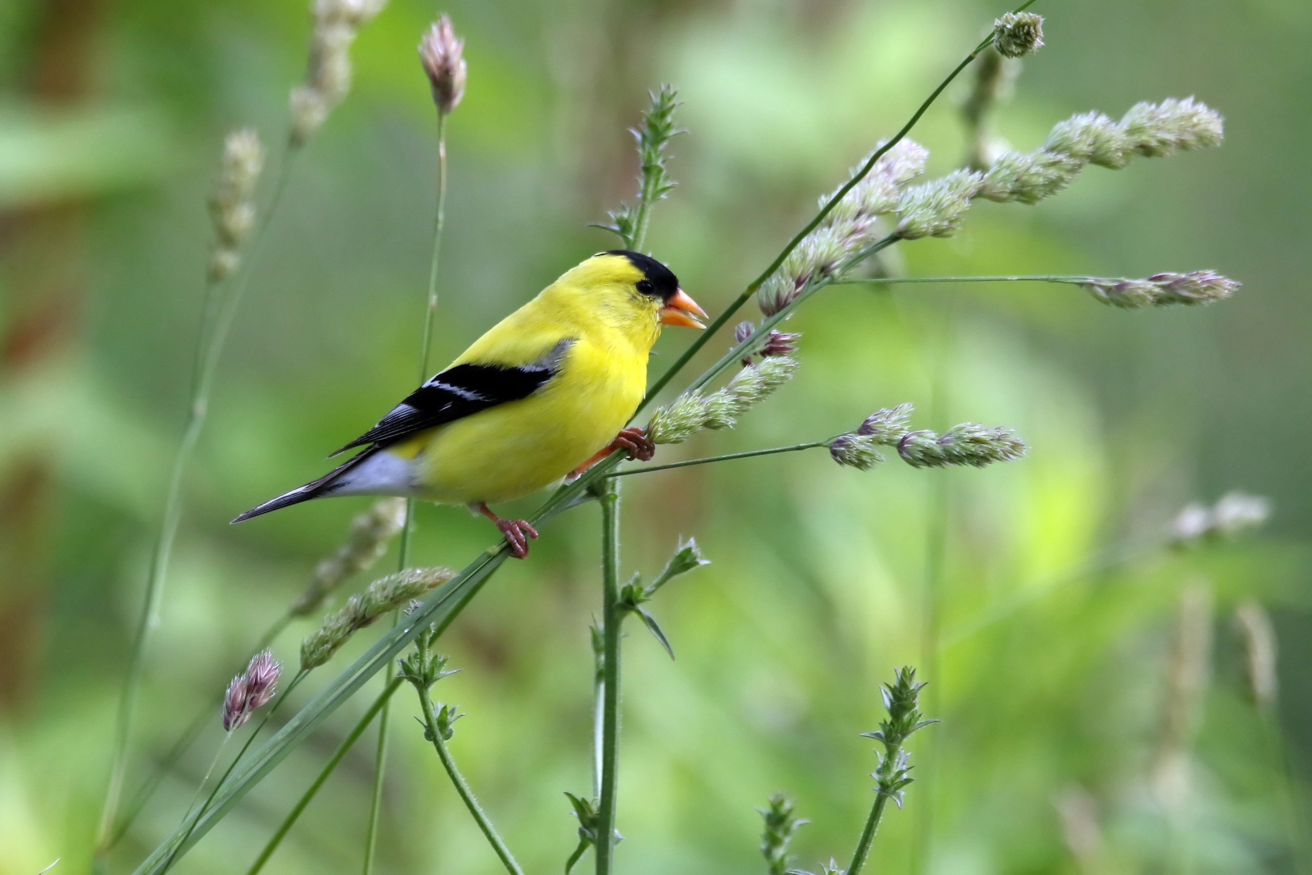 ewing is first in line of recreational activities. Attentive wildlife management has been geared not to just game animals. Equal consideration has been extended to increasing the numbers and diversity of species including neo-tropical songbirds, butterflies, turtles, frogs, rabbits, chipmunks, dragonflies, owls and hawks.
Stargazing-Planet Observation
Complete or near darkness can be still be found on most of the property, thereby affording the opportunity to view the night sky in all its brilliant wonder.
Water-sports enthusiasts will find the nearby Greenbrier River ideal for swimming, canoeing, fishing, kayaking, tubing, snorkeling, paddle boarding and windsurfing.
Shooting-sports devotees find all the land and privacy needed to enjoy:
- Paintball-Airsoft-Laser Tag-Archery tag
- Shotgun sport shooting including Skeet, Trap, Double Trap and Sporting Clays

- Rifle & Handgun shooting: bullseye, silhouette, western, bench rest, long-range, fast draw
- Archery and Crossbow competition shooting
- Plain ole’ plinking: Grandpa’s old 22 single shot rifle and a few tin cans make a fun day

All Terrain Motorsports
The property is perfect for experiencing the property from an ATV or UTV. Riders are welcome to ride all public roads that do not have a painted dividing line and there are miles and miles of open roads in the area. These exciting machines handle the wide variety of the forest’s terrain.
Dirt bikes can also be a lot of fun and they come in all sizes and horsepower to fit anyone who enjoys being on two wheels.
 Mountain Biking, Horseback Riding and Hiking
The land may be used for mountain biking, hiking or horseback riding and the area offers several state and national parks geared for these activities.
Hunting is a first-class experience. White tail deer, black bear, red/gray fox, bobcat, wild turkey, grouse, duck, squirrel, raccoon, fox and rabbit make up the resident wildlife population. It is hard to find a property that has a better mix of wildlife.
SURROUNDING AREA
Lewisburg, which is the Greenbrier County seat, was voted the Cooles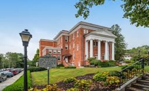 t Small Town in America, combining the warmth of a close community with the sophistication of more urban locations. The thriving do
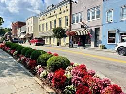 wntown historic district offers year-round live productions presented at the State Professional Theatre of WV, Carnegie Hall, distinctive dining venues, antique shops, award-winning galleries/boutiques, a year-round farmer’s markets.
Greenbrier Valley Medical Center is a modern hospital and all attendant medical facilities, along with the many big box stores.
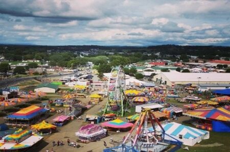
The county and city host several fairs & festivals throughout the year including The WV State Fair, a professional 4-weekend Renaissance Festival, Chocolate Festival, Taste of our Town Festival (TOOT), antique car shows, Jeep Rally, Airstream Rally, WV Barn Hunt Competition, PGA Tour @ The Greenbrier Resort, and numerous fun parades.
Lewisburg is the home to the Greenbrier Country Public Library, a fantastic, ultra-modern public library that is open 7 days a week. The library’s services include: Reading Areas, References, Notary Public, Local History Room, Tax Forms, Fax Service, Photo Copies, Digital Printing, Inter Library Loans, Internet/Computer Access, Audio Books, eBooks, Story Hour, Video & DVD’s, Paperback Book Exchange, Literacy Tutoring, Databases, Computer Classes, Book Discussions, Children’s Programming and an Online Catalogue.
Located in Lewisburg is the modern Robert. C Byrd Medical Clinic (300 employees), the WV Osteopathic Medical School (600 students) and the New River Community and Technical College. The area is a strong economic generator with a solid workforce employed in county/state government, tourism, hospitality, medical, education, retail, construction, wood products, mining and agriculture.
 The world-renowned Greenbrier Resort, with 800 rooms and 1600 employees, is located in the sleepy little town of White Sulphur Springs. The 4-Star resort has a subterranean casino and is at times the home to the NFL Summer Practice Event, Tennis Exhibitions (Venus Williams, John McEnroe etc.). Several other area golf courses are available in the area – including Oakhurst Links, America’s first golf course, where guests play using old style hickory-handled clubs and ground-burrowing golf balls.
A picturesque train ride from White Sulphur Springs connects the area to DC, Philadelphia, Chicago, and many other locations. By car, DC is 4 hours away and Charlotte is only 4.
Within a two-hour’s drive are located some of the finest recreational facilities in West Virginia. Winterplace Ski Resort, whitewater rafting / fishing on the New River and Gauley River, 2000-acre Bluestone Lake, Pipestem State Park and Resort and the 80,000-acre New River National Gorge National Park. Five other area state parks and state forests offer unlimited hiking, horseback riding, ATV riding and rock climbing opportunities. Snowshoe Ski Resort is 90-minute drive through some of the most scenic country on the East Coast. The new 12,000-acre Boy Scout High Adventure Camp and home to the US and World Jamboree is an hour’s drive.
THE GREENBRIER RIVER
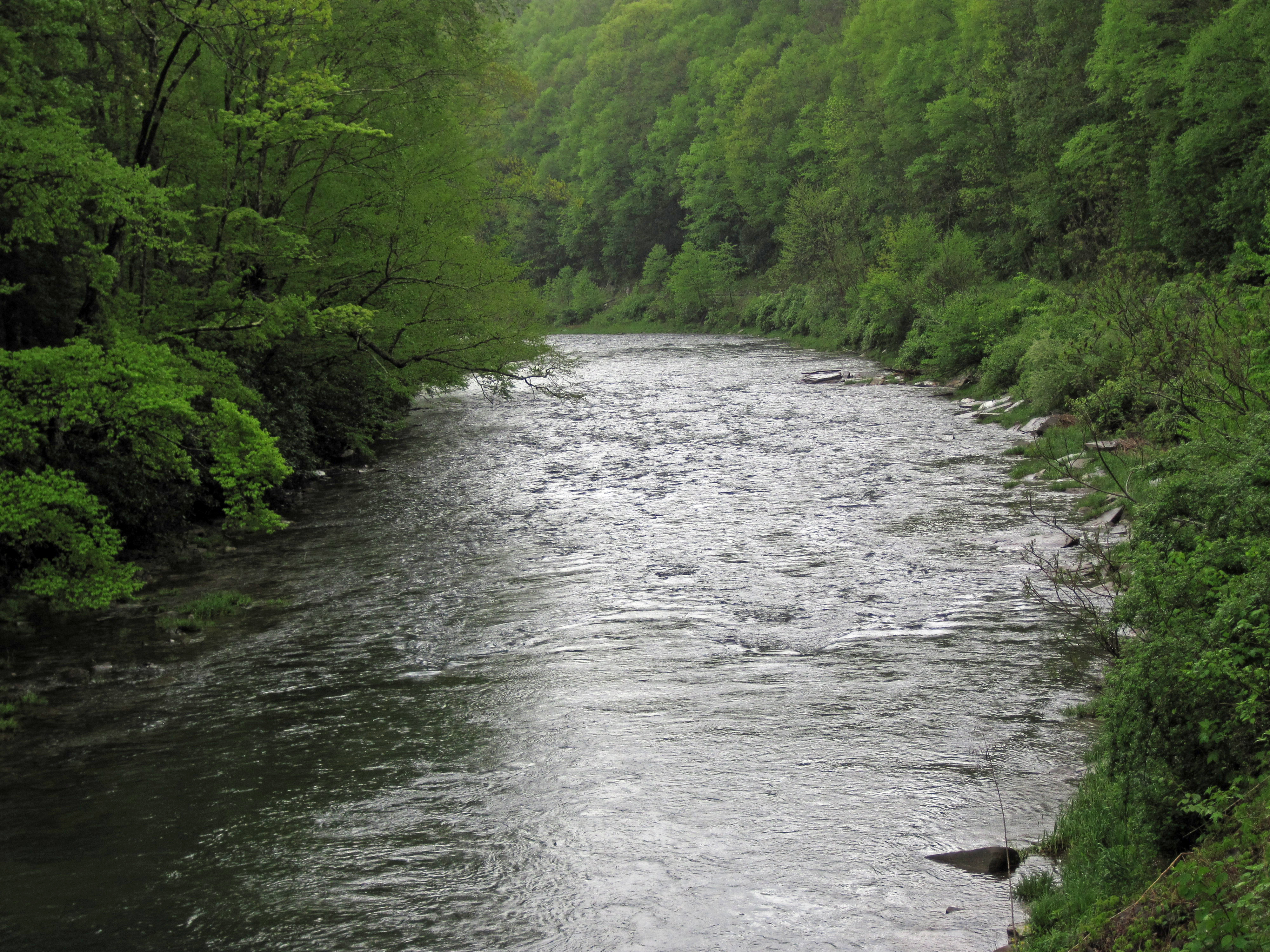 The upper Greenbrier River possesses the excitement of life on one of the nation’s great wild rivers. The focus of a vast outdoor-recreation destination, it flows untamed out of the lofty Alleghenies, attracting anglers, paddlers, and naturalists from across the globe.
At 162 miles long, the Greenbrier is the longest undammed river left in the Eastern United States. It is primarily used for recreational pursuits and well known for its fishing, canoeing, kayaking and floating opportunities. Its upper reaches flow through the Monongahela National Forest, and it is paralleled for 77 miles by the Greenbrier River Trail, a rail trail which runs between the communities of Cass and North Caldwell.
It has always been a valuable water route, with the majority of the important cities in the watershed being established river ports. The river gives the receiving waters of the New River an estimated 30% of its water volume. Over three-fourths of the watershed is an extensive karstic (cavern system), which supports fine trout fishing, cave exploration and recreation. Many important festivals and public events are held along the river throughout the watershed.
The Greenbrier is formed at Durbin in northern Pocahontas County by the confluence of the East Fork Greenbrier River and the West Fork Greenbrier River, both of which are short streams rising at elevations exceeding 3,300 feet and flowing for their entire lengths in northern Pocahontas County. From Durbin the Green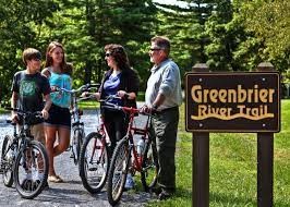 brier flows generally south-southwest through Pocahontas, Greenbrier and Summers Counties, past several communities including Cass, Marlinton, Hillsboro, Ronceverte, Fort Spring, Alderson, and Hinton, where it flows into the New River.
Along most of its course, the Greenbrier accommodated the celebrated Indian warpath known as the Seneca Trail (Great Indian Warpath). From the vicinity of present-day White Sulphur Springs the Trail followed Anthony’s Creek down to the Greenbrier near the present Pocahontas-Greenbrier County line. It then ascended the River to the vicinity of Hillsboro and Droop Mountain and made its way through present Pocahontas County by way of future Marlinton, Indian Draft Run, and Edray.
SCHOOLS
Greenbrier County School District
Public Elementary School:
Frankford Elementary School
Public Middle School:
Eastern Greenbrier Middle School
Public High School:
Greenbrier East High School
Colleges:
New River Community and Technical College (Lewisburg campus)
West Virginia School of Osteopathic Medicine
Private Schools:
Greenbrier Episcopal School (PK-8)
Greenbrier Valley Academy (2-8)
Lewisburg Baptist Academy (PK-12)
Renick Christian School (2-7)
Seneca Trail Christian Academy (PK-12)
Information provided by Foxfire Realty is believed to be reliable but is not guaranteed and should be independently verified by potential purchasers. Foxfire Realty and the Seller(s) make no representations or warranties about the property or the accuracy or completeness of the Information concerning the property, including, but not limited to, title, mineral rights, condition, access, acreage, zoning, taxes, square footage, measurements, protective covenants. Information concerning the property is provided for marketing purposes only and is subject to change, withdrawal, or correction. Foxfire Realty is not responsible for any inaccuracies, errors, or omissions concerning Information about the property, and provided information is not a substitute for inspections, surveys, title searches or other due diligence by potential purchasers. Photographs may be digitally enhanced, and maps are provided for informational purposes only.
Buyer’s agents must be identified on the first contact with Foxfire Realty and must accompany the buyer on showings to receive fee participation.
DIRECTIONS
From Lewisburg, West Virginia: 20.1 miles +/- (approximately 40 minutes)
From the intersection of US 60 and US 219 in the center of Lewisburg, travel US 219 North for 10 miles; just past the Frankford Post Office, turn left onto Williamsburg Road; travel 6.3 miles; continue straight onto Trout Rd / Trout Valley; travel 2.9 miles; turn right onto Friars Hill road; travel 9/10 mile; turn sharp left onto Johnson Lane and travel Johnson Lane into the property.
REGIONAL INFORMATION
STATE INFORMATION
- State of West Virginia
- West Virginia Explorer
- West Virginia Government
- West Virginia State Parks
- West Virginia Tourism
- Wonderful West Virginia Magazine
- WV Department of Natural Resources
- Virginia – Commonwealth of Virginia
- Virginia is for Lovers
- Virginia Museum of History & Culture
- Virginia Museum of Natural History
- Virginia National Park Service
- Virginia Recreation
- Virginia State Parks

Contact Foxfire
304.645.7674
Gallery


